ECMWF IFS ENS forecast, 15 day, 0.1 degree, virtual validation report
This dataset validation report plots a sample of values from the ECMWF IFS ENS forecast, 15 day, 0.1 degree, virtual dataset over time and across space, comparing where possible to a previously validated reference dataset. It also reports the quantity of unavailable values and their associated timestamps. These analyses are one layer of a multi-layered dataset validation process we perform at dynamical.org and also provide users a preview of the dataset contents.
Report generation start time: 2026-11-11T07:26:08 UTC
Summary
This dataset has been reviewed and is ready for use.
What looks good
- All expected source files and variable references are present. Completeness covers every tested initialization; decoding samples leads, members and pressure levels.
- The 15-day horizon and forecast-window transition decode correctly. Independent source comparisons cover leads 144, 150 and 360 hours for the control and a perturbed member, including temperature and wind-gust windows.
- Maps, units and temporal patterns are coherent. Both ensemble members were reviewed, with NOAA GEFS analysis comparisons where coverage and equivalent fields are available.
Datasets
| Role | Name | ID | Version | URL |
|---|---|---|---|---|
| Validation | ECMWF IFS ENS forecast, 15 day, 0.1 degree, virtual | ecmwf-ifs-ens-forecast-15-day-0-1-degree-virtual |
v0.1.0 |
s3://dynamical-ecmwf-ifs-ens/ecmwf-ifs-ens-forecast-15-day-0-1-degree-virtual/v0.1.0.icechunk |
| Reference | NOAA GEFS analysis | noaa-gefs-analysis |
0.1.2 |
s3://dynamical-noaa-gefs/noaa-gefs-analysis/v0.1.2.icechunk/ |
Run parameters
| Parameter | Value |
|---|---|
| Validation dataset type | forecast |
| Validation time range | init_time 2026-10-21T00:00 → 2026-11-10T12:00 |
| Reference time range | time 2000-01-01T00:00 → 2026-11-11T03:00 |
| Point 1 | lat=40.0000, lon=-105.0000 |
| Point 2 | lat=30.0000, lon=-40.0000 |
| Ensemble member | 0 |
| Spatial comparison time | init=2026-11-03T00:00, lead=150h (reference at 2026-11-09T06:00) |
| Timeseries period | init=2026-11-08T00:00 |
| Vertical level | override 500 |
| Store type | virtual — availability manifest-probed; value series sampled |
| Validation snapshot | CMK6ATMKVWCTNKTBPCD0 |
| Static-field sampling | Surface geopotential height, orography standard deviation and orography slope use lead 0 for spatial and full-period point plots; they are published only for control member 0. |
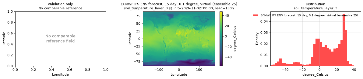
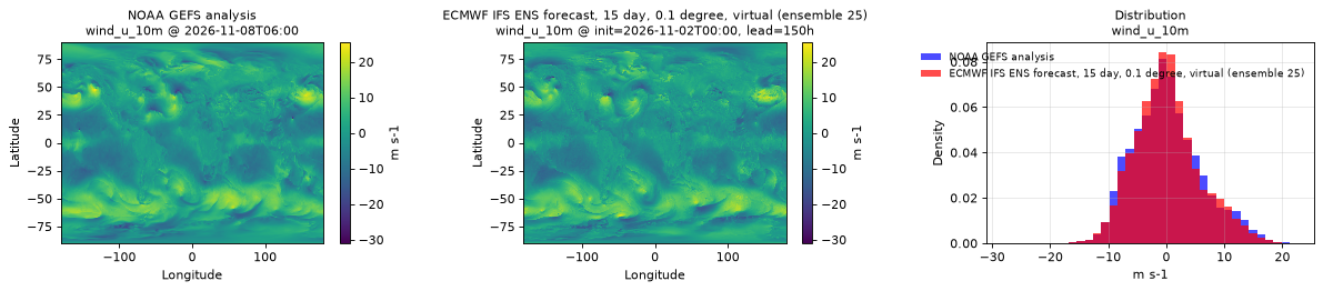
| Additional member check | Every variable inspected at member 25, initialization 2026-11-02T00:00, lead 150 hours; these maps appear in each variable section. |
Availability
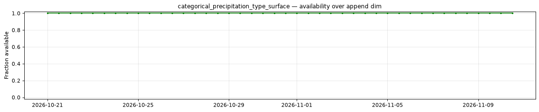
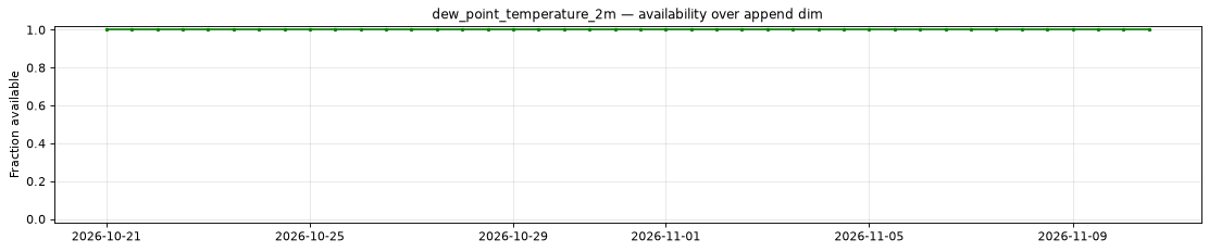
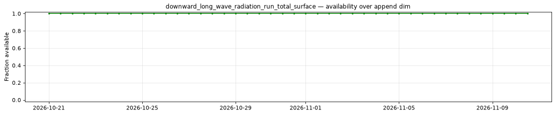
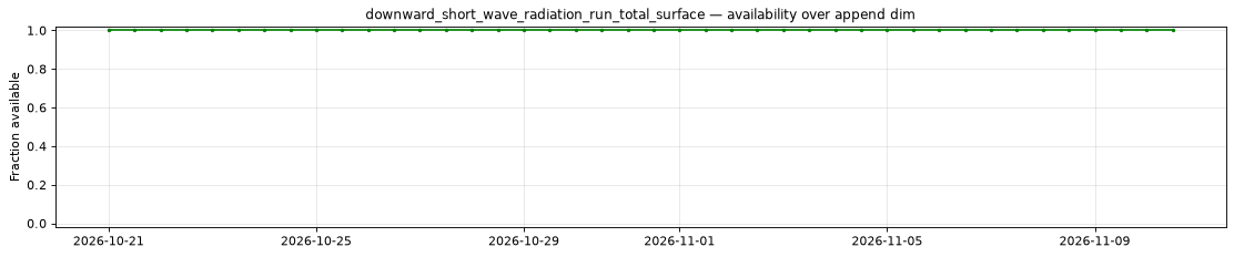
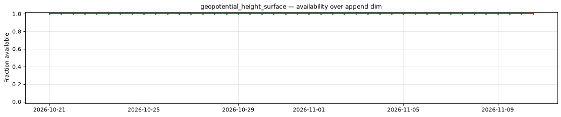
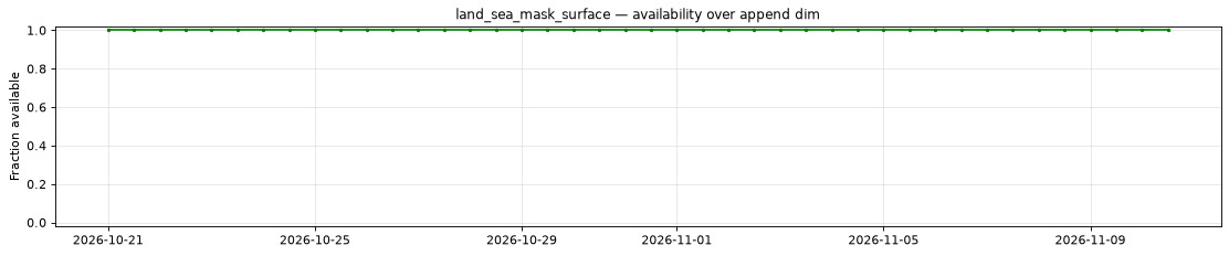
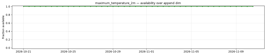
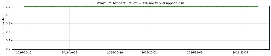
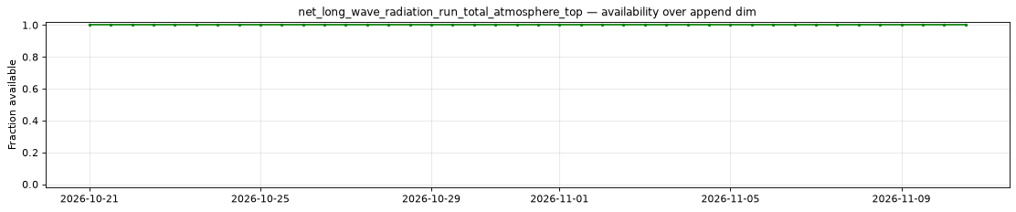
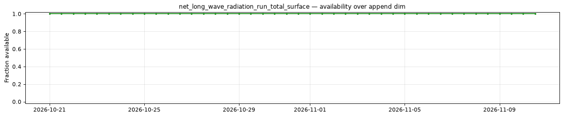
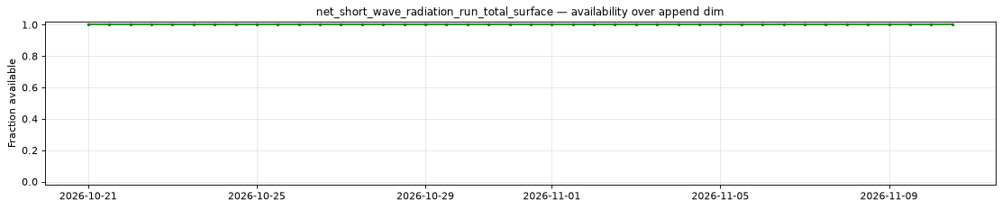
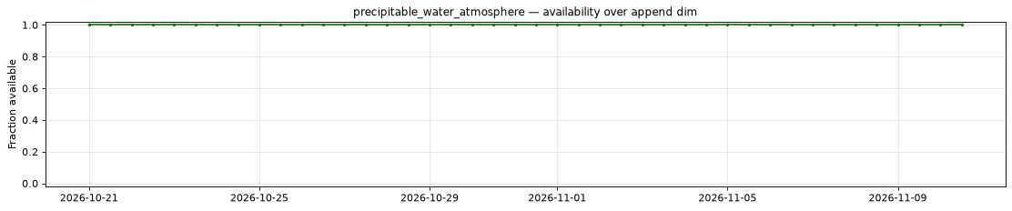
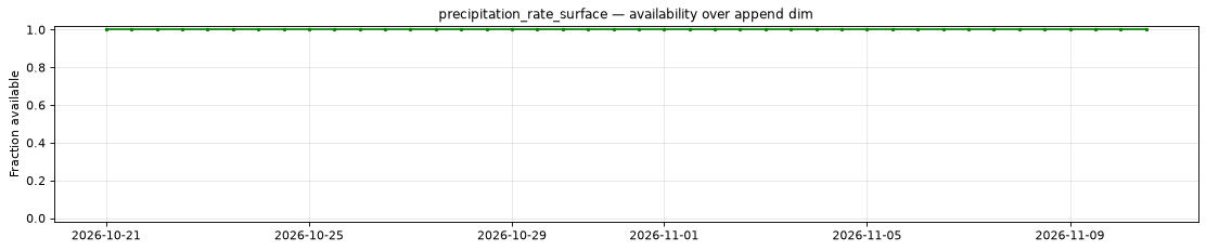
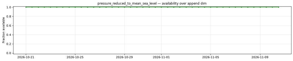
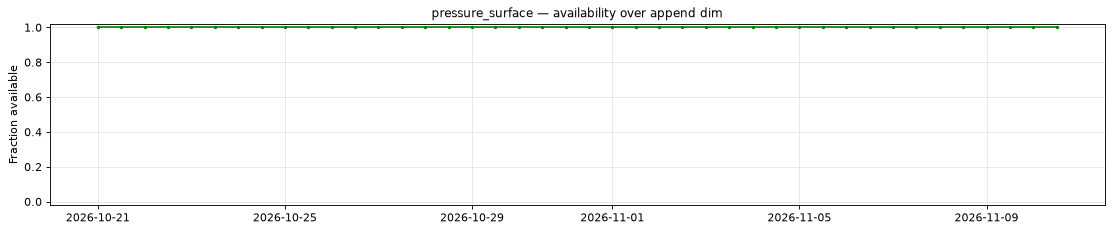
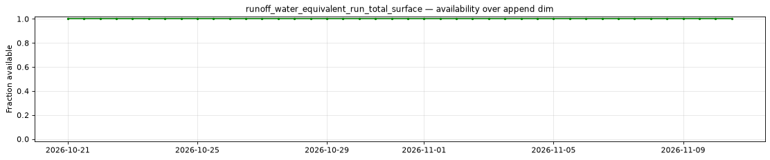
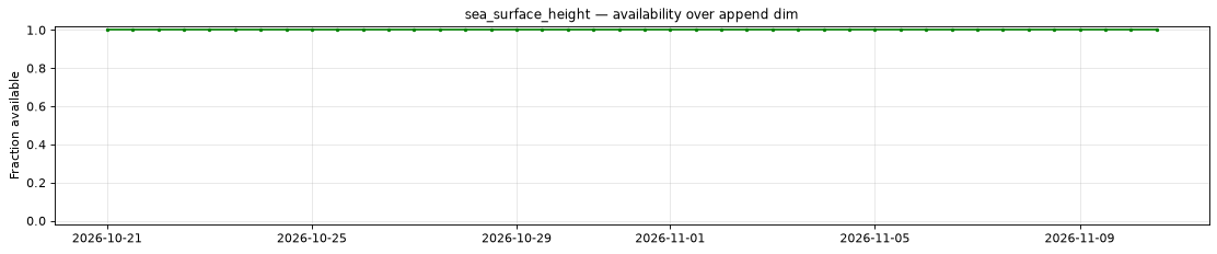
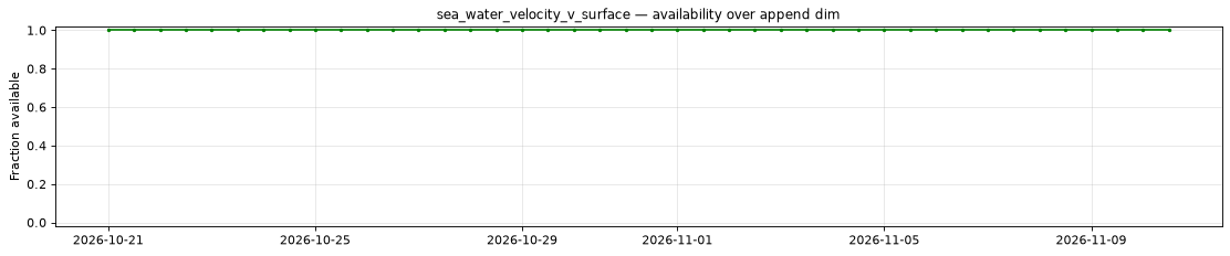
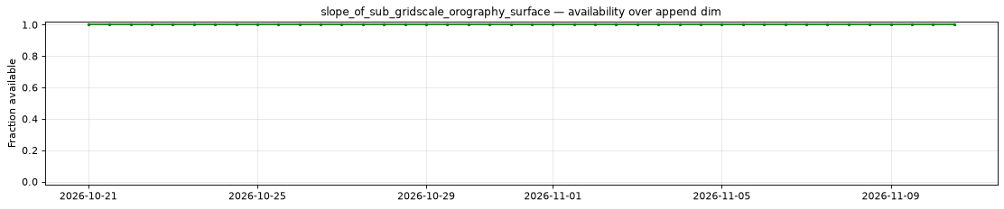
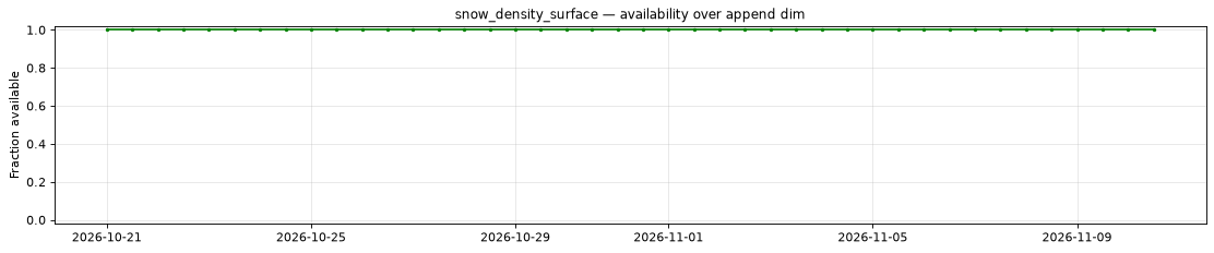
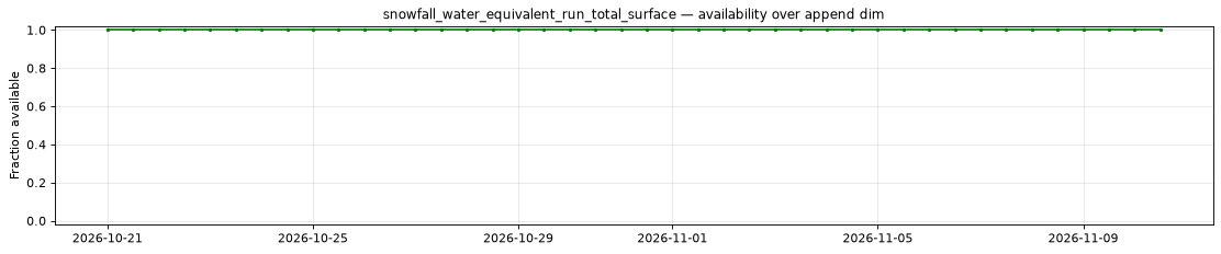
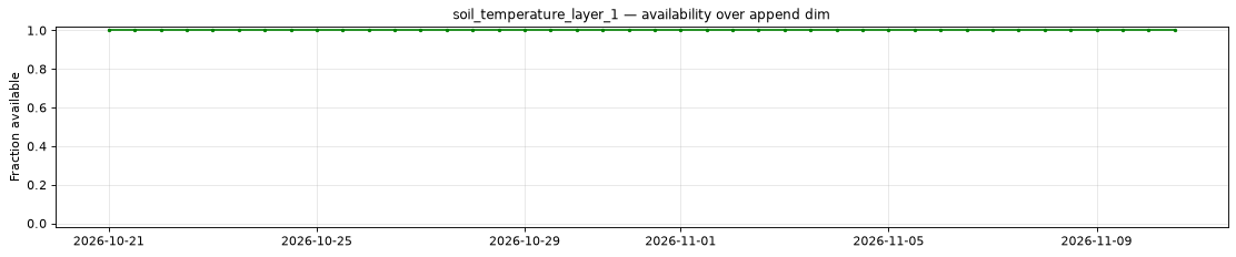
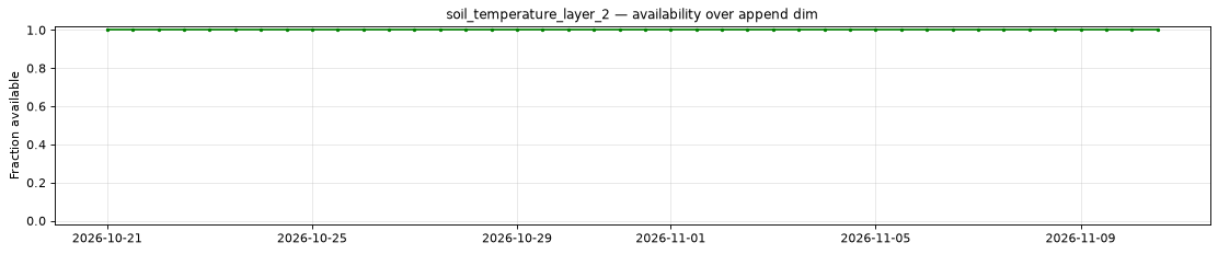
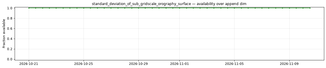
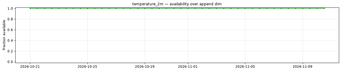
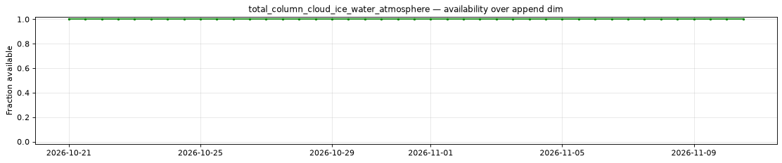
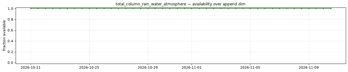
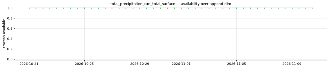
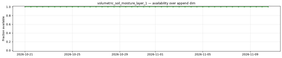
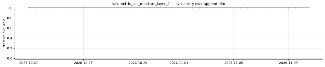
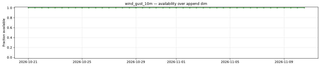
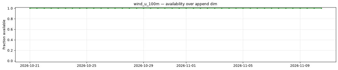
The plot below shows the availability of each variable over time — light red marks unavailable data, dark green marks present data.
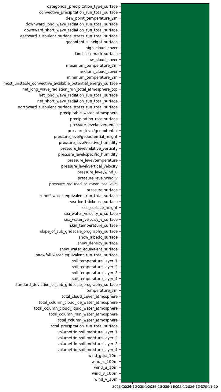
Every variable is complete at every scanned position.
Decode health
12,040 sampled variable/source checks passed across 20 of 42 initialization regions. The sampled leads are 0, 63, 126, 234 and 360 hours, with ensemble endpoints 0 and 50 and up to two referenced pressure levels per group variable. A check can read more than one member or level chunk. File completeness and per-variable presence are exhaustive within the tested initialization window; decode health is sampled. Variable presence does not establish that every level is referenced.
Per-variable details
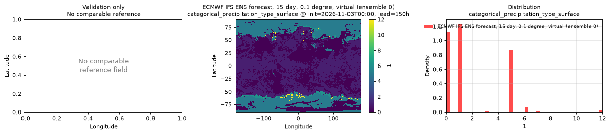
categorical_precipitation_type_surface
Metadata
| Field | Value |
|---|---|
| units | 1 |
| long_name | Precipitation type |
| short_name | ptype |
| standard_name | n/a |
| step_type | instant |
| flag_values | 0, 1, 2, 3, 4, 5, 6, 7, 8, 9, 10, 11, 12, 13, 14, 255 |
| flag_meanings | no_precipitation rain thunderstorm freezing_rain mixed_ice snow wet_snow mixture_of_rain_and_snow ice_pellets graupel hail drizzle freezing_drizzle hail_less_than_5mm hail_greater_than_or_equal_to_5mm missing |
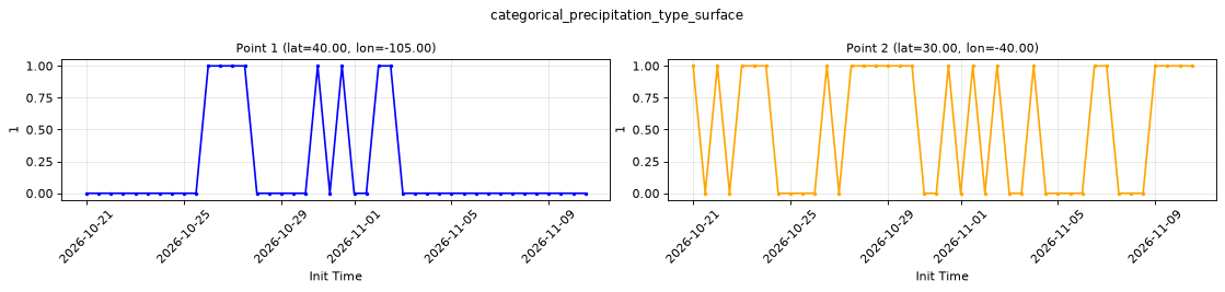
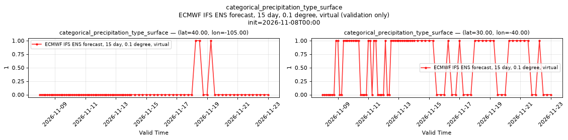
Point time series — 2026-10-21T00:00 - 2026-11-10T12:00, sampled lead=3h, member=0
| Point | min | mean | max |
|---|---|---|---|
| P1 | 0 | 0.1905 | 1 |
| P2 | 0 | 0.5238 | 1 |
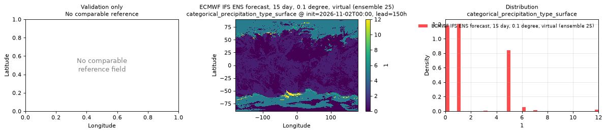
Spatial — init=2026-11-03T00:00, lead=150h (reference not available)
| Source | min | mean | max |
|---|---|---|---|
| Validation | 0 | 1.898 | 12 |
Temporal — init=2026-11-08T00:00
| Source | min | mean | max |
|---|---|---|---|
| P1 Validation | 0 | 0.03529 | 1 |
| P2 Validation | 0 | 0.5765 | 1 |
Availability — 42 of 42 positions complete
Additional spatial comparison — member 25, init=2026-11-02T00:00, lead=150h.
convective_precipitation_run_total_surface
Metadata
| Field | Value |
|---|---|
| units | kg m-2 |
| long_name | Convective precipitation |
| short_name | cp |
| standard_name | convective_precipitation_amount |
| step_type | accum |
| comment | Accumulated since forecast initialization. |
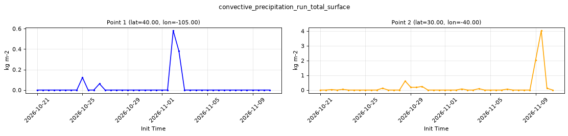
Point time series — 2026-10-21T00:00 - 2026-11-10T12:00, sampled lead=3h, member=0
| Point | min | mean | max |
|---|---|---|---|
| P1 | 0 | 0.02725 | 0.5798 |
| P2 | 0 | 0.1864 | 4.028 |
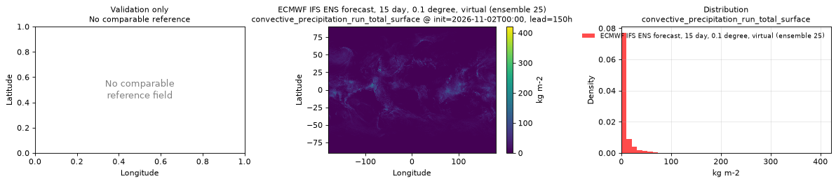
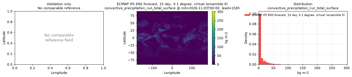
Spatial — init=2026-11-03T00:00, lead=150h (reference not available)
| Source | min | mean | max |
|---|---|---|---|
| Validation | 0 | 6.874 | 302.7 |
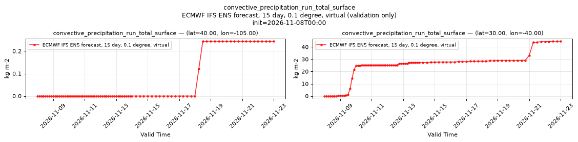
Temporal — init=2026-11-08T00:00
| Source | min | mean | max |
|---|---|---|---|
| P1 Validation | 0 | 0.05601 | 0.2441 |
| P2 Validation | 0 | 24 | 44.68 |
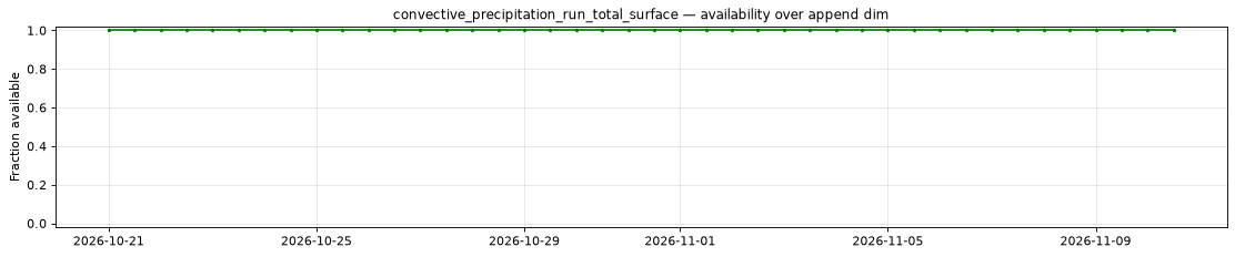
Availability — 42 of 42 positions complete
Additional spatial comparison — member 25, init=2026-11-02T00:00, lead=150h.
dew_point_temperature_2m
Metadata
| Field | Value |
|---|---|
| units | degree_Celsius |
| long_name | 2 metre dewpoint temperature |
| short_name | 2d |
| standard_name | dew_point_temperature |
| step_type | instant |
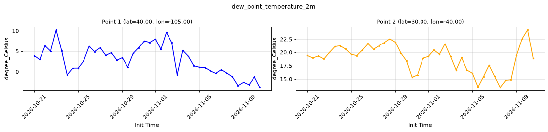
Point time series — 2026-10-21T00:00 - 2026-11-10T12:00, sampled lead=3h, member=0
| Point | min | mean | max |
|---|---|---|---|
| P1 | -3.843 | 2.881 | 10.22 |
| P2 | 13.41 | 18.94 | 24.25 |
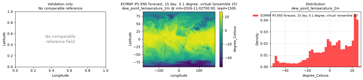
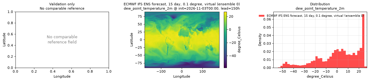
Spatial — init=2026-11-03T00:00, lead=150h (reference not available)
| Source | min | mean | max |
|---|---|---|---|
| Validation | -58.28 | 1.177 | 27.22 |
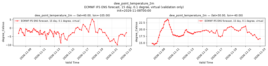
Temporal — init=2026-11-08T00:00
| Source | min | mean | max |
|---|---|---|---|
| P1 Validation | -9.8 | -2.725 | 5.236 |
| P2 Validation | 14.36 | 18.89 | 23.79 |
Availability — 42 of 42 positions complete
Additional spatial comparison — member 25, init=2026-11-02T00:00, lead=150h.
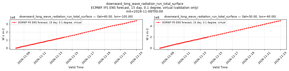
downward_long_wave_radiation_run_total_surface
Metadata
| Field | Value |
|---|---|
| units | W s m-2 |
| long_name | Surface long-wave (thermal) radiation downwards |
| short_name | strd |
| standard_name | integral_wrt_time_of_surface_downwelling_longwave_flux_in_air |
| step_type | accum |
| comment | Accumulated since forecast initialization. |
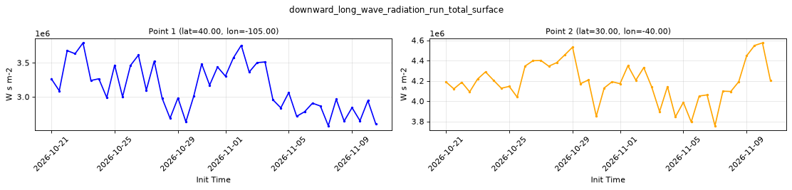
Point time series — 2026-10-21T00:00 - 2026-11-10T12:00, sampled lead=3h, member=0
| Point | min | mean | max |
|---|---|---|---|
| P1 | 2.574e+06 | 3.138e+06 | 3.791e+06 |
| P2 | 3.757e+06 | 4.188e+06 | 4.574e+06 |
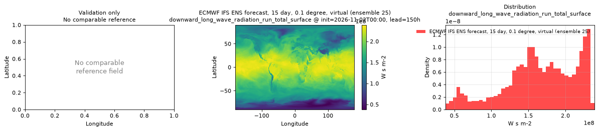
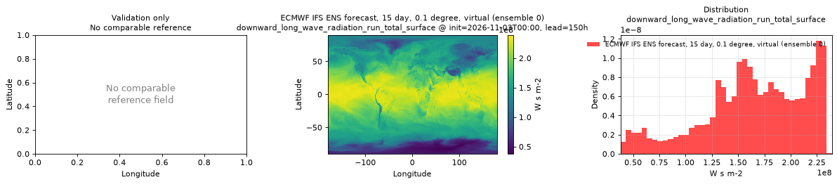
Spatial — init=2026-11-03T00:00, lead=150h (reference not available)
| Source | min | mean | max |
|---|---|---|---|
| Validation | 3.789e+07 | 1.643e+08 | 2.392e+08 |
Temporal — init=2026-11-08T00:00
| Source | min | mean | max |
|---|---|---|---|
| P1 Validation | 0 | 1.416e+08 | 3.427e+08 |
| P2 Validation | 0 | 2.092e+08 | 4.984e+08 |
Availability — 42 of 42 positions complete
Additional spatial comparison — member 25, init=2026-11-02T00:00, lead=150h.
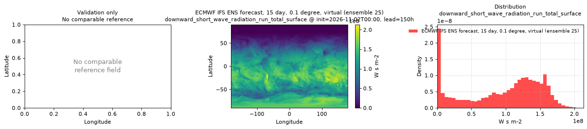
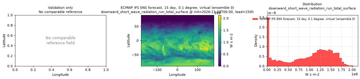
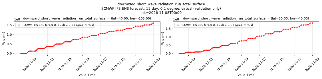
downward_short_wave_radiation_run_total_surface
Metadata
| Field | Value |
|---|---|
| units | W s m-2 |
| long_name | Surface short-wave (solar) radiation downwards |
| short_name | ssrd |
| standard_name | integral_wrt_time_of_surface_downwelling_shortwave_flux_in_air |
| step_type | accum |
| comment | Accumulated since forecast initialization. |
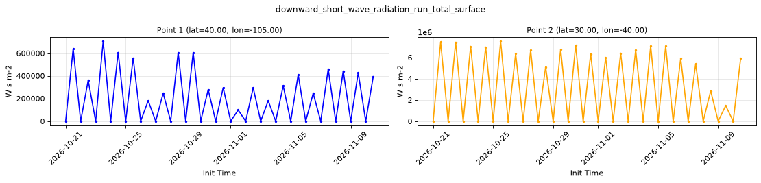
Point time series — 2026-10-21T00:00 - 2026-11-10T12:00, sampled lead=3h, member=0
| Point | min | mean | max |
|---|---|---|---|
| P1 | 0 | 1.986e+05 | 7.045e+05 |
| P2 | 0 | 3.084e+06 | 7.52e+06 |
Spatial — init=2026-11-03T00:00, lead=150h (reference not available)
| Source | min | mean | max |
|---|---|---|---|
| Validation | 0 | 9.628e+07 | 2.134e+08 |
Temporal — init=2026-11-08T00:00
| Source | min | mean | max |
|---|---|---|---|
| P1 Validation | 0 | 6.966e+07 | 1.615e+08 |
| P2 Validation | 0 | 6.721e+07 | 1.845e+08 |
Availability — 42 of 42 positions complete
Additional spatial comparison — member 25, init=2026-11-02T00:00, lead=150h.
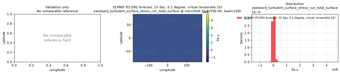
eastward_turbulent_surface_stress_run_total_surface
Metadata
| Field | Value |
|---|---|
| units | Pa s |
| long_name | Time-integrated eastward turbulent surface stress |
| short_name | ewss |
| standard_name | integral_wrt_time_of_surface_downward_eastward_stress |
| step_type | accum |
| comment | Accumulated since forecast initialization. |
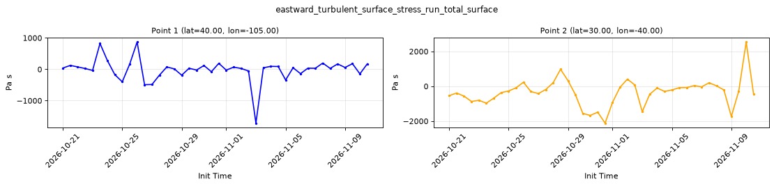
Point time series — 2026-10-21T00:00 - 2026-11-10T12:00, sampled lead=3h, member=0
| Point | min | mean | max |
|---|---|---|---|
| P1 | -1716 | -9.341 | 870.9 |
| P2 | -2114 | -359.8 | 2542 |
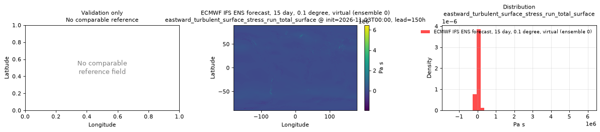
Spatial — init=2026-11-03T00:00, lead=150h (reference not available)
| Source | min | mean | max |
|---|---|---|---|
| Validation | -1.928e+06 | 1.251e+04 | 6.468e+06 |
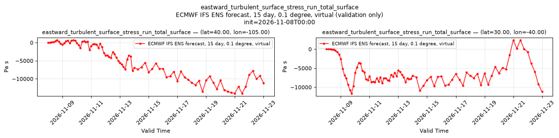
Temporal — init=2026-11-08T00:00
| Source | min | mean | max |
|---|---|---|---|
| P1 Validation | -1.4e+04 | -5300 | 723.5 |
| P2 Validation | -1.16e+04 | -6190 | 2398 |
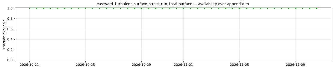
Availability — 42 of 42 positions complete
Additional spatial comparison — member 25, init=2026-11-02T00:00, lead=150h.
geopotential_height_surface
Metadata
| Field | Value |
|---|---|
| units | m |
| long_name | Geopotential height |
| short_name | gh |
| standard_name | geopotential_height |
| step_type | instant |
| comment | Surface (orography) geopotential height. Available for control member 0 only; members 1-50 are NaN. Time-invariant field published at lead time 0 only. |
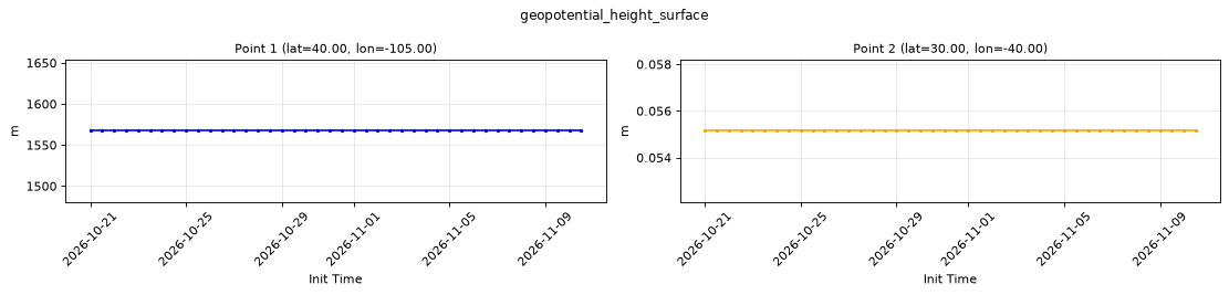
Point time series — 2026-10-21T00:00 - 2026-11-10T12:00, sampled lead=0h, member=0
| Point | min | mean | max |
|---|---|---|---|
| P1 | 1567 | 1567 | 1567 |
| P2 | 0.05514 | 0.05514 | 0.05514 |
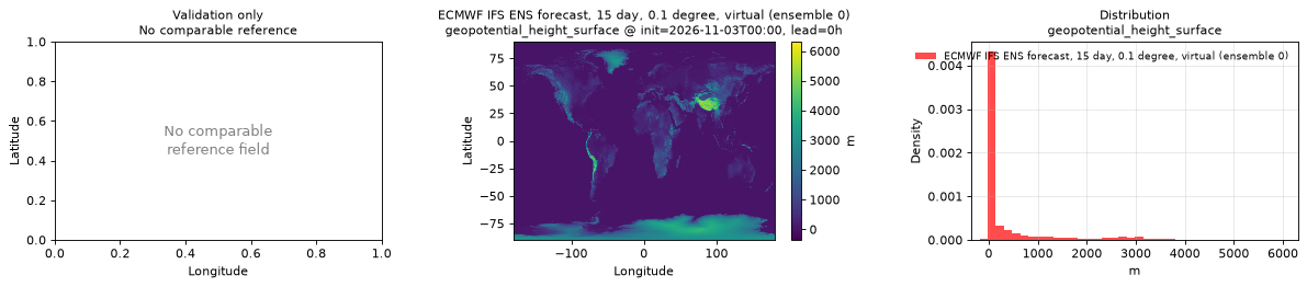
Spatial — init=2026-11-03T00:00, lead=0h (reference not available)
| Source | min | mean | max |
|---|---|---|---|
| Validation | -354.4 | 378.9 | 6312 |
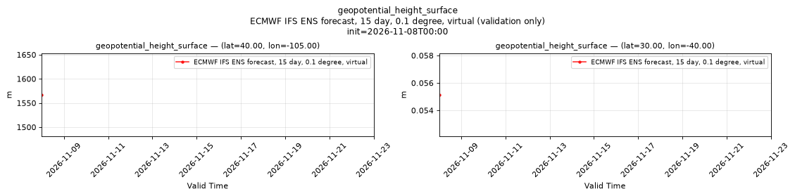
Temporal — init=2026-11-08T00:00
| Source | min | mean | max |
|---|---|---|---|
| P1 Validation | 1567 | 1567 | 1567 |
| P2 Validation | 0.05514 | 0.05514 | 0.05514 |
Availability — 42 of 42 positions complete
Additional spatial comparison — member 25, init=2026-11-02T00:00, lead=150h. This field is published only for control member 0 and is intentionally absent here.
high_cloud_cover
Metadata
| Field | Value |
|---|---|
| units | percent |
| long_name | High cloud cover |
| short_name | hcc |
| standard_name | cloud_area_fraction_in_atmosphere_layer |
| step_type | instant |
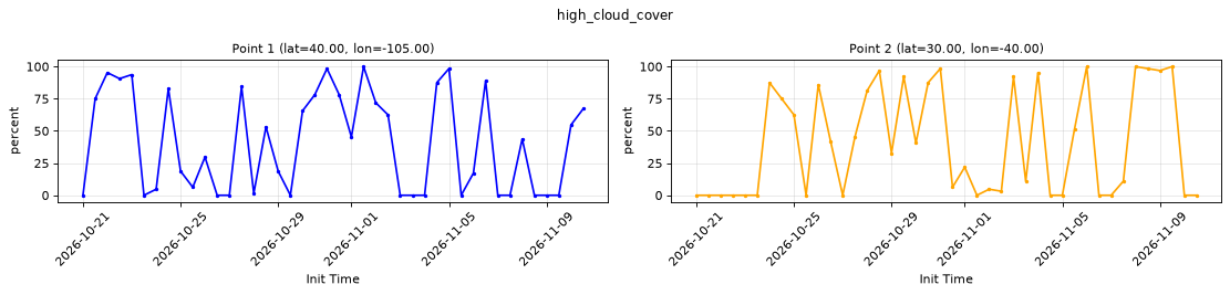
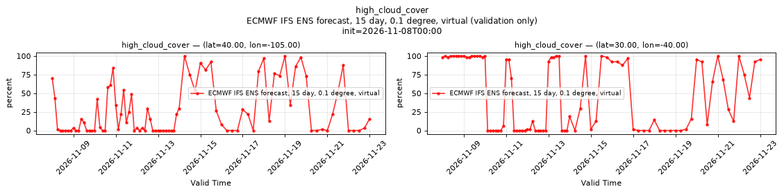
Point time series — 2026-10-21T00:00 - 2026-11-10T12:00, sampled lead=3h, member=0
| Point | min | mean | max |
|---|---|---|---|
| P1 | 0 | 40.77 | 100 |
| P2 | 0 | 40.96 | 100 |
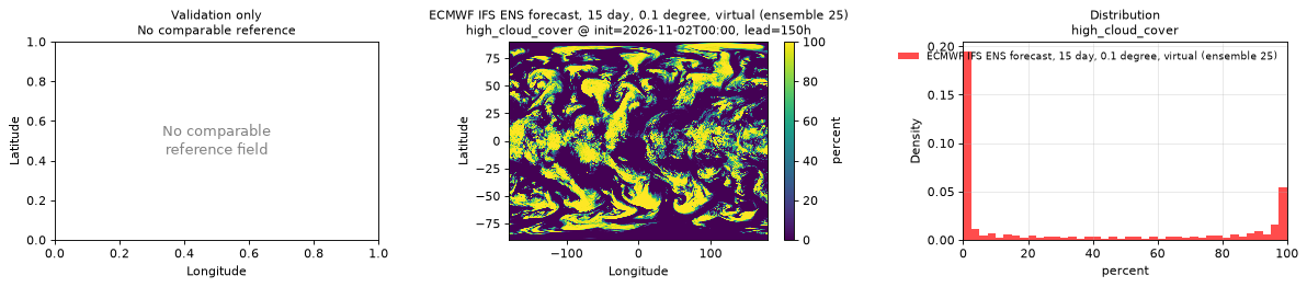
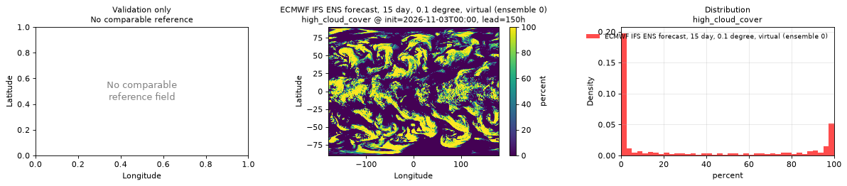
Spatial — init=2026-11-03T00:00, lead=150h (reference not available)
| Source | min | mean | max |
|---|---|---|---|
| Validation | 0 | 32.5 | 100 |
Temporal — init=2026-11-08T00:00
| Source | min | mean | max |
|---|---|---|---|
| P1 Validation | 0 | 25.7 | 100 |
| P2 Validation | 0 | 48.27 | 100 |
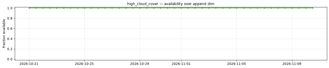
Availability — 42 of 42 positions complete
Additional spatial comparison — member 25, init=2026-11-02T00:00, lead=150h.
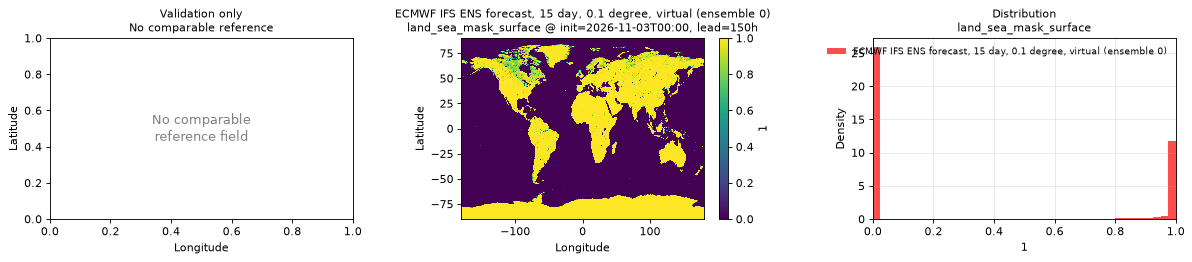
land_sea_mask_surface
Metadata
| Field | Value |
|---|---|
| units | 1 |
| long_name | Land-sea mask |
| short_name | lsm |
| standard_name | land_area_fraction |
| step_type | instant |
| comment | Fraction (0-1) of the grid box that is land. |
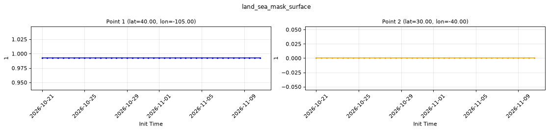
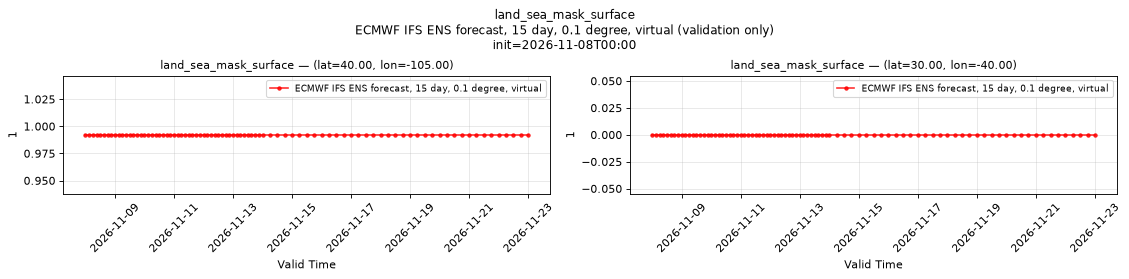
Point time series — 2026-10-21T00:00 - 2026-11-10T12:00, sampled lead=3h, member=0
| Point | min | mean | max |
|---|---|---|---|
| P1 | 0.9922 | 0.9922 | 0.9922 |
| P2 | 0 | 0 | 0 |
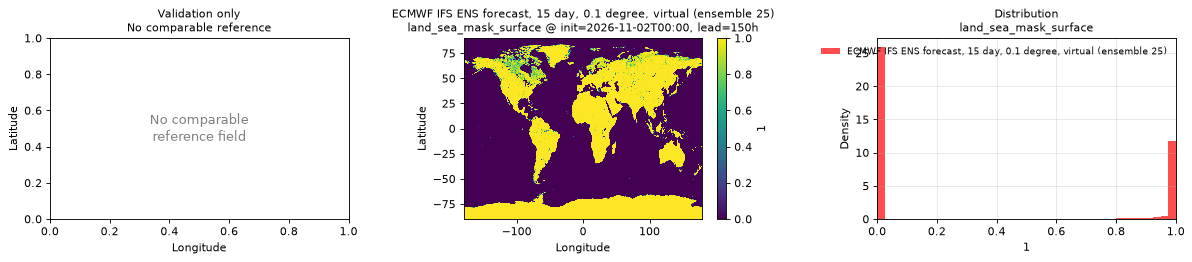
Spatial — init=2026-11-03T00:00, lead=150h (reference not available)
| Source | min | mean | max |
|---|---|---|---|
| Validation | 0 | 0.3343 | 1 |
Temporal — init=2026-11-08T00:00
| Source | min | mean | max |
|---|---|---|---|
| P1 Validation | 0.9922 | 0.9922 | 0.9922 |
| P2 Validation | 0 | 0 | 0 |
Availability — 42 of 42 positions complete
Additional spatial comparison — member 25, init=2026-11-02T00:00, lead=150h.
low_cloud_cover
Metadata
| Field | Value |
|---|---|
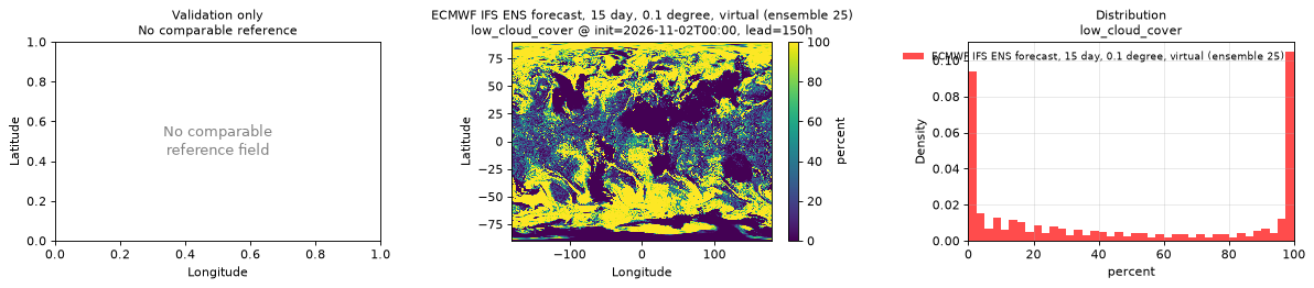
| units | percent |
| long_name | Low cloud cover |
| short_name | lcc |
| standard_name | cloud_area_fraction_in_atmosphere_layer |
| step_type | instant |
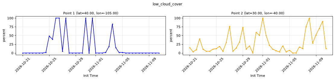
Point time series — 2026-10-21T00:00 - 2026-11-10T12:00, sampled lead=3h, member=0
| Point | min | mean | max |
|---|---|---|---|
| P1 | 0 | 17.04 | 100 |
| P2 | 0 | 28.27 | 100 |
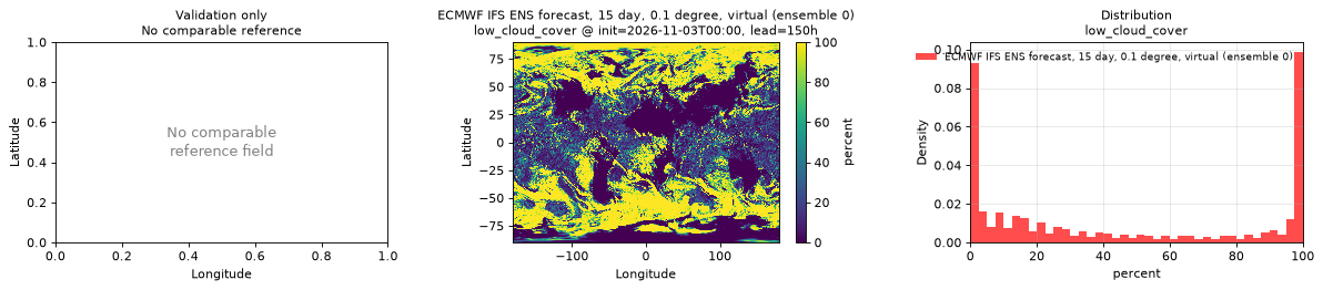
Spatial — init=2026-11-03T00:00, lead=150h (reference not available)
| Source | min | mean | max |
|---|---|---|---|
| Validation | 0 | 45.01 | 100 |
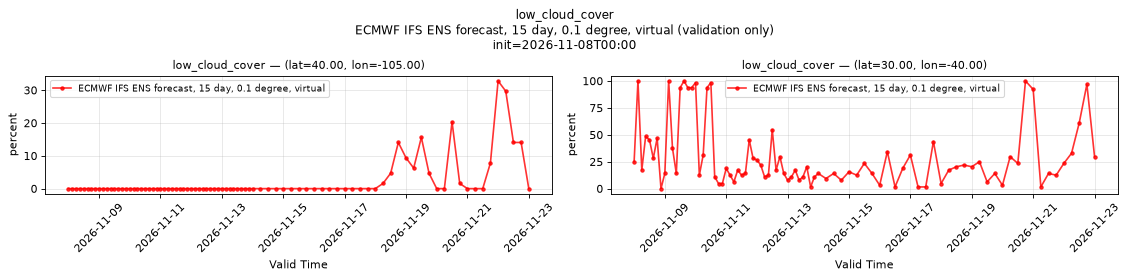
Temporal — init=2026-11-08T00:00
| Source | min | mean | max |
|---|---|---|---|
| P1 Validation | 0 | 2.077 | 32.81 |
| P2 Validation | 0 | 29.87 | 100 |
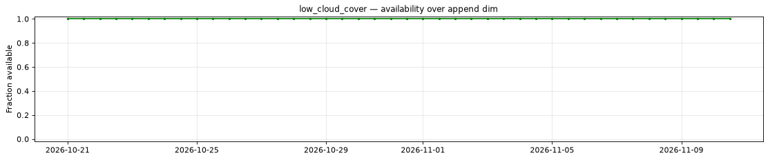
Availability — 42 of 42 positions complete
Additional spatial comparison — member 25, init=2026-11-02T00:00, lead=150h.
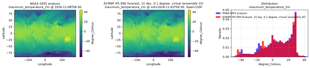
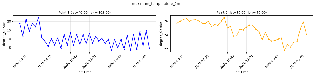
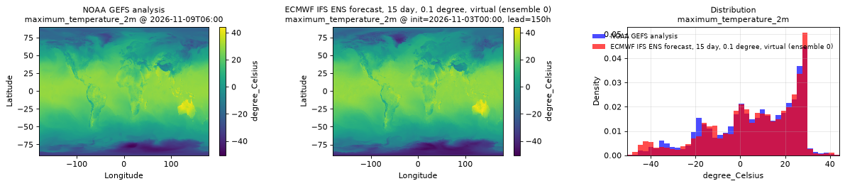
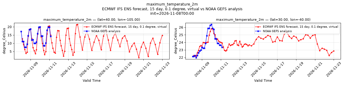
maximum_temperature_2m
Metadata
| Field | Value |
|---|---|
| units | degree_Celsius |
| long_name | Maximum temperature |
| short_name | tmax |
| standard_name | air_temperature |
| step_type | max |
| comment | Maximum since the preceding forecast step. Not available at lead time 0. |
Point time series — 2026-10-21T00:00 - 2026-11-10T12:00, sampled lead=3h, member=0
| Point | min | mean | max |
|---|---|---|---|
| P1 | 3.434 | 10.27 | 22.46 |
| P2 | 21.81 | 24.75 | 26.56 |
Spatial — init=2026-11-03T00:00, lead=150h (reference at 2026-11-09T06:00)
| Source | min | mean | max |
|---|---|---|---|
| Validation | -48.8 | 6.208 | 43.45 |
| Reference | -50.5 | 6.362 | 44.25 |
Temporal — init=2026-11-08T00:00
| Source | min | mean | max |
|---|---|---|---|
| P1 Validation | 1.334 | 10.88 | 21.43 |
| P1 Reference | 7.5 | 13.62 | 20 |
| P2 Validation | 22.18 | 23.99 | 25.82 |
| P2 Reference | 22 | 23.89 | 26.38 |
Availability — 42 of 42 positions complete
Additional spatial comparison — member 25, init=2026-11-02T00:00, lead=150h.
medium_cloud_cover
Metadata
| Field | Value |
|---|---|
| units | percent |
| long_name | Medium cloud cover |
| short_name | mcc |
| standard_name | cloud_area_fraction_in_atmosphere_layer |
| step_type | instant |
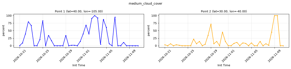
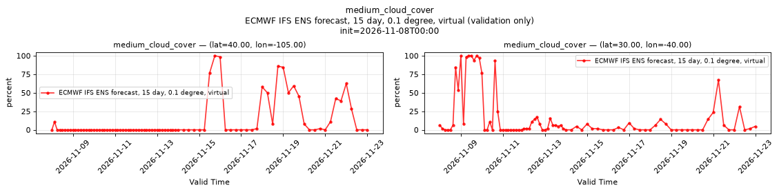
Point time series — 2026-10-21T00:00 - 2026-11-10T12:00, sampled lead=3h, member=0
| Point | min | mean | max |
|---|---|---|---|
| P1 | 0 | 26.12 | 100 |
| P2 | 0 | 13.32 | 100 |
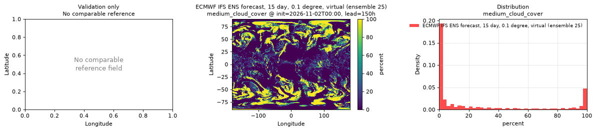
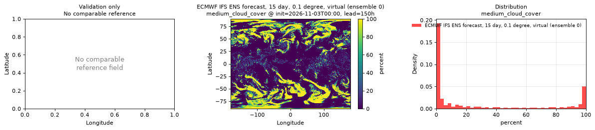
Spatial — init=2026-11-03T00:00, lead=150h (reference not available)
| Source | min | mean | max |
|---|---|---|---|
| Validation | 0 | 27.74 | 100 |
Temporal — init=2026-11-08T00:00
| Source | min | mean | max |
|---|---|---|---|
| P1 Validation | 0 | 10.83 | 100 |
| P2 Validation | 0 | 15.97 | 100 |
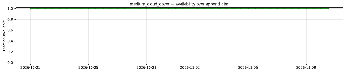
Availability — 42 of 42 positions complete
Additional spatial comparison — member 25, init=2026-11-02T00:00, lead=150h.
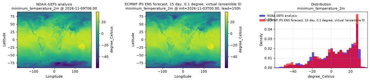
minimum_temperature_2m
Metadata
| Field | Value |
|---|---|
| units | degree_Celsius |
| long_name | Minimum temperature |
| short_name | tmin |
| standard_name | air_temperature |
| step_type | min |
| comment | Minimum since the preceding forecast step. Not available at lead time 0. |
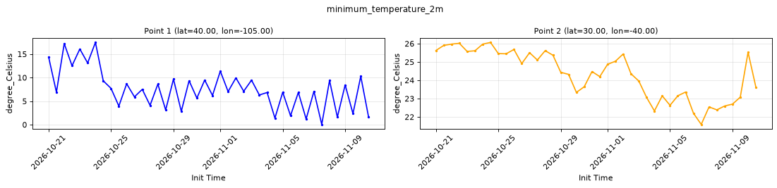
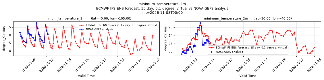
Point time series — 2026-10-21T00:00 - 2026-11-10T12:00, sampled lead=3h, member=0
| Point | min | mean | max |
|---|---|---|---|
| P1 | 0.04409 | 7.541 | 17.47 |
| P2 | 21.59 | 24.33 | 26.06 |
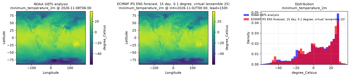
Spatial — init=2026-11-03T00:00, lead=150h (reference at 2026-11-09T06:00)
| Source | min | mean | max |
|---|---|---|---|
| Validation | -52.22 | 4.609 | 37.28 |
| Reference | -59 | 4.629 | 37.75 |
Temporal — init=2026-11-08T00:00
| Source | min | mean | max |
|---|---|---|---|
| P1 Validation | -2.196 | 6.13 | 16.32 |
| P1 Reference | 5.188 | 9.413 | 17.62 |
| P2 Validation | 21.84 | 23.51 | 25.21 |
| P2 Reference | 21.75 | 23.08 | 25.5 |
Availability — 42 of 42 positions complete
Additional spatial comparison — member 25, init=2026-11-02T00:00, lead=150h.
most_unstable_convective_available_potential_energy_surface
Metadata
| Field | Value |
|---|---|
| units | J kg-1 |
| long_name | Most-unstable CAPE |
| short_name | mucape |
| standard_name | atmosphere_convective_available_potential_energy |
| step_type | instant |
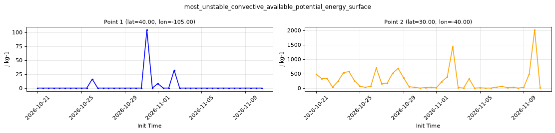
Point time series — 2026-10-21T00:00 - 2026-11-10T12:00, sampled lead=3h, member=0
| Point | min | mean | max |
|---|---|---|---|
| P1 | 0 | 3.81 | 104 |
| P2 | 0 | 253.3 | 2008 |
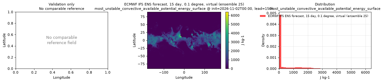
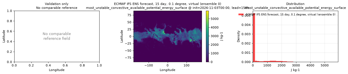
Spatial — init=2026-11-03T00:00, lead=150h (reference not available)
| Source | min | mean | max |
|---|---|---|---|
| Validation | 0 | 317 | 5920 |
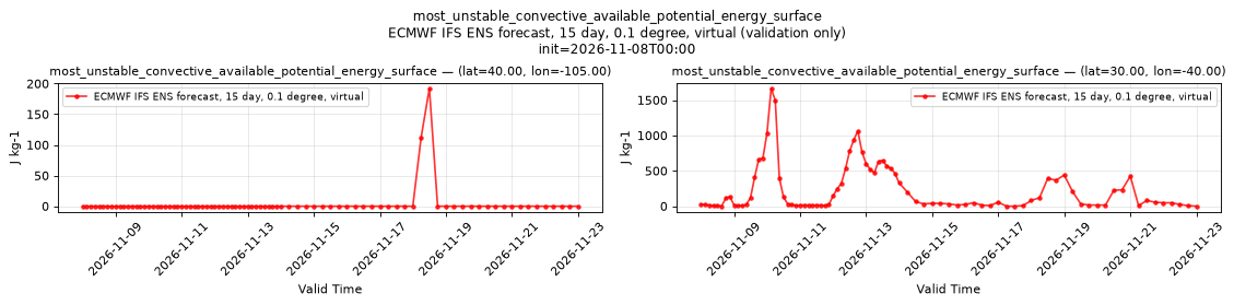
Temporal — init=2026-11-08T00:00
| Source | min | mean | max |
|---|---|---|---|
| P1 Validation | 0 | 3.576 | 192 |
| P2 Validation | 0 | 236.9 | 1664 |
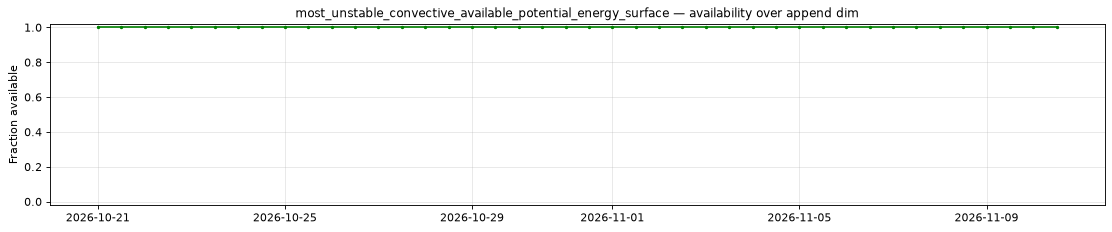
Availability — 42 of 42 positions complete
Additional spatial comparison — member 25, init=2026-11-02T00:00, lead=150h.
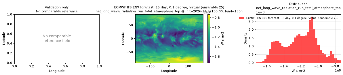
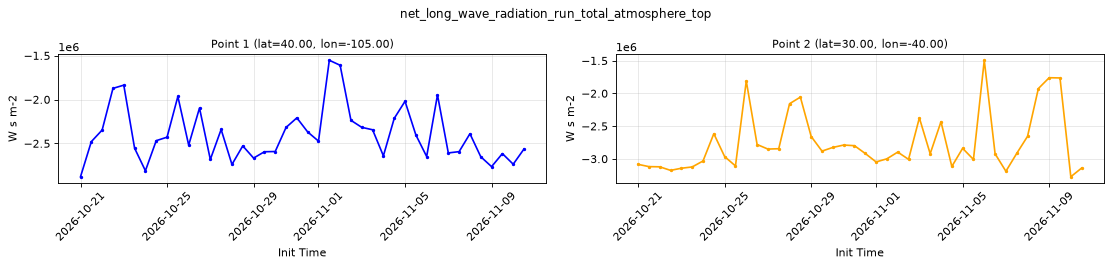
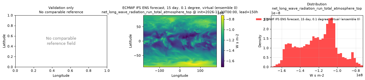
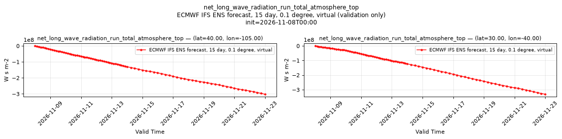
net_long_wave_radiation_run_total_atmosphere_top
Metadata
| Field | Value |
|---|---|
| units | W s m-2 |
| long_name | Top net long-wave (thermal) radiation |
| short_name | ttr |
| standard_name | n/a |
| step_type | accum |
| comment | Positive downwards, the negative of outgoing long-wave radiation. Accumulated since forecast initialization. |
Point time series — 2026-10-21T00:00 - 2026-11-10T12:00, sampled lead=3h, member=0
| Point | min | mean | max |
|---|---|---|---|
| P1 | -2.879e+06 | -2.396e+06 | -1.553e+06 |
| P2 | -3.273e+06 | -2.751e+06 | -1.494e+06 |
Spatial — init=2026-11-03T00:00, lead=150h (reference not available)
| Source | min | mean | max |
|---|---|---|---|
| Validation | -1.715e+08 | -1.215e+08 | -7.243e+07 |
Temporal — init=2026-11-08T00:00
| Source | min | mean | max |
|---|---|---|---|
| P1 Validation | -3.02e+08 | -1.301e+08 | 0 |
| P2 Validation | -3.309e+08 | -1.308e+08 | 0 |
Availability — 42 of 42 positions complete
Additional spatial comparison — member 25, init=2026-11-02T00:00, lead=150h.
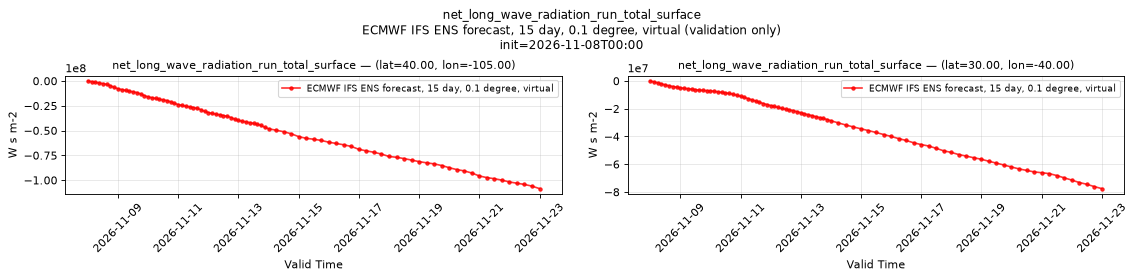
net_long_wave_radiation_run_total_surface
Metadata
| Field | Value |
|---|---|
| units | W s m-2 |
| long_name | Surface net long-wave (thermal) radiation |
| short_name | str |
| standard_name | integral_wrt_time_of_surface_net_downward_longwave_flux |
| step_type | accum |
| comment | Accumulated since forecast initialization. |
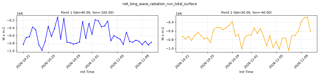
Point time series — 2026-10-21T00:00 - 2026-11-10T12:00, sampled lead=3h, member=0
| Point | min | mean | max |
|---|---|---|---|
| P1 | -9.871e+05 | -5.987e+05 | -1.197e+05 |
| P2 | -1.043e+06 | -6.834e+05 | -2.846e+05 |
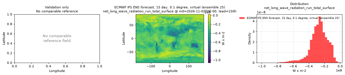
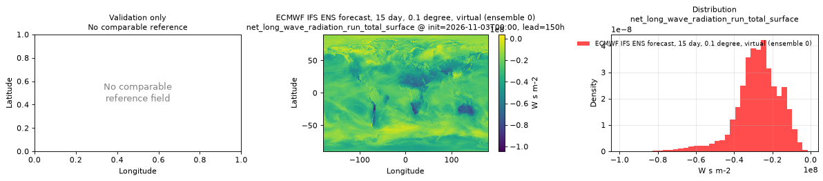
Spatial — init=2026-11-03T00:00, lead=150h (reference not available)
| Source | min | mean | max |
|---|---|---|---|
| Validation | -1.044e+08 | -2.756e+07 | 3.829e+06 |
Temporal — init=2026-11-08T00:00
| Source | min | mean | max |
|---|---|---|---|
| P1 Validation | -1.085e+08 | -4.691e+07 | 0 |
| P2 Validation | -7.756e+07 | -3.044e+07 | 0 |
Availability — 42 of 42 positions complete
Additional spatial comparison — member 25, init=2026-11-02T00:00, lead=150h.
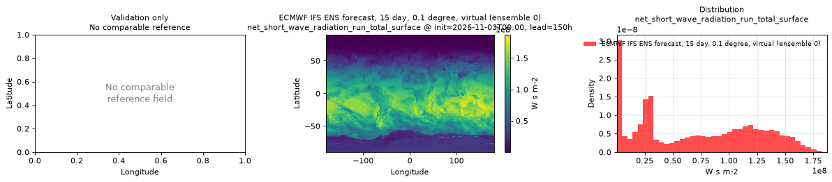
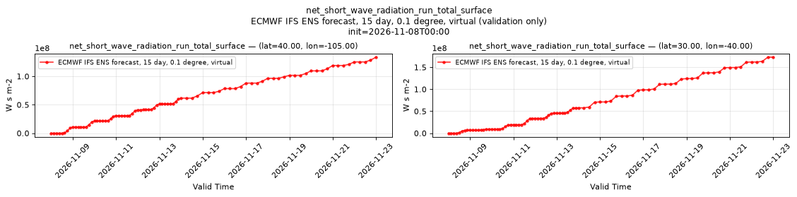
net_short_wave_radiation_run_total_surface
Metadata
| Field | Value |
|---|---|
| units | W s m-2 |
| long_name | Surface net short-wave (solar) radiation |
| short_name | ssr |
| standard_name | integral_wrt_time_of_surface_net_downward_shortwave_flux |
| step_type | accum |
| comment | Accumulated since forecast initialization. |
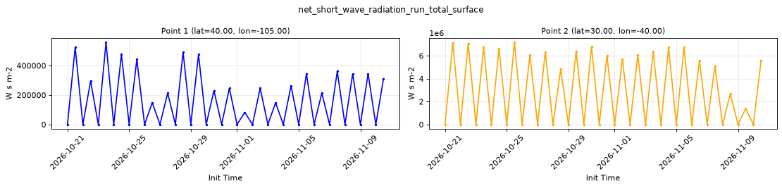
Point time series — 2026-10-21T00:00 - 2026-11-10T12:00, sampled lead=3h, member=0
| Point | min | mean | max |
|---|---|---|---|
| P1 | 0.1287 | 1.607e+05 | 5.571e+05 |
| P2 | 0.1287 | 2.93e+06 | 7.16e+06 |
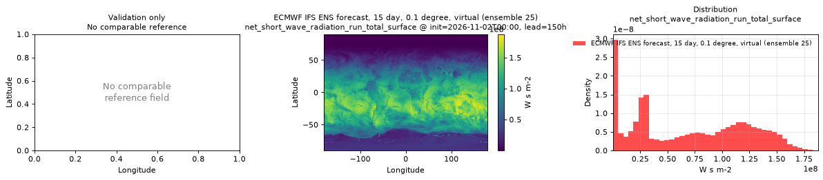
Spatial — init=2026-11-03T00:00, lead=150h (reference not available)
| Source | min | mean | max |
|---|---|---|---|
| Validation | 6.437 | 7.188e+07 | 1.872e+08 |
Temporal — init=2026-11-08T00:00
| Source | min | mean | max |
|---|---|---|---|
| P1 Validation | 0 | 5.752e+07 | 1.337e+08 |
| P2 Validation | 0 | 6.303e+07 | 1.73e+08 |
Availability — 42 of 42 positions complete
Additional spatial comparison — member 25, init=2026-11-02T00:00, lead=150h.
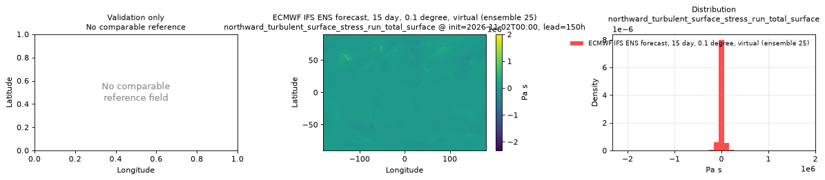
northward_turbulent_surface_stress_run_total_surface
Metadata
| Field | Value |
|---|---|
| units | Pa s |
| long_name | Time-integrated northward turbulent surface stress |
| short_name | nsss |
| standard_name | integral_wrt_time_of_surface_downward_northward_stress |
| step_type | accum |
| comment | Accumulated since forecast initialization. |
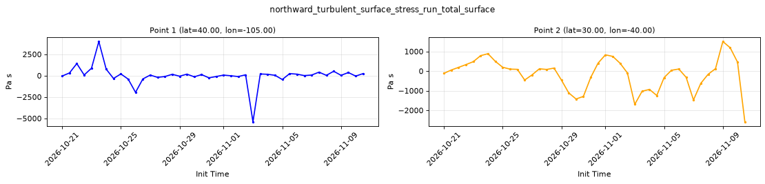
Point time series — 2026-10-21T00:00 - 2026-11-10T12:00, sampled lead=3h, member=0
| Point | min | mean | max |
|---|---|---|---|
| P1 | -5407 | 11.01 | 3984 |
| P2 | -2585 | -147.5 | 1502 |
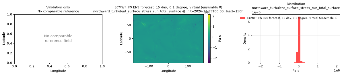
Spatial — init=2026-11-03T00:00, lead=150h (reference not available)
| Source | min | mean | max |
|---|---|---|---|
| Validation | -2.45e+06 | 1575 | 2.166e+06 |
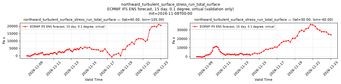
Temporal — init=2026-11-08T00:00
| Source | min | mean | max |
|---|---|---|---|
| P1 Validation | -767 | 4506 | 2.116e+04 |
| P2 Validation | -369.1 | 9967 | 3.616e+04 |
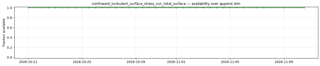
Availability — 42 of 42 positions complete
Additional spatial comparison — member 25, init=2026-11-02T00:00, lead=150h.
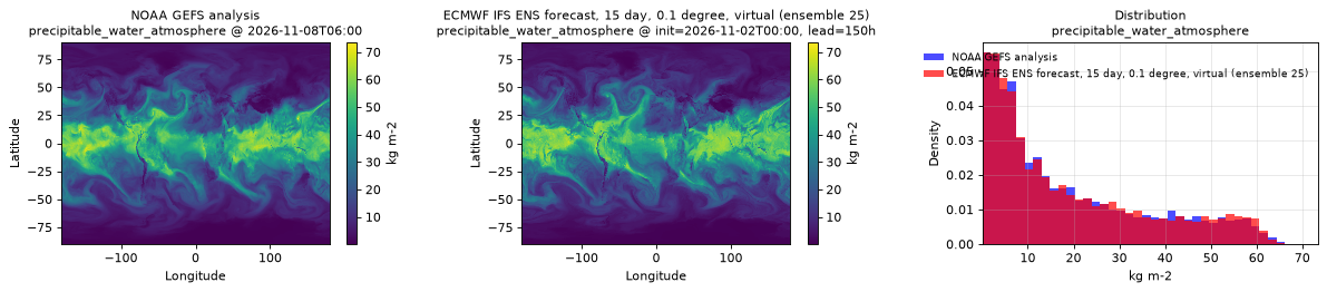
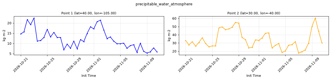
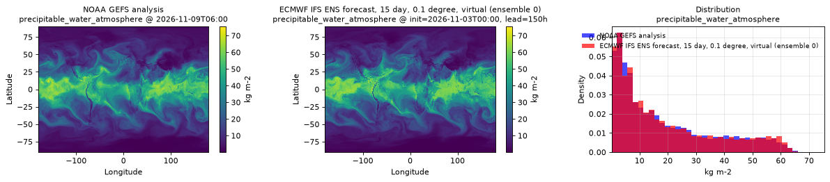
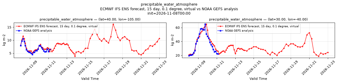
precipitable_water_atmosphere
Metadata
| Field | Value |
|---|---|
| units | kg m-2 |
| long_name | Precipitable water |
| short_name | pwat |
| standard_name | atmosphere_mass_content_of_water_vapor |
| step_type | instant |
Point time series — 2026-10-21T00:00 - 2026-11-10T12:00, sampled lead=3h, member=0
| Point | min | mean | max |
|---|---|---|---|
| P1 | 5.328 | 12.24 | 22.42 |
| P2 | 17.87 | 34.04 | 60.35 |
Spatial — init=2026-11-03T00:00, lead=150h (reference at 2026-11-09T06:00)
| Source | min | mean | max |
|---|---|---|---|
| Validation | 0.1146 | 18.92 | 74.11 |
| Reference | 0.1001 | 18.68 | 75.5 |
Temporal — init=2026-11-08T00:00
| Source | min | mean | max |
|---|---|---|---|
| P1 Validation | 3.865 | 7.949 | 16.19 |
| P1 Reference | 4.5 | 6.637 | 10.62 |
| P2 Validation | 18.92 | 32.53 | 64.84 |
| P2 Reference | 19.62 | 37.63 | 65 |
Availability — 42 of 42 positions complete
Additional spatial comparison — member 25, init=2026-11-02T00:00, lead=150h.
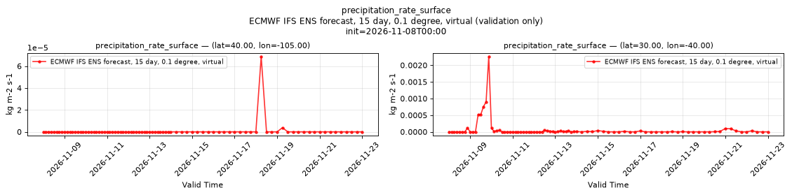
precipitation_rate_surface
Metadata
| Field | Value |
|---|---|
| units | kg m-2 s-1 |
| long_name | Precipitation rate |
| short_name | prate |
| standard_name | precipitation_flux |
| step_type | instant |
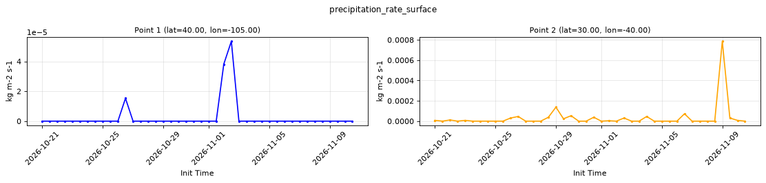
Point time series — 2026-10-21T00:00 - 2026-11-10T12:00, sampled lead=3h, member=0
| Point | min | mean | max |
|---|---|---|---|
| P1 | 0 | 2.543e-06 | 5.341e-05 |
| P2 | 0 | 3.261e-05 | 0.0007858 |
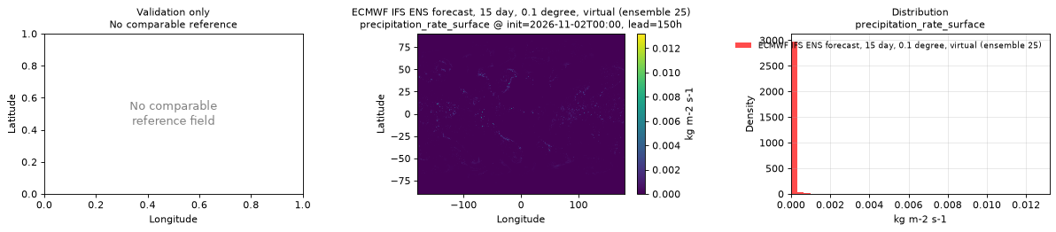
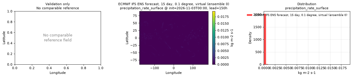
Spatial — init=2026-11-03T00:00, lead=150h (reference not available)
| Source | min | mean | max |
|---|---|---|---|
| Validation | 0 | 2.84e-05 | 0.01949 |
Temporal — init=2026-11-08T00:00
| Source | min | mean | max |
|---|---|---|---|
| P1 Validation | 0 | 8.527e-07 | 6.866e-05 |
| P2 Validation | 0 | 6.893e-05 | 0.002258 |
Availability — 42 of 42 positions complete
Additional spatial comparison — member 25, init=2026-11-02T00:00, lead=150h.
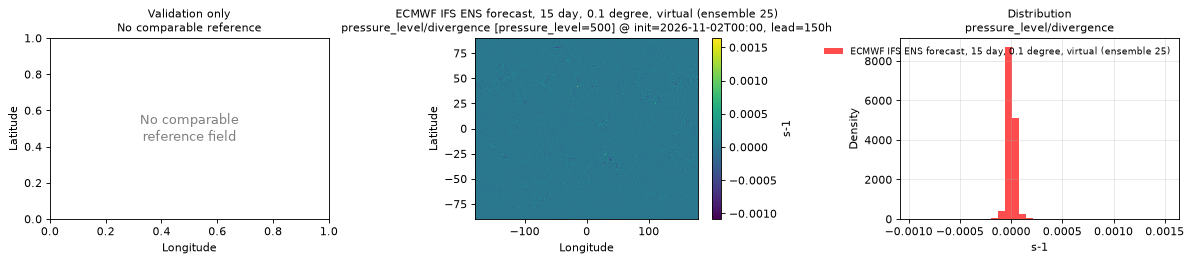
pressure_level/divergence [pressure_level=500]
Metadata
| Field | Value |
|---|---|
| units | s-1 |
| long_name | Divergence |
| short_name | d |
| standard_name | divergence_of_wind |
| step_type | instant |
| sampled level | pressure_level=500 |
Point time series — 2026-10-21T00:00 - 2026-11-10T12:00, sampled lead=3h, member=0, pressure_level=500
| Point | min | mean | max |
|---|---|---|---|
| P1 | -0.0001955 | -9.436e-06 | 0.000229 |
| P2 | -0.0003401 | -9.212e-07 | 0.0003712 |
Spatial — init=2026-11-03T00:00, lead=150h (reference not available)
| Source | min | mean | max |
|---|---|---|---|
| Validation | -0.0009239 | -1.384e-08 | 0.001214 |
Temporal — init=2026-11-08T00:00
| Source | min | mean | max |
|---|---|---|---|
| P1 Validation | -0.0001261 | 4.074e-06 | 0.0002283 |
| P2 Validation | -0.0001292 | -3.35e-07 | 0.0001772 |
Availability — 42 of 42 positions complete
Additional spatial comparison — member 25, init=2026-11-02T00:00, lead=150h, pressure level 500 hPa.
pressure_level/geopotential [pressure_level=500]
Metadata
| Field | Value |
|---|---|
| units | m2 s-2 |
| long_name | Geopotential |
| short_name | z |
| standard_name | geopotential |
| step_type | instant |
| sampled level | pressure_level=500 |
| comment | Available for control member 0 only; members 1-50 are NaN. |
Point time series — 2026-10-21T00:00 - 2026-11-10T12:00, sampled lead=3h, member=0, pressure_level=500
| Point | min | mean | max |
|---|---|---|---|
| P1 | 5.52e+04 | 5.652e+04 | 5.745e+04 |
| P2 | 5.627e+04 | 5.747e+04 | 5.824e+04 |
Spatial — init=2026-11-03T00:00, lead=150h (reference not available)
| Source | min | mean | max |
|---|---|---|---|
| Validation | 4.661e+04 | 5.399e+04 | 5.831e+04 |
Temporal — init=2026-11-08T00:00
| Source | min | mean | max |
|---|---|---|---|
| P1 Validation | 5.444e+04 | 5.638e+04 | 5.72e+04 |
| P2 Validation | 5.679e+04 | 5.74e+04 | 5.838e+04 |
Availability — 42 of 42 positions complete
Additional spatial comparison — member 25, init=2026-11-02T00:00, lead=150h, pressure level 500 hPa. This field is published only for control member 0 and is intentionally absent here.
pressure_level/geopotential_height [pressure_level=500]
Metadata
| Field | Value |
|---|---|
| units | m |
| long_name | Geopotential height |
| short_name | gh |
| standard_name | geopotential_height |
| step_type | instant |
| sampled level | pressure_level=500 |
Point time series — 2026-10-21T00:00 - 2026-11-10T12:00, sampled lead=3h, member=0, pressure_level=500
| Point | min | mean | max |
|---|---|---|---|
| P1 | 5628 | 5763 | 5858 |
| P2 | 5739 | 5861 | 5939 |
Spatial — init=2026-11-03T00:00, lead=150h (reference not available)
| Source | min | mean | max |
|---|---|---|---|
| Validation | 4753 | 5506 | 5946 |
Temporal — init=2026-11-08T00:00
| Source | min | mean | max |
|---|---|---|---|
| P1 Validation | 5552 | 5749 | 5833 |
| P2 Validation | 5791 | 5853 | 5953 |
Availability — 42 of 42 positions complete
Additional spatial comparison — member 25, init=2026-11-02T00:00, lead=150h, pressure level 500 hPa.
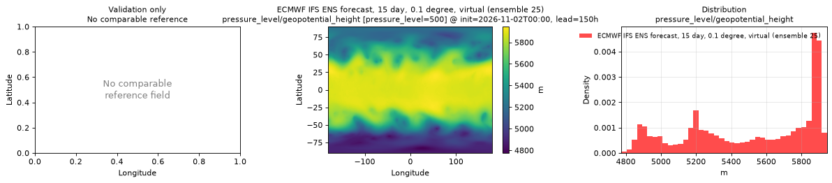
pressure_level/relative_humidity [pressure_level=500]
Metadata
| Field | Value |
|---|---|
| units | percent |
| long_name | Relative humidity |
| short_name | r |
| standard_name | relative_humidity |
| step_type | instant |
| sampled level | pressure_level=500 |
Point time series — 2026-10-21T00:00 - 2026-11-10T12:00, sampled lead=3h, member=0, pressure_level=500
| Point | min | mean | max |
|---|---|---|---|
| P1 | 3.054 | 45.52 | 98.89 |
| P2 | 2.299 | 36.21 | 96.55 |
Spatial — init=2026-11-03T00:00, lead=150h (reference not available)
| Source | min | mean | max |
|---|---|---|---|
| Validation | -2.993 | 52.04 | 122 |
Temporal — init=2026-11-08T00:00
| Source | min | mean | max |
|---|---|---|---|
| P1 Validation | 2.823 | 31.88 | 102.7 |
| P2 Validation | 0.8538 | 33.31 | 101.7 |
Availability — 42 of 42 positions complete
Additional spatial comparison — member 25, init=2026-11-02T00:00, lead=150h, pressure level 500 hPa.
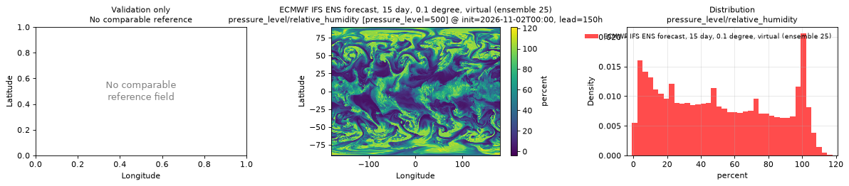
pressure_level/relative_vorticity [pressure_level=500]
Metadata
| Field | Value |
|---|---|
| units | s-1 |
| long_name | Vorticity (relative) |
| short_name | vo |
| standard_name | atmosphere_upward_relative_vorticity |
| step_type | instant |
| sampled level | pressure_level=500 |
Point time series — 2026-10-21T00:00 - 2026-11-10T12:00, sampled lead=3h, member=0, pressure_level=500
| Point | min | mean | max |
|---|---|---|---|
| P1 | -0.0001455 | -5.336e-07 | 0.0002463 |
| P2 | -7.097e-05 | -9.049e-06 | 0.0002107 |
Spatial — init=2026-11-03T00:00, lead=150h (reference not available)
| Source | min | mean | max |
|---|---|---|---|
| Validation | -0.001445 | 6.719e-07 | 0.001712 |
Temporal — init=2026-11-08T00:00
| Source | min | mean | max |
|---|---|---|---|
| P1 Validation | -9.225e-05 | -2.812e-06 | 0.0002176 |
| P2 Validation | -8.451e-05 | 9.017e-07 | 0.0003067 |
Availability — 42 of 42 positions complete
Additional spatial comparison — member 25, init=2026-11-02T00:00, lead=150h, pressure level 500 hPa.
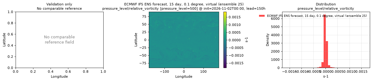
pressure_level/specific_humidity [pressure_level=500]
Metadata
| Field | Value |
|---|---|
| units | 1 |
| long_name | Specific humidity |
| short_name | q |
| standard_name | specific_humidity |
| step_type | instant |
| sampled level | pressure_level=500 |
Point time series — 2026-10-21T00:00 - 2026-11-10T12:00, sampled lead=3h, member=0, pressure_level=500
| Point | min | mean | max |
|---|---|---|---|
| P1 | 9.158e-05 | 0.001146 | 0.003449 |
| P2 | 6.109e-05 | 0.001438 | 0.004745 |
Spatial — init=2026-11-03T00:00, lead=150h (reference not available)
| Source | min | mean | max |
|---|---|---|---|
| Validation | 6.635e-06 | 0.0008996 | 0.006263 |
Temporal — init=2026-11-08T00:00
| Source | min | mean | max |
|---|---|---|---|
| P1 Validation | 9.324e-05 | 0.0006829 | 0.002264 |
| P2 Validation | 3.739e-05 | 0.001349 | 0.005285 |
Availability — 42 of 42 positions complete
Additional spatial comparison — member 25, init=2026-11-02T00:00, lead=150h, pressure level 500 hPa.
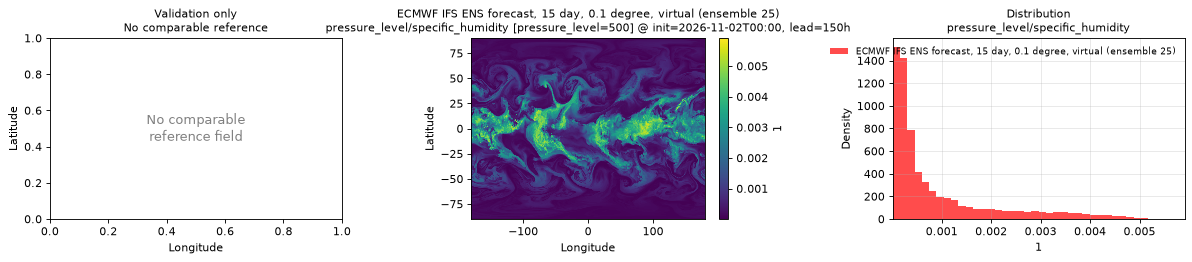
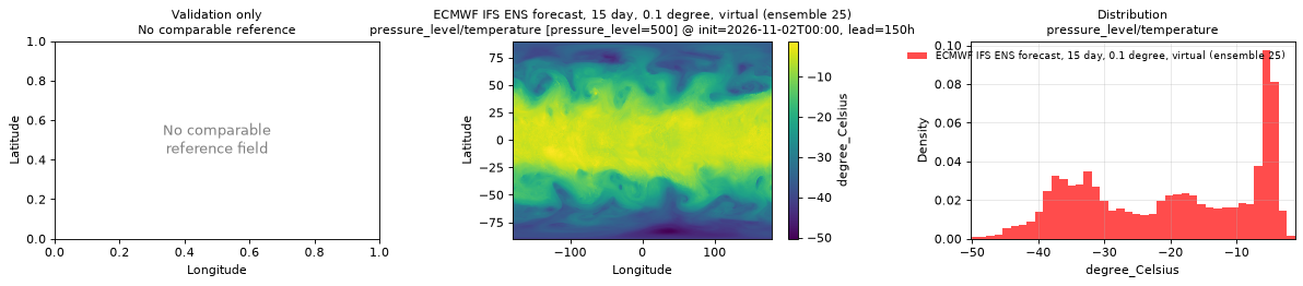
pressure_level/temperature [pressure_level=500]
Metadata
| Field | Value |
|---|---|
| units | degree_Celsius |
| long_name | Temperature |
| short_name | t |
| standard_name | air_temperature |
| step_type | instant |
| sampled level | pressure_level=500 |
Point time series — 2026-10-21T00:00 - 2026-11-10T12:00, sampled lead=3h, member=0, pressure_level=500
| Point | min | mean | max |
|---|---|---|---|
| P1 | -19.04 | -13.24 | -8.233 |
| P2 | -12.56 | -8.018 | -1.42 |
Spatial — init=2026-11-03T00:00, lead=150h (reference not available)
| Source | min | mean | max |
|---|---|---|---|
| Validation | -49.5 | -20.31 | 0.8753 |
Temporal — init=2026-11-08T00:00
| Source | min | mean | max |
|---|---|---|---|
| P1 Validation | -22.08 | -13.68 | -9.872 |
| P2 Validation | -13.84 | -8.161 | -0.7938 |
Availability — 42 of 42 positions complete
Additional spatial comparison — member 25, init=2026-11-02T00:00, lead=150h, pressure level 500 hPa.
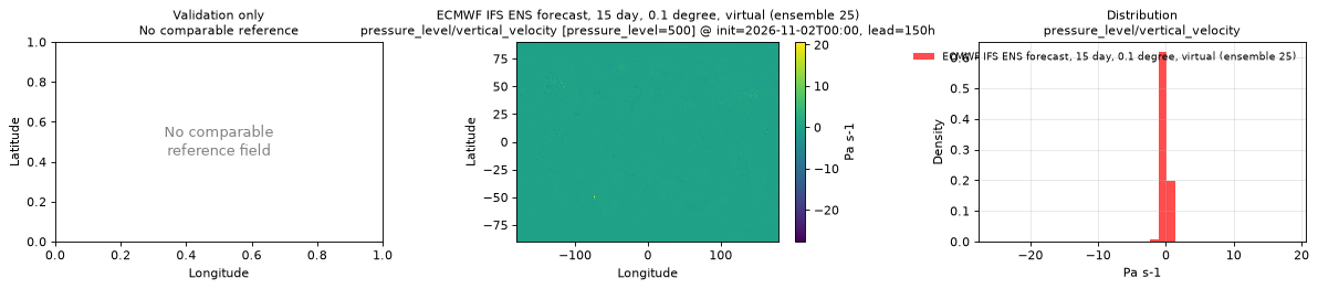
pressure_level/vertical_velocity [pressure_level=500]
Metadata
| Field | Value |
|---|---|
| units | Pa s-1 |
| long_name | Vertical velocity |
| short_name | w |
| standard_name | lagrangian_tendency_of_air_pressure |
| step_type | instant |
| sampled level | pressure_level=500 |
Point time series — 2026-10-21T00:00 - 2026-11-10T12:00, sampled lead=3h, member=0, pressure_level=500
| Point | min | mean | max |
|---|---|---|---|
| P1 | -0.8513 | -0.0117 | 1.085 |
| P2 | -2.31 | -0.01895 | 0.763 |
Spatial — init=2026-11-03T00:00, lead=150h (reference not available)
| Source | min | mean | max |
|---|---|---|---|
| Validation | -43.24 | 0.0005465 | 15.79 |
Temporal — init=2026-11-08T00:00
| Source | min | mean | max |
|---|---|---|---|
| P1 Validation | -2.951 | -0.06577 | 0.7825 |
| P2 Validation | -1.081 | -0.012 | 0.6054 |
Availability — 42 of 42 positions complete
Additional spatial comparison — member 25, init=2026-11-02T00:00, lead=150h, pressure level 500 hPa.
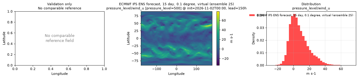
pressure_level/wind_u [pressure_level=500]
Metadata
| Field | Value |
|---|---|
| units | m s-1 |
| long_name | U component of wind |
| short_name | u |
| standard_name | eastward_wind |
| step_type | instant |
| sampled level | pressure_level=500 |
Point time series — 2026-10-21T00:00 - 2026-11-10T12:00, sampled lead=3h, member=0, pressure_level=500
| Point | min | mean | max |
|---|---|---|---|
| P1 | -9.869 | 7.254 | 23.77 |
| P2 | -8.355 | 7.964 | 21.47 |
Spatial — init=2026-11-03T00:00, lead=150h (reference not available)
| Source | min | mean | max |
|---|---|---|---|
| Validation | -26.5 | 7.416 | 69.88 |
Temporal — init=2026-11-08T00:00
| Source | min | mean | max |
|---|---|---|---|
| P1 Validation | -5.04 | 5.264 | 13.89 |
| P2 Validation | -2.604 | 9.802 | 23.67 |
Availability — 42 of 42 positions complete
Additional spatial comparison — member 25, init=2026-11-02T00:00, lead=150h, pressure level 500 hPa.
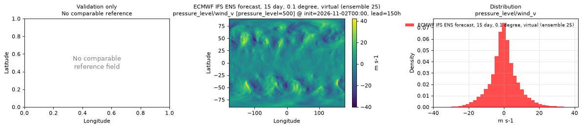
pressure_level/wind_v [pressure_level=500]
Metadata
| Field | Value |
|---|---|
| units | m s-1 |
| long_name | V component of wind |
| short_name | v |
| standard_name | northward_wind |
| step_type | instant |
| sampled level | pressure_level=500 |
Point time series — 2026-10-21T00:00 - 2026-11-10T12:00, sampled lead=3h, member=0, pressure_level=500
| Point | min | mean | max |
|---|---|---|---|
| P1 | -16.91 | 3.042 | 21.09 |
| P2 | -22.13 | -3.38 | 10.58 |
Spatial — init=2026-11-03T00:00, lead=150h (reference not available)
| Source | min | mean | max |
|---|---|---|---|
| Validation | -41.58 | -0.05629 | 39.61 |
Temporal — init=2026-11-08T00:00
| Source | min | mean | max |
|---|---|---|---|
| P1 Validation | -25.4 | -3.802 | 14.46 |
| P2 Validation | -12.72 | 0.2586 | 13.65 |
Availability — 42 of 42 positions complete
Additional spatial comparison — member 25, init=2026-11-02T00:00, lead=150h, pressure level 500 hPa.
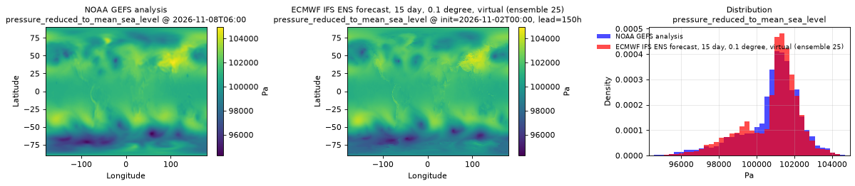
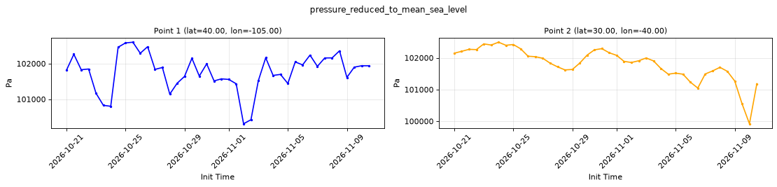
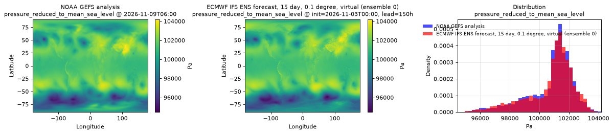
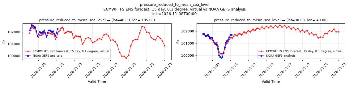
pressure_reduced_to_mean_sea_level
Metadata
| Field | Value |
|---|---|
| units | Pa |
| long_name | Pressure reduced to MSL |
| short_name | prmsl |
| standard_name | air_pressure_at_mean_sea_level |
| step_type | instant |
Point time series — 2026-10-21T00:00 - 2026-11-10T12:00, sampled lead=3h, member=0
| Point | min | mean | max |
|---|---|---|---|
| P1 | 1.003e+05 | 1.018e+05 | 1.026e+05 |
| P2 | 9.992e+04 | 1.018e+05 | 1.025e+05 |
Spatial — init=2026-11-03T00:00, lead=150h (reference at 2026-11-09T06:00)
| Source | min | mean | max |
|---|---|---|---|
| Validation | 9.447e+04 | 1.008e+05 | 1.042e+05 |
| Reference | 9.491e+04 | 1.008e+05 | 1.041e+05 |
Temporal — init=2026-11-08T00:00
| Source | min | mean | max |
|---|---|---|---|
| P1 Validation | 9.98e+04 | 1.016e+05 | 1.025e+05 |
| P1 Reference | 1.016e+05 | 1.021e+05 | 1.026e+05 |
| P2 Validation | 1.001e+05 | 1.017e+05 | 1.025e+05 |
| P2 Reference | 9.978e+04 | 1.011e+05 | 1.018e+05 |
Availability — 42 of 42 positions complete
Additional spatial comparison — member 25, init=2026-11-02T00:00, lead=150h.
pressure_surface
Metadata
| Field | Value |
|---|---|
| units | Pa |
| long_name | Surface pressure |
| short_name | sp |
| standard_name | surface_air_pressure |
| step_type | instant |
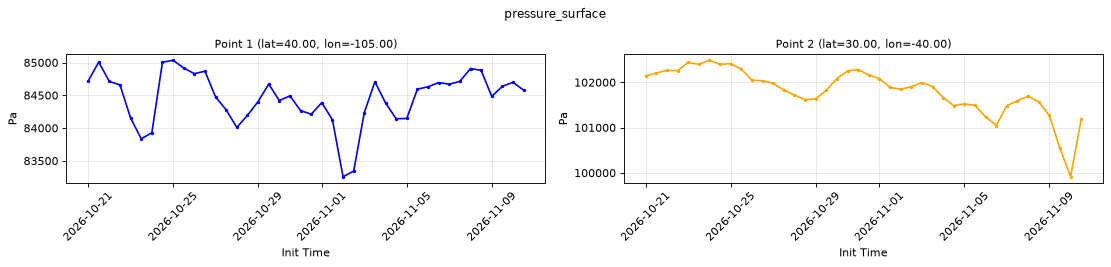
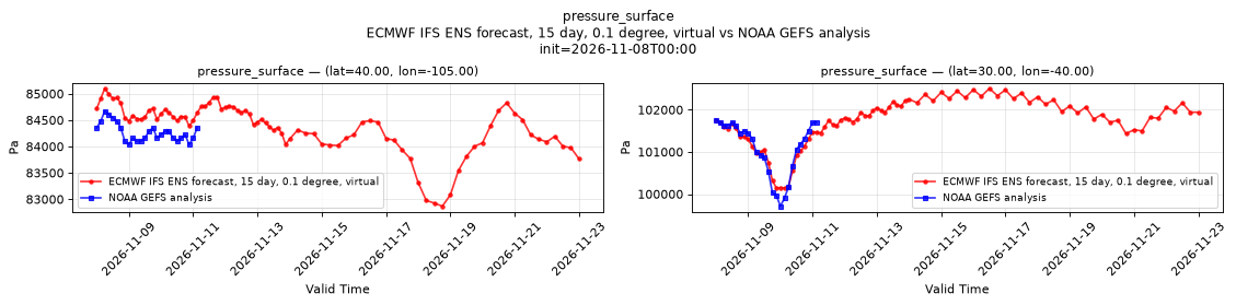
Point time series — 2026-10-21T00:00 - 2026-11-10T12:00, sampled lead=3h, member=0
| Point | min | mean | max |
|---|---|---|---|
| P1 | 8.326e+04 | 8.446e+04 | 8.504e+04 |
| P2 | 9.991e+04 | 1.018e+05 | 1.025e+05 |
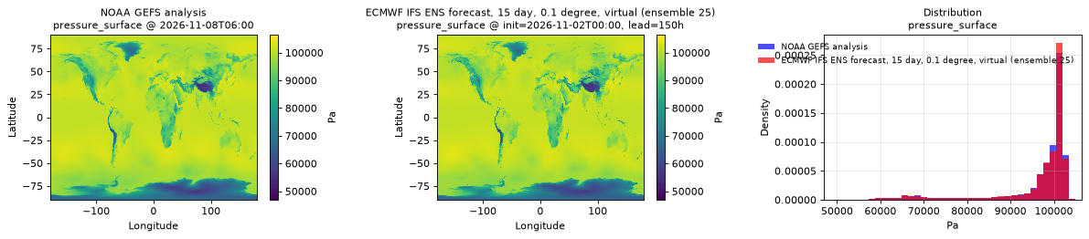
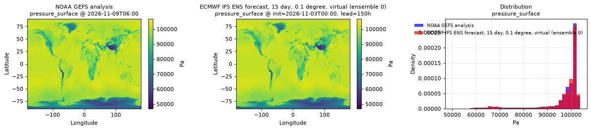
Spatial — init=2026-11-03T00:00, lead=150h (reference at 2026-11-09T06:00)
| Source | min | mean | max |
|---|---|---|---|
| Validation | 4.688e+04 | 9.652e+04 | 1.068e+05 |
| Reference | 5.04e+04 | 9.648e+04 | 1.044e+05 |
Temporal — init=2026-11-08T00:00
| Source | min | mean | max |
|---|---|---|---|
| P1 Validation | 8.287e+04 | 8.436e+04 | 8.51e+04 |
| P1 Reference | 8.403e+04 | 8.427e+04 | 8.467e+04 |
| P2 Validation | 1.001e+05 | 1.017e+05 | 1.025e+05 |
| P2 Reference | 9.971e+04 | 1.011e+05 | 1.018e+05 |
Availability — 42 of 42 positions complete
Additional spatial comparison — member 25, init=2026-11-02T00:00, lead=150h.
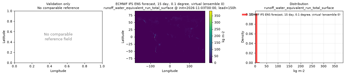
runoff_water_equivalent_run_total_surface
Metadata
| Field | Value |
|---|---|
| units | kg m-2 |
| long_name | Runoff water equivalent (surface plus subsurface) |
| short_name | rowe |
| standard_name | runoff_amount |
| step_type | accum |
| comment | Accumulated since forecast initialization. |
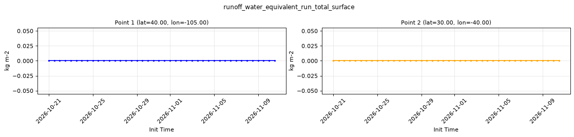
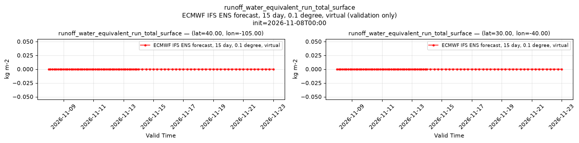
Point time series — 2026-10-21T00:00 - 2026-11-10T12:00, sampled lead=3h, member=0
| Point | min | mean | max |
|---|---|---|---|
| P1 | 0 | 0 | 0 |
| P2 | 0 | 0 | 0 |
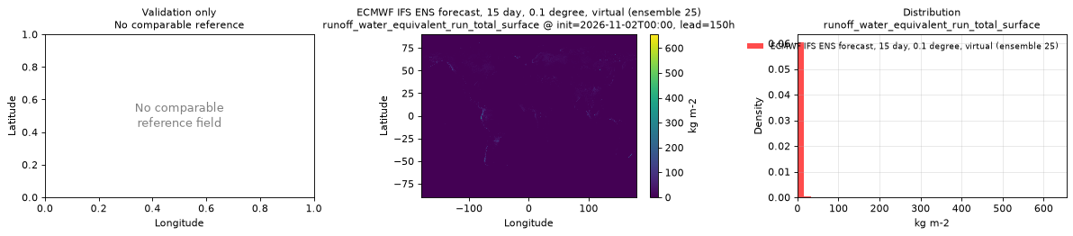
Spatial — init=2026-11-03T00:00, lead=150h (reference not available)
| Source | min | mean | max |
|---|---|---|---|
| Validation | 0 | 0.7259 | 385 |
Temporal — init=2026-11-08T00:00
| Source | min | mean | max |
|---|---|---|---|
| P1 Validation | 0 | 0 | 0 |
| P2 Validation | 0 | 0 | 0 |
Availability — 42 of 42 positions complete
Additional spatial comparison — member 25, init=2026-11-02T00:00, lead=150h.
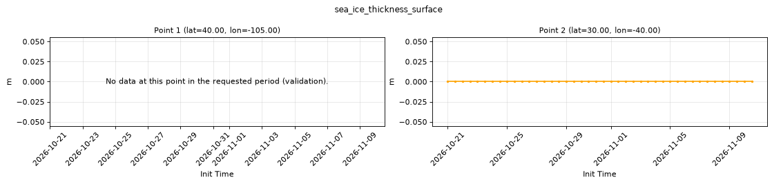
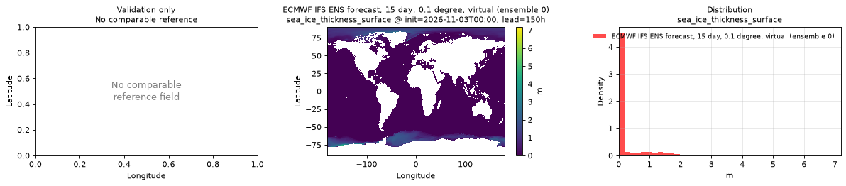
sea_ice_thickness_surface
Metadata
| Field | Value |
|---|---|
| units | m |
| long_name | Sea ice thickness |
| short_name | sithick |
| standard_name | sea_ice_thickness |
| step_type | instant |
| comment | NaN where there is no ocean model value, including over land. |
Point time series — 2026-10-21T00:00 - 2026-11-10T12:00, sampled lead=3h, member=0
| Point | min | mean | max |
|---|---|---|---|
| P1 | n/a | n/a | n/a |
| P2 | 0 | 0 | 0 |
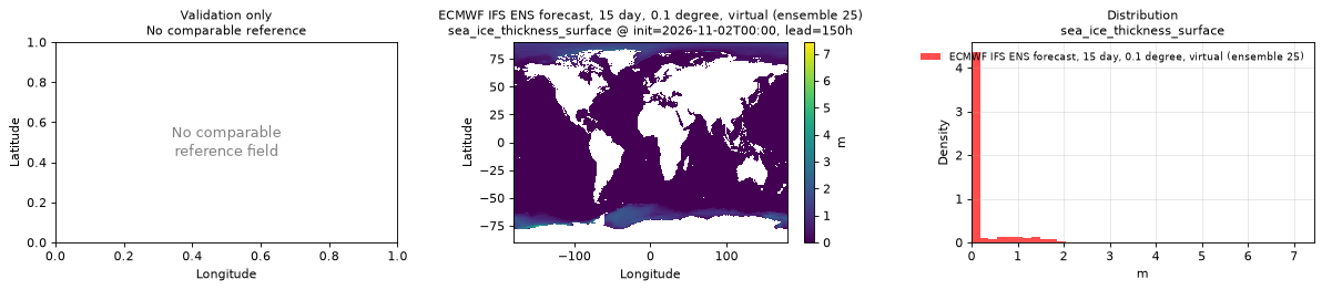
Spatial — init=2026-11-03T00:00, lead=150h (reference not available)
| Source | min | mean | max |
|---|---|---|---|
| Validation | 0 | 0.2046 | 7.188 |
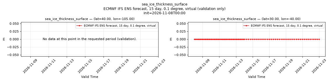
Temporal — init=2026-11-08T00:00
| Source | min | mean | max |
|---|---|---|---|
| P1 Validation | n/a | n/a | n/a |
| P2 Validation | 0 | 0 | 0 |
Availability — 42 of 42 positions complete
Additional spatial comparison — member 25, init=2026-11-02T00:00, lead=150h.
sea_surface_height
Metadata
| Field | Value |
|---|---|
| units | m |
| long_name | Sea surface height |
| short_name | zos |
| standard_name | n/a |
| step_type | instant |
| comment | NaN where there is no ocean model value, including over land. |
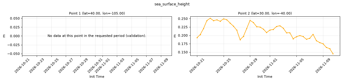
Point time series — 2026-10-21T00:00 - 2026-11-10T12:00, sampled lead=3h, member=0
| Point | min | mean | max |
|---|---|---|---|
| P1 | n/a | n/a | n/a |
| P2 | 0.1454 | 0.2115 | 0.2509 |
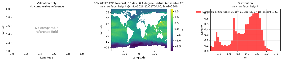
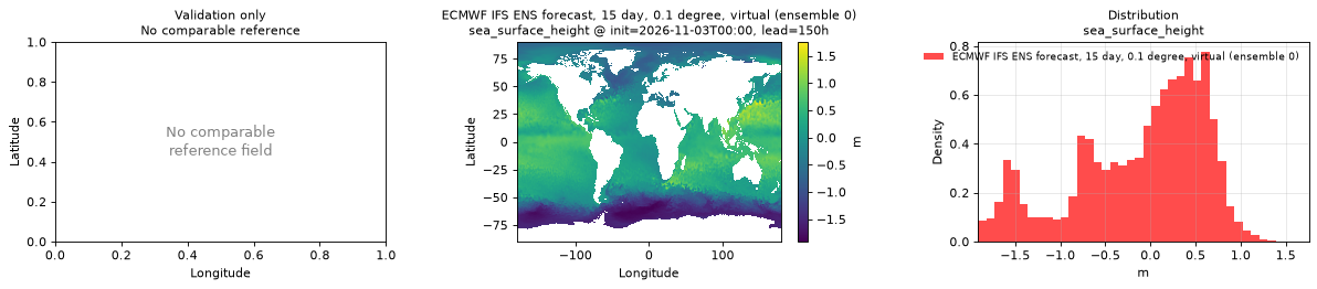
Spatial — init=2026-11-03T00:00, lead=150h (reference not available)
| Source | min | mean | max |
|---|---|---|---|
| Validation | -1.912 | -0.1118 | 1.756 |
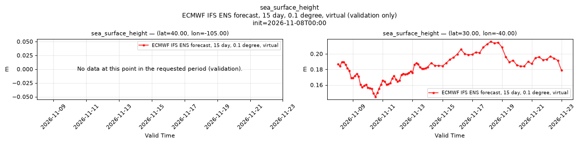
Temporal — init=2026-11-08T00:00
| Source | min | mean | max |
|---|---|---|---|
| P1 Validation | n/a | n/a | n/a |
| P2 Validation | 0.1448 | 0.1812 | 0.2159 |
Availability — 42 of 42 positions complete
Additional spatial comparison — member 25, init=2026-11-02T00:00, lead=150h.
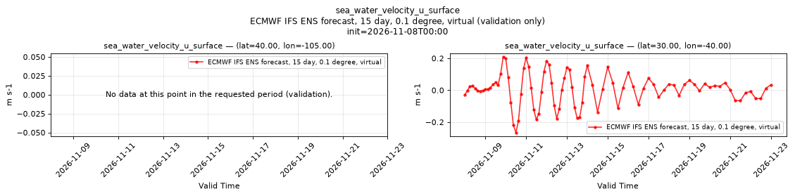
sea_water_velocity_u_surface
Metadata
| Field | Value |
|---|---|
| units | m s-1 |
| long_name | Eastward surface sea water velocity |
| short_name | sve |
| standard_name | eastward_sea_water_velocity |
| step_type | instant |
| comment | Applies over the ocean only; over land the values are NaN or near zero, so mask with land_sea_mask_surface. |
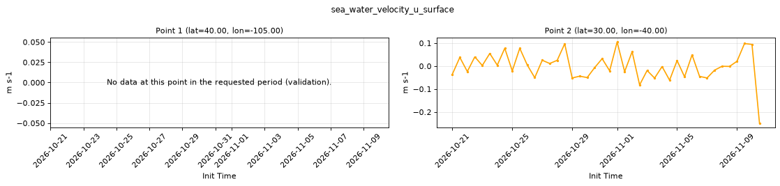
Point time series — 2026-10-21T00:00 - 2026-11-10T12:00, sampled lead=3h, member=0
| Point | min | mean | max |
|---|---|---|---|
| P1 | n/a | n/a | n/a |
| P2 | -0.2484 | -0.0001963 | 0.1051 |
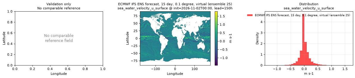
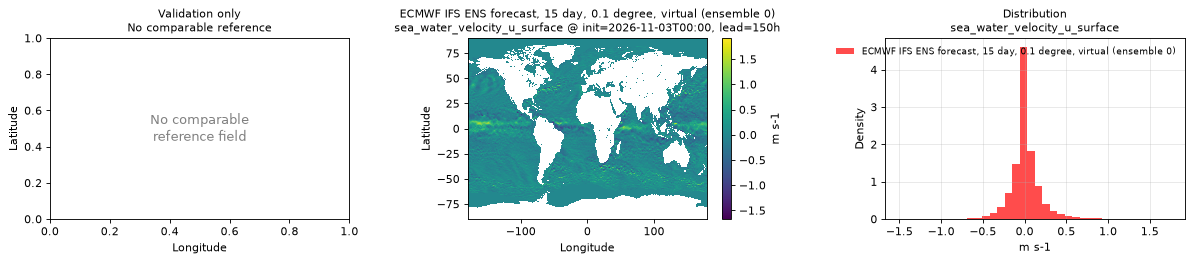
Spatial — init=2026-11-03T00:00, lead=150h (reference not available)
| Source | min | mean | max |
|---|---|---|---|
| Validation | -1.671 | 0.0131 | 1.917 |
Temporal — init=2026-11-08T00:00
| Source | min | mean | max |
|---|---|---|---|
| P1 Validation | n/a | n/a | n/a |
| P2 Validation | -0.2653 | 0.005208 | 0.209 |
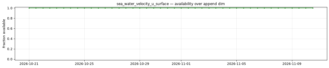
Availability — 42 of 42 positions complete
Additional spatial comparison — member 25, init=2026-11-02T00:00, lead=150h.
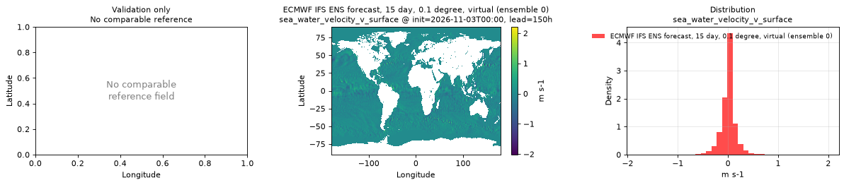
sea_water_velocity_v_surface
Metadata
| Field | Value |
|---|---|
| units | m s-1 |
| long_name | Northward surface sea water velocity |
| short_name | svn |
| standard_name | northward_sea_water_velocity |
| step_type | instant |
| comment | Applies over the ocean only; over land the values are NaN or near zero, so mask with land_sea_mask_surface. |
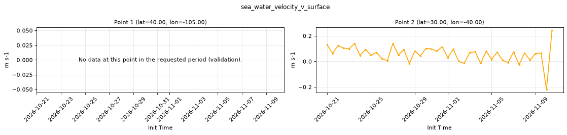
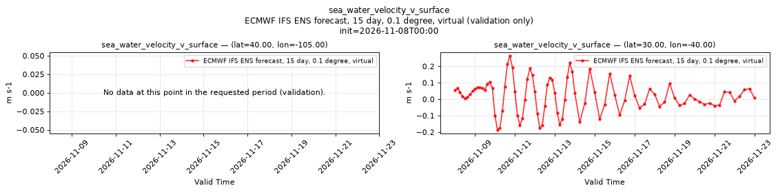
Point time series — 2026-10-21T00:00 - 2026-11-10T12:00, sampled lead=3h, member=0
| Point | min | mean | max |
|---|---|---|---|
| P1 | n/a | n/a | n/a |
| P2 | -0.2185 | 0.05742 | 0.2418 |
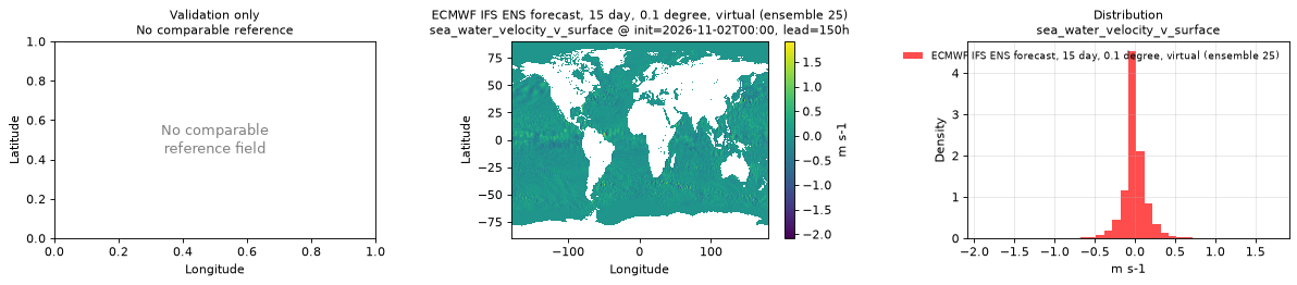
Spatial — init=2026-11-03T00:00, lead=150h (reference not available)
| Source | min | mean | max |
|---|---|---|---|
| Validation | -2.018 | 0.002618 | 2.208 |
Temporal — init=2026-11-08T00:00
| Source | min | mean | max |
|---|---|---|---|
| P1 Validation | n/a | n/a | n/a |
| P2 Validation | -0.1862 | 0.0188 | 0.264 |
Availability — 42 of 42 positions complete
Additional spatial comparison — member 25, init=2026-11-02T00:00, lead=150h.
skin_temperature_surface
Metadata
| Field | Value |
|---|---|
| units | degree_Celsius |
| long_name | Skin temperature |
| short_name | skt |
| standard_name | surface_temperature |
| step_type | instant |
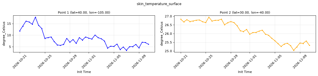
Point time series — 2026-10-21T00:00 - 2026-11-10T12:00, sampled lead=3h, member=0
| Point | min | mean | max |
|---|---|---|---|
| P1 | 3.443 | 8.336 | 17.77 |
| P2 | 25.04 | 26.16 | 26.94 |
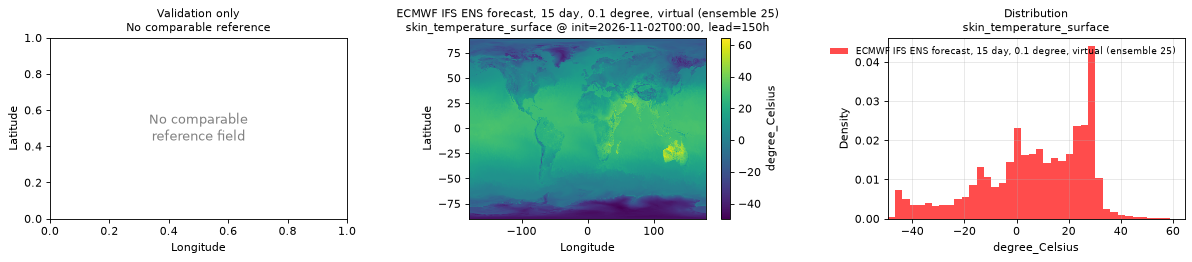
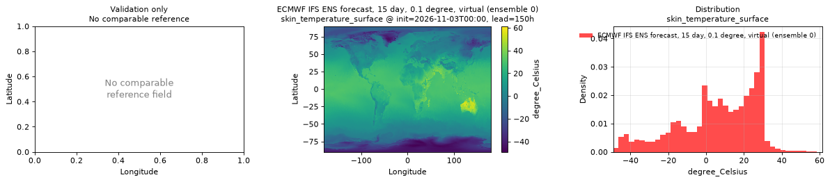
Spatial — init=2026-11-03T00:00, lead=150h (reference not available)
| Source | min | mean | max |
|---|---|---|---|
| Validation | -49.12 | 6.263 | 61.38 |
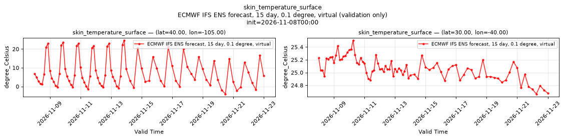
Temporal — init=2026-11-08T00:00
| Source | min | mean | max |
|---|---|---|---|
| P1 Validation | -3.997 | 7.716 | 24.66 |
| P2 Validation | 24.66 | 25.06 | 25.5 |
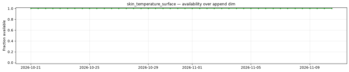
Availability — 42 of 42 positions complete
Additional spatial comparison — member 25, init=2026-11-02T00:00, lead=150h.
slope_of_sub_gridscale_orography_surface
Metadata
| Field | Value |
|---|---|
| units | 1 |
| long_name | Slope of sub-gridscale orography |
| short_name | slor |
| standard_name | n/a |
| step_type | instant |
| comment | Available for control member 0 only; members 1-50 are NaN. Time-invariant field published at lead time 0 only. |
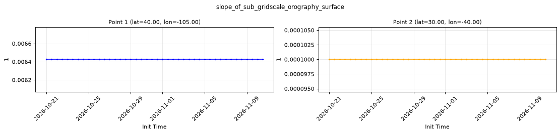
Point time series — 2026-10-21T00:00 - 2026-11-10T12:00, sampled lead=0h, member=0
| Point | min | mean | max |
|---|---|---|---|
| P1 | 0.006425 | 0.006425 | 0.006425 |
| P2 | 9.999e-05 | 9.999e-05 | 9.999e-05 |
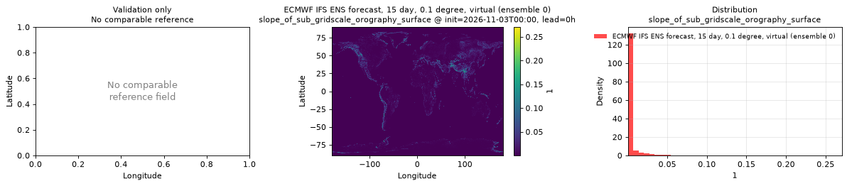
Spatial — init=2026-11-03T00:00, lead=0h (reference not available)
| Source | min | mean | max |
|---|---|---|---|
| Validation | 9.999e-05 | 0.003158 | 0.2705 |
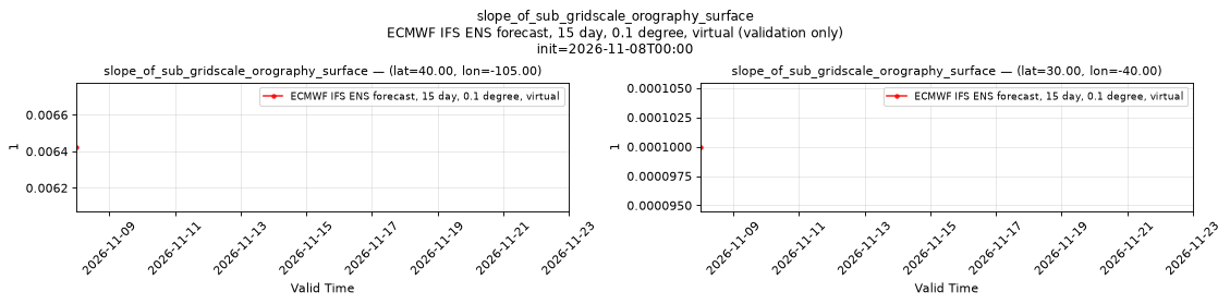
Temporal — init=2026-11-08T00:00
| Source | min | mean | max |
|---|---|---|---|
| P1 Validation | 0.006425 | 0.006425 | 0.006425 |
| P2 Validation | 9.999e-05 | 9.999e-05 | 9.999e-05 |
Availability — 42 of 42 positions complete
Additional spatial comparison — member 25, init=2026-11-02T00:00, lead=150h. This field is published only for control member 0 and is intentionally absent here.
snow_albedo_surface
Metadata
| Field | Value |
|---|---|
| units | percent |
| long_name | Snow albedo |
| short_name | asn |
| standard_name | n/a |
| step_type | instant |
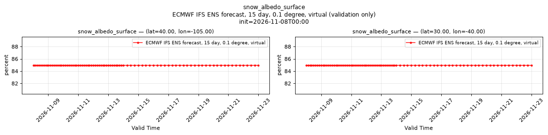
| comment | Applies only where snow is present (snow_water_equivalent_surface > 0); snow-free cells hold placeholder values that also occur over snow. |
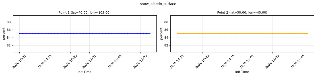
Point time series — 2026-10-21T00:00 - 2026-11-10T12:00, sampled lead=3h, member=0
| Point | min | mean | max |
|---|---|---|---|
| P1 | 84.96 | 84.96 | 84.96 |
| P2 | 84.96 | 84.96 | 84.96 |
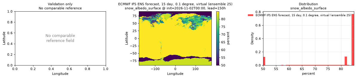
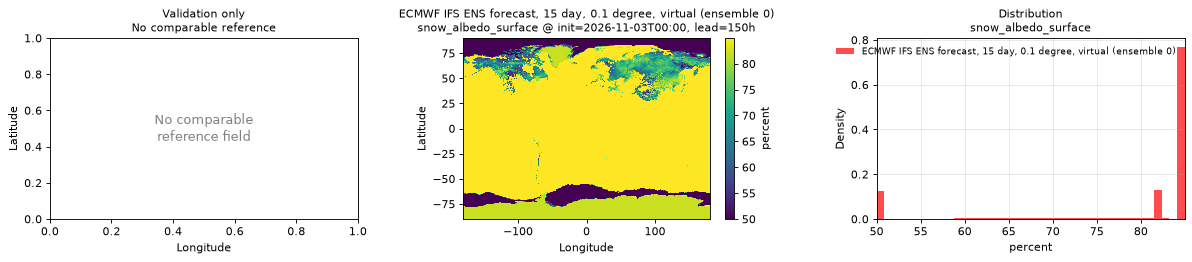
Spatial — init=2026-11-03T00:00, lead=150h (reference not available)
| Source | min | mean | max |
|---|---|---|---|
| Validation | 50 | 79.22 | 84.96 |
Temporal — init=2026-11-08T00:00
| Source | min | mean | max |
|---|---|---|---|
| P1 Validation | 84.96 | 84.96 | 84.96 |
| P2 Validation | 84.96 | 84.96 | 84.96 |
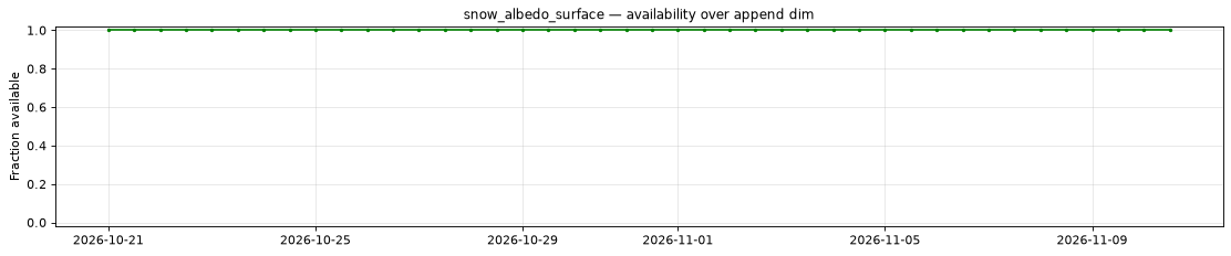
Availability — 42 of 42 positions complete
Additional spatial comparison — member 25, init=2026-11-02T00:00, lead=150h.
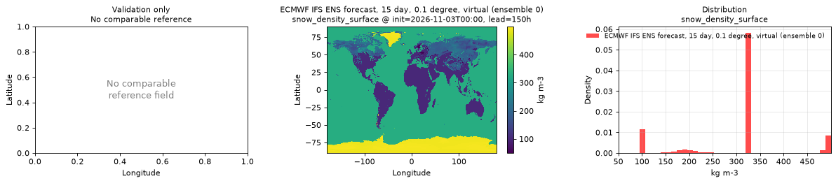
snow_density_surface
Metadata
| Field | Value |
|---|---|
| units | kg m-3 |
| long_name | Snow density |
| short_name | rsn |
| standard_name | surface_snow_density |
| step_type | instant |
| comment | Applies only where snow is present (snow_water_equivalent_surface > 0); snow-free cells hold placeholder values that also occur over snow. |
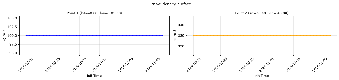
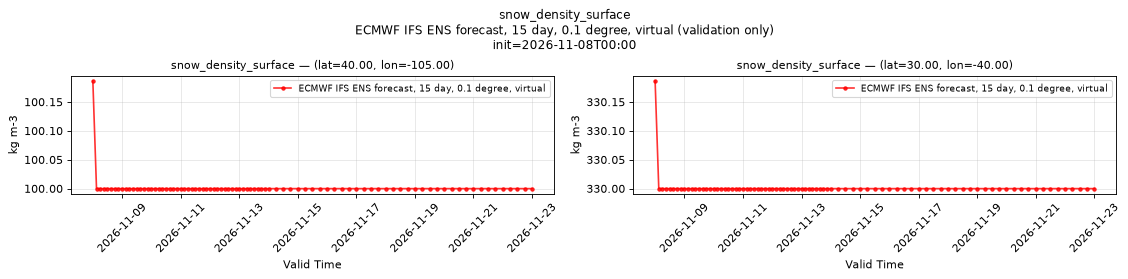
Point time series — 2026-10-21T00:00 - 2026-11-10T12:00, sampled lead=3h, member=0
| Point | min | mean | max |
|---|---|---|---|
| P1 | 100 | 100 | 100 |
| P2 | 330 | 330 | 330 |
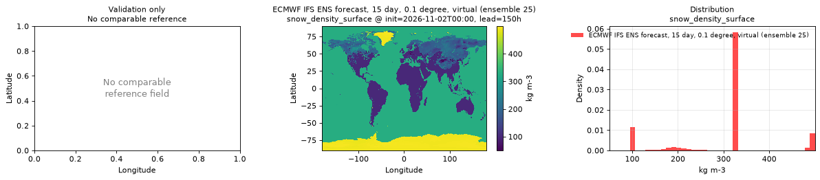
Spatial — init=2026-11-03T00:00, lead=150h (reference not available)
| Source | min | mean | max |
|---|---|---|---|
| Validation | 50 | 304.1 | 500 |
Temporal — init=2026-11-08T00:00
| Source | min | mean | max |
|---|---|---|---|
| P1 Validation | 100 | 100 | 100.2 |
| P2 Validation | 330 | 330 | 330.2 |
Availability — 42 of 42 positions complete
Additional spatial comparison — member 25, init=2026-11-02T00:00, lead=150h.
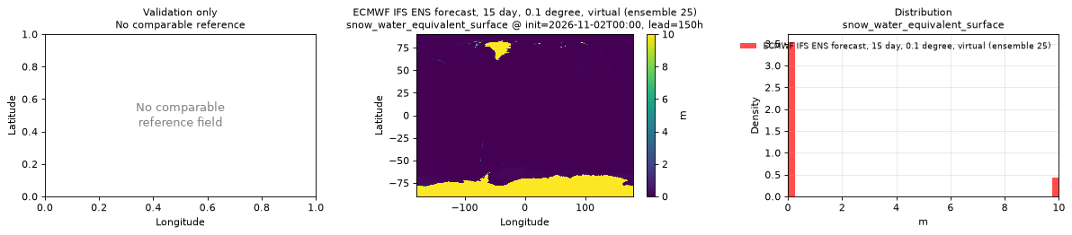
snow_water_equivalent_surface
Metadata
| Field | Value |
|---|---|
| units | m |
| long_name | Snow depth water equivalent |
| short_name | sd |
| standard_name | lwe_thickness_of_surface_snow_amount |
| step_type | instant |
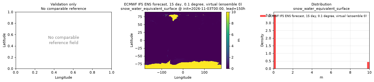
| comment | Capped at 10 m; most of the Antarctic and Greenland ice sheets sit at this cap. |
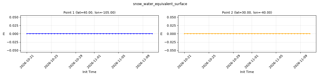
Point time series — 2026-10-21T00:00 - 2026-11-10T12:00, sampled lead=3h, member=0
| Point | min | mean | max |
|---|---|---|---|
| P1 | 0 | 0 | 0 |
| P2 | 0 | 0 | 0 |
Spatial — init=2026-11-03T00:00, lead=150h (reference not available)
| Source | min | mean | max |
|---|---|---|---|
| Validation | 0 | 1.11 | 10 |
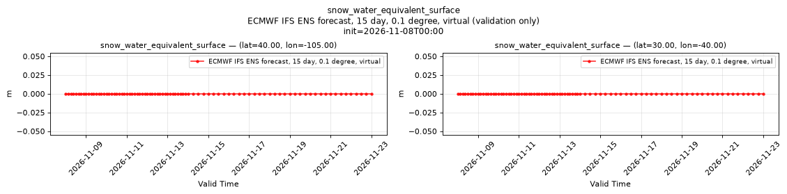
Temporal — init=2026-11-08T00:00
| Source | min | mean | max |
|---|---|---|---|
| P1 Validation | 0 | 0 | 0 |
| P2 Validation | 0 | 0 | 0 |
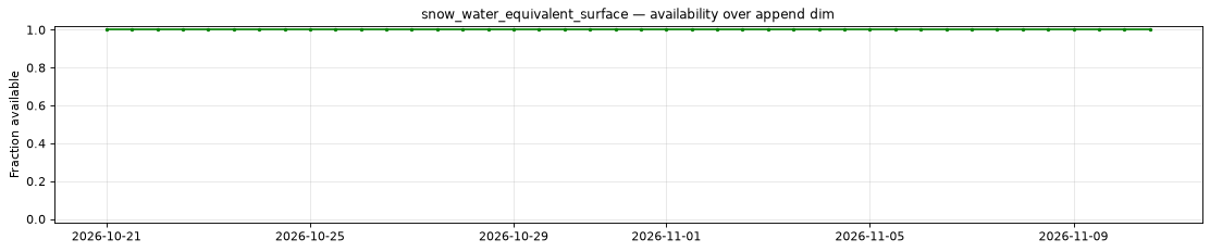
Availability — 42 of 42 positions complete
Additional spatial comparison — member 25, init=2026-11-02T00:00, lead=150h.
snowfall_water_equivalent_run_total_surface
Metadata
| Field | Value |
|---|---|
| units | kg m-2 |
| long_name | Snowfall water equivalent |
| short_name | sf |
| standard_name | snowfall_amount |
| step_type | accum |
| comment | Accumulated since forecast initialization. |
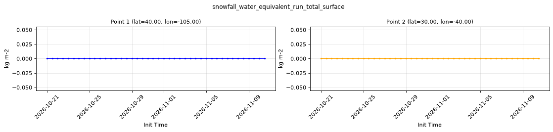
Point time series — 2026-10-21T00:00 - 2026-11-10T12:00, sampled lead=3h, member=0
| Point | min | mean | max |
|---|---|---|---|
| P1 | 0 | 0 | 0 |
| P2 | 0 | 0 | 0 |
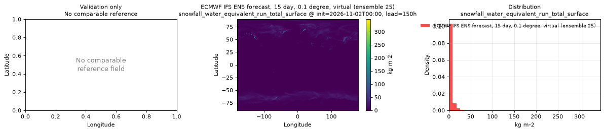
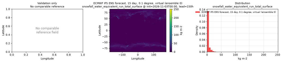
Spatial — init=2026-11-03T00:00, lead=150h (reference not available)
| Source | min | mean | max |
|---|---|---|---|
| Validation | 0 | 2.637 | 251.2 |
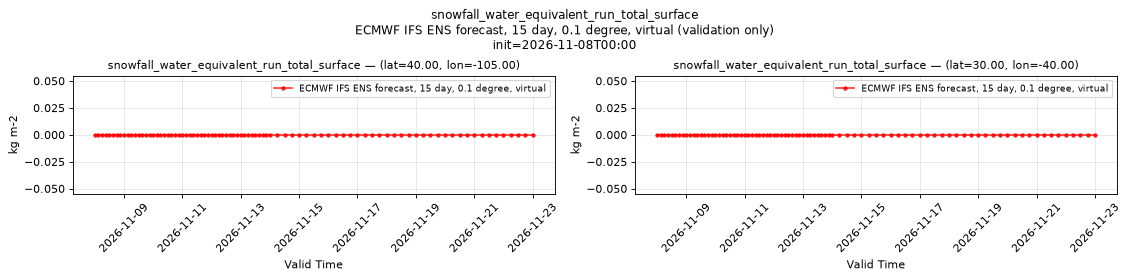
Temporal — init=2026-11-08T00:00
| Source | min | mean | max |
|---|---|---|---|
| P1 Validation | 0 | 0 | 0 |
| P2 Validation | 0 | 0 | 0 |
Availability — 42 of 42 positions complete
Additional spatial comparison — member 25, init=2026-11-02T00:00, lead=150h.
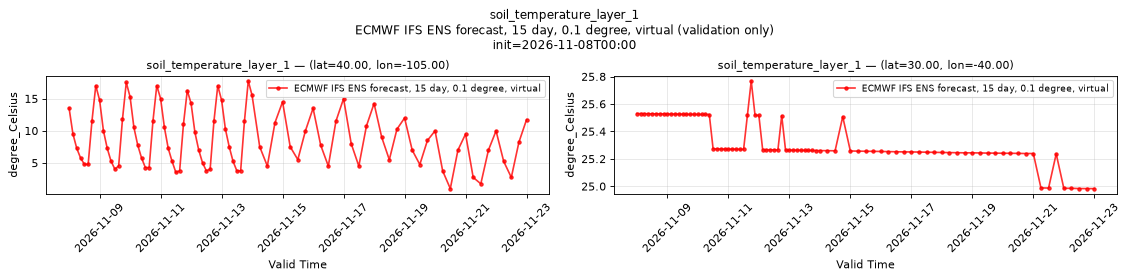
soil_temperature_layer_1
Metadata
| Field | Value |
|---|---|
| units | degree_Celsius |
| long_name | Soil temperature |
| short_name | sot |
| standard_name | soil_temperature |
| step_type | instant |
| comment | ECMWF soil level 1, the uppermost soil layer. Over water this is the sea surface temperature, not a soil temperature. |
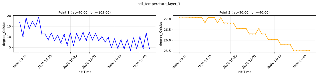
Point time series — 2026-10-21T00:00 - 2026-11-10T12:00, sampled lead=3h, member=0
| Point | min | mean | max |
|---|---|---|---|
| P1 | 3.531 | 9.763 | 19.33 |
| P2 | 25.52 | 26.44 | 27.09 |
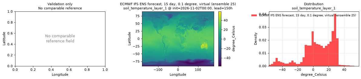
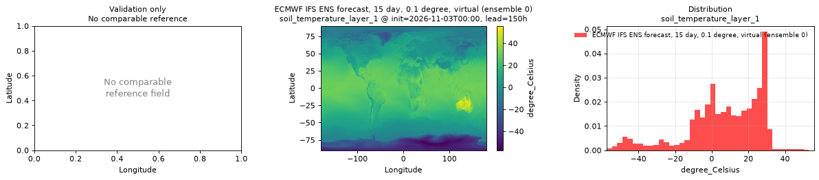
Spatial — init=2026-11-03T00:00, lead=150h (reference not available)
| Source | min | mean | max |
|---|---|---|---|
| Validation | -57.23 | 6.87 | 55.77 |
Temporal — init=2026-11-08T00:00
| Source | min | mean | max |
|---|---|---|---|
| P1 Validation | 0.9898 | 8.813 | 17.76 |
| P2 Validation | 24.98 | 25.32 | 25.77 |
Availability — 42 of 42 positions complete
Additional spatial comparison — member 25, init=2026-11-02T00:00, lead=150h.
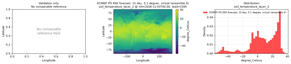
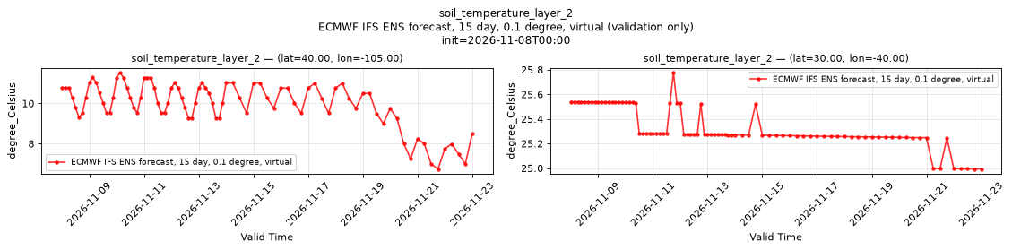
soil_temperature_layer_2
Metadata
| Field | Value |
|---|---|
| units | degree_Celsius |
| long_name | Soil temperature |
| short_name | sot |
| standard_name | soil_temperature |
| step_type | instant |
| comment | ECMWF soil level 2, the second soil layer from the surface. Over water this is the sea surface temperature, not a soil temperature. |
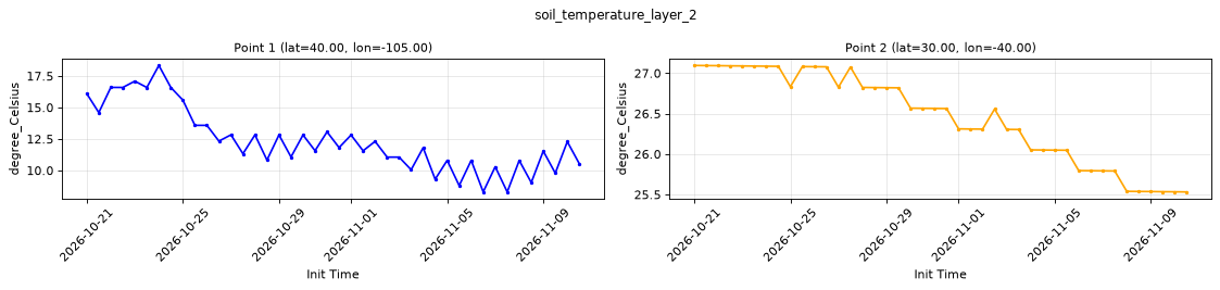
Point time series — 2026-10-21T00:00 - 2026-11-10T12:00, sampled lead=3h, member=0
| Point | min | mean | max |
|---|---|---|---|
| P1 | 8.291 | 12.37 | 18.34 |
| P2 | 25.53 | 26.45 | 27.1 |
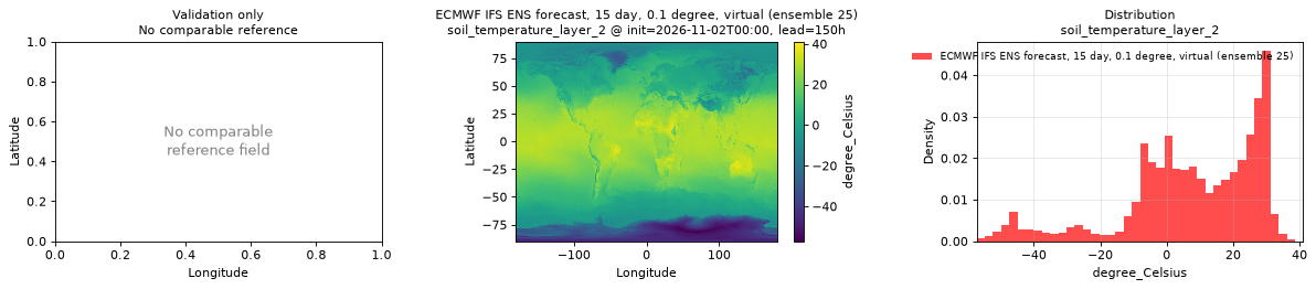
Spatial — init=2026-11-03T00:00, lead=150h (reference not available)
| Source | min | mean | max |
|---|---|---|---|
| Validation | -57.22 | 7.246 | 41.03 |
Temporal — init=2026-11-08T00:00
| Source | min | mean | max |
|---|---|---|---|
| P1 Validation | 6.746 | 9.963 | 11.53 |
| P2 Validation | 24.99 | 25.33 | 25.78 |
Availability — 42 of 42 positions complete
Additional spatial comparison — member 25, init=2026-11-02T00:00, lead=150h.
soil_temperature_layer_3
Metadata
| Field | Value |
|---|---|
| units | degree_Celsius |
| long_name | Soil temperature |
| short_name | sot |
| standard_name | soil_temperature |
| step_type | instant |
| comment | ECMWF soil level 3. Over water this is the sea surface temperature, not a soil temperature. |
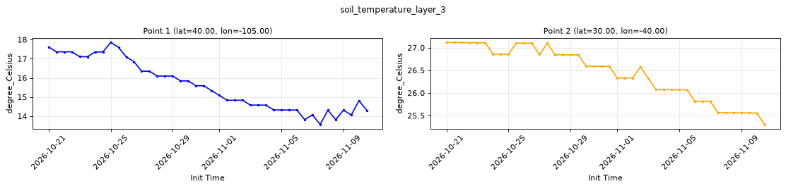
Point time series — 2026-10-21T00:00 - 2026-11-10T12:00, sampled lead=3h, member=0
| Point | min | mean | max |
|---|---|---|---|
| P1 | 13.56 | 15.59 | 17.85 |
| P2 | 25.3 | 26.44 | 27.11 |
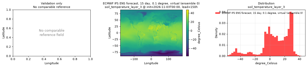
Spatial — init=2026-11-03T00:00, lead=150h (reference not available)
| Source | min | mean | max |
|---|---|---|---|
| Validation | -57.2 | 7.95 | 47.55 |
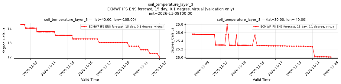
Temporal — init=2026-11-08T00:00
| Source | min | mean | max |
|---|---|---|---|
| P1 Validation | 12.01 | 13.4 | 14.31 |
| P2 Validation | 25.01 | 25.34 | 25.8 |
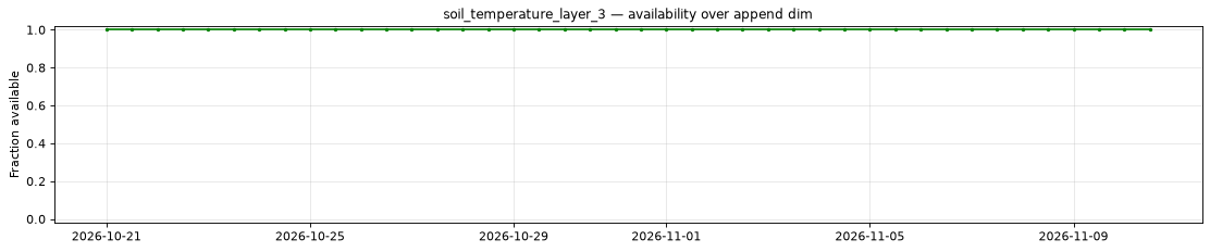
Availability — 42 of 42 positions complete
Additional spatial comparison — member 25, init=2026-11-02T00:00, lead=150h.
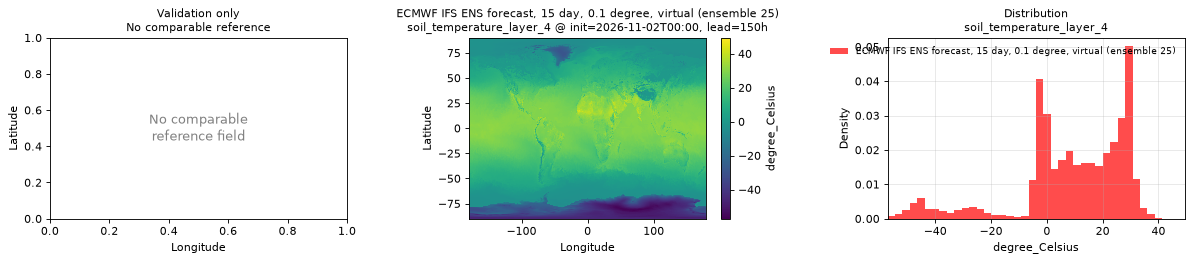
soil_temperature_layer_4
Metadata
| Field | Value |
|---|---|
| units | degree_Celsius |
| long_name | Soil temperature |
| short_name | sot |
| standard_name | soil_temperature |
| step_type | instant |
| comment | ECMWF soil level 4. Over water this is the sea surface temperature, not a soil temperature. |
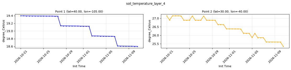
Point time series — 2026-10-21T00:00 - 2026-11-10T12:00, sampled lead=3h, member=0
| Point | min | mean | max |
|---|---|---|---|
| P1 | 18.6 | 19.06 | 19.4 |
| P2 | 25.35 | 26.45 | 27.15 |
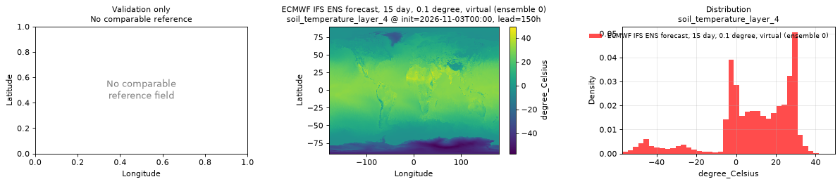
Spatial — init=2026-11-03T00:00, lead=150h (reference not available)
| Source | min | mean | max |
|---|---|---|---|
| Validation | -57.15 | 8.628 | 49.6 |
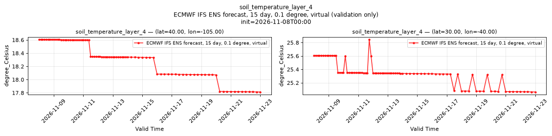
Temporal — init=2026-11-08T00:00
| Source | min | mean | max |
|---|---|---|---|
| P1 Validation | 17.81 | 18.3 | 18.61 |
| P2 Validation | 25.06 | 25.33 | 25.85 |
Availability — 42 of 42 positions complete
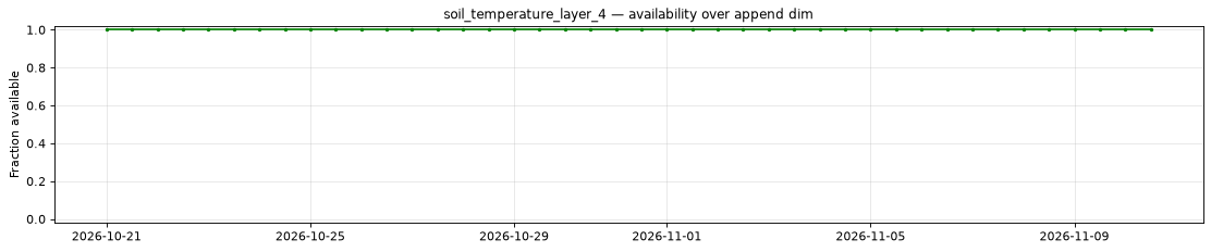
Additional spatial comparison — member 25, init=2026-11-02T00:00, lead=150h.
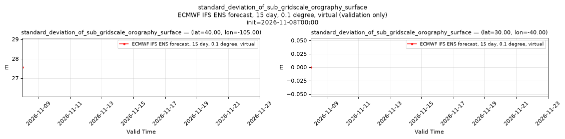
standard_deviation_of_sub_gridscale_orography_surface
Metadata
| Field | Value |
|---|---|
| units | m |
| long_name | Standard deviation of sub-gridscale orography |
| short_name | sdor |
| standard_name | n/a |
| step_type | instant |
| comment | Available for control member 0 only; members 1-50 are NaN. Time-invariant field published at lead time 0 only. |
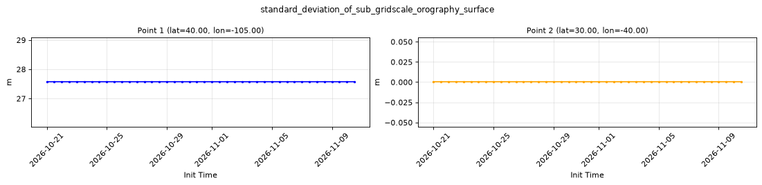
Point time series — 2026-10-21T00:00 - 2026-11-10T12:00, sampled lead=0h, member=0
| Point | min | mean | max |
|---|---|---|---|
| P1 | 27.56 | 27.56 | 27.56 |
| P2 | 0 | 0 | 0 |
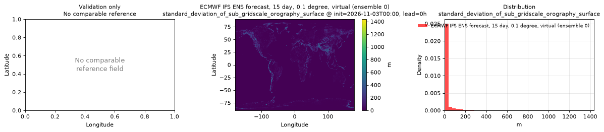
Spatial — init=2026-11-03T00:00, lead=0h (reference not available)
| Source | min | mean | max |
|---|---|---|---|
| Validation | 0 | 15.12 | 1436 |
Temporal — init=2026-11-08T00:00
| Source | min | mean | max |
|---|---|---|---|
| P1 Validation | 27.56 | 27.56 | 27.56 |
| P2 Validation | 0 | 0 | 0 |
Availability — 42 of 42 positions complete
Additional spatial comparison — member 25, init=2026-11-02T00:00, lead=150h. This field is published only for control member 0 and is intentionally absent here.
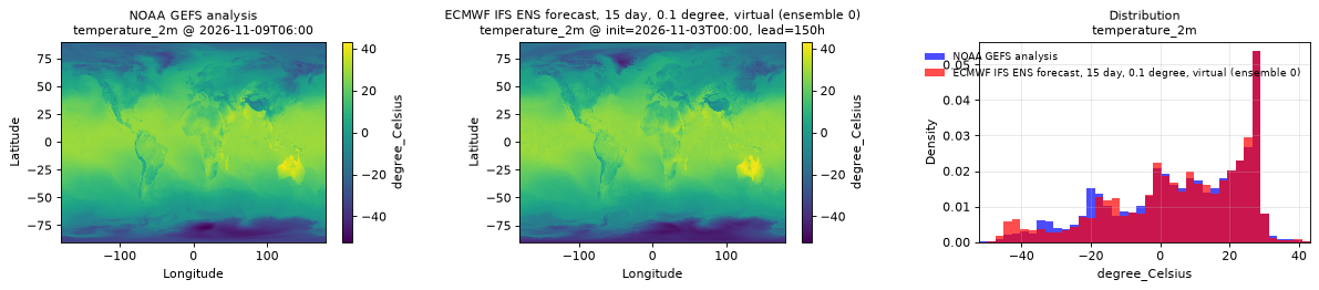
temperature_2m
Metadata
| Field | Value |
|---|---|
| units | degree_Celsius |
| long_name | 2 metre temperature |
| short_name | 2t |
| standard_name | air_temperature |
| step_type | instant |
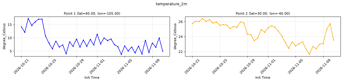
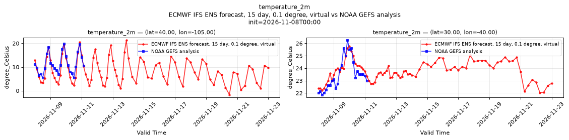
Point time series — 2026-10-21T00:00 - 2026-11-10T12:00, sampled lead=3h, member=0
| Point | min | mean | max |
|---|---|---|---|
| P1 | 3.812 | 8.728 | 17.27 |
| P2 | 21.64 | 24.53 | 26.42 |
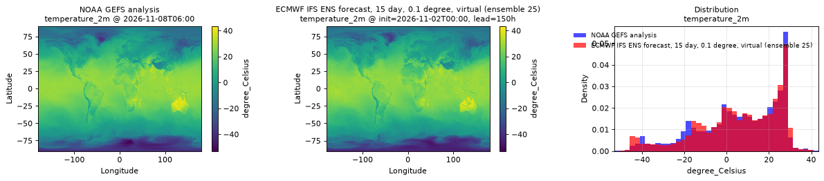
Spatial — init=2026-11-03T00:00, lead=150h (reference at 2026-11-09T06:00)
| Source | min | mean | max |
|---|---|---|---|
| Validation | -48.73 | 5.615 | 43.27 |
| Reference | -52.25 | 5.658 | 43 |
Temporal — init=2026-11-08T00:00
| Source | min | mean | max |
|---|---|---|---|
| P1 Validation | -1.661 | 8.427 | 21.31 |
| P1 Reference | 5.375 | 11.38 | 19.88 |
| P2 Validation | 22.02 | 23.76 | 25.77 |
| P2 Reference | 21.88 | 23.51 | 26.25 |
Availability — 42 of 42 positions complete
Additional spatial comparison — member 25, init=2026-11-02T00:00, lead=150h.
total_cloud_cover_atmosphere
Metadata
| Field | Value |
|---|---|
| units | percent |
| long_name | Total cloud cover |
| short_name | tcc |
| standard_name | cloud_area_fraction |
| step_type | instant |
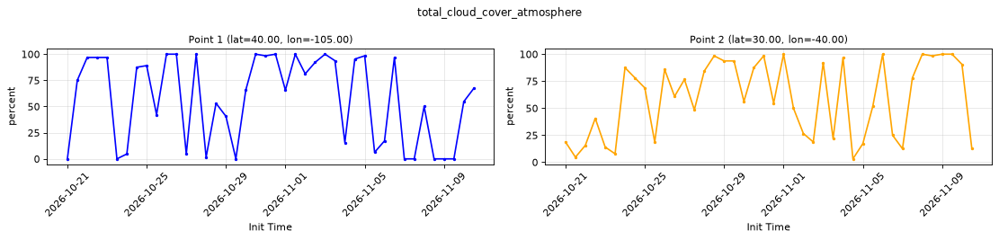
Point time series — 2026-10-21T00:00 - 2026-11-10T12:00, sampled lead=3h, member=0
| Point | min | mean | max |
|---|---|---|---|
| P1 | 0 | 56.85 | 100 |
| P2 | 3.125 | 59.26 | 100 |
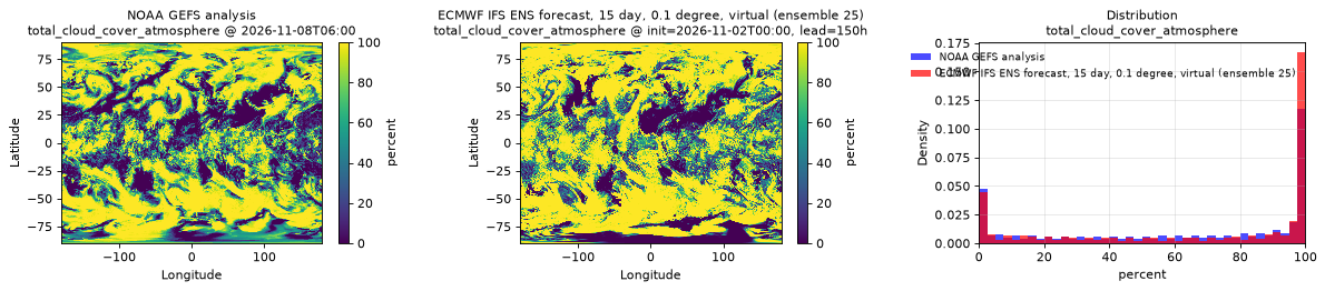
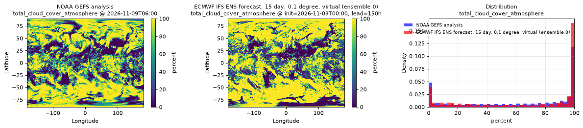
Spatial — init=2026-11-03T00:00, lead=150h (reference at 2026-11-09T06:00)
| Source | min | mean | max |
|---|---|---|---|
| Validation | 0 | 66.89 | 100 |
| Reference | 0 | 62.85 | 100 |
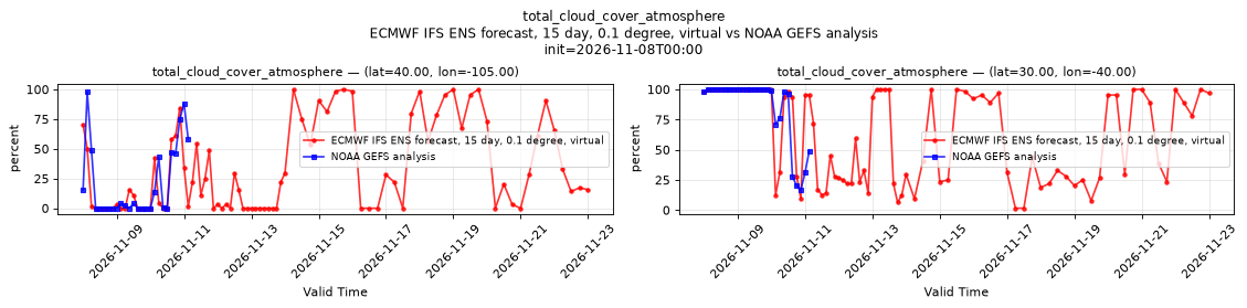
Temporal — init=2026-11-08T00:00
| Source | min | mean | max |
|---|---|---|---|
| P1 Validation | 0 | 31.07 | 100 |
| P1 Reference | 0 | 20.92 | 98 |
| P2 Validation | 1.562 | 62.35 | 100 |
| P2 Reference | 17 | 83.96 | 100 |
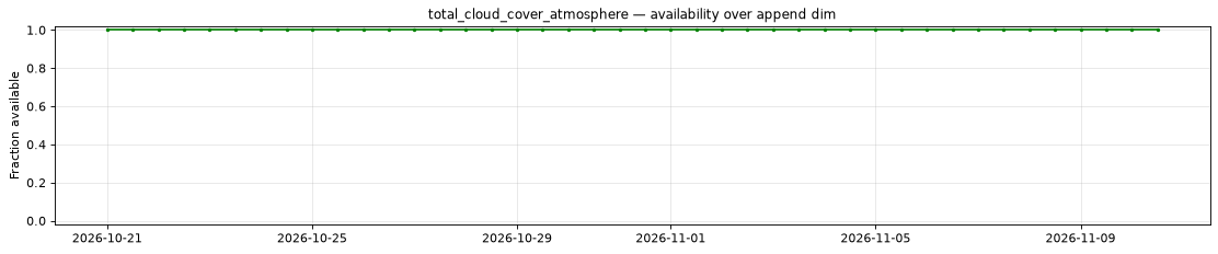
Availability — 42 of 42 positions complete
Additional spatial comparison — member 25, init=2026-11-02T00:00, lead=150h.
total_column_cloud_ice_water_atmosphere
Metadata
| Field | Value |
|---|---|
| units | kg m-2 |
| long_name | Total column cloud ice water |
| short_name | tciw |
| standard_name | atmosphere_mass_content_of_cloud_ice |
| step_type | instant |
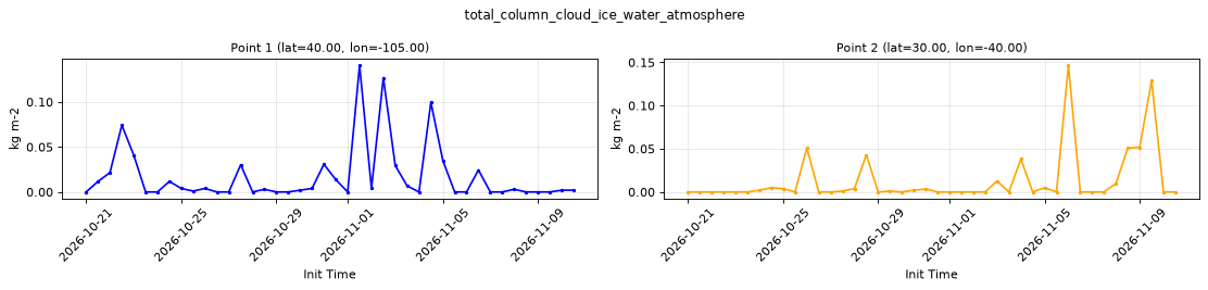
Point time series — 2026-10-21T00:00 - 2026-11-10T12:00, sampled lead=3h, member=0
| Point | min | mean | max |
|---|---|---|---|
| P1 | 0 | 0.01729 | 0.1406 |
| P2 | 0 | 0.01331 | 0.1465 |
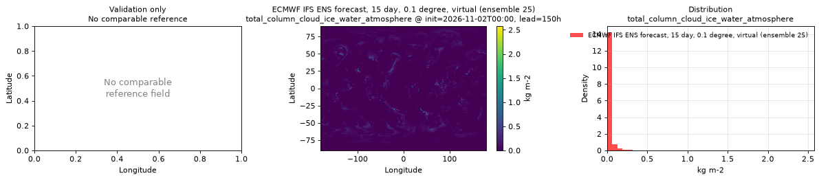
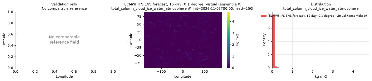
Spatial — init=2026-11-03T00:00, lead=150h (reference not available)
| Source | min | mean | max |
|---|---|---|---|
| Validation | 0 | 0.01688 | 4.822 |
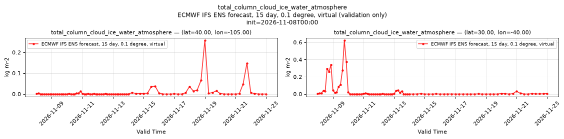
Temporal — init=2026-11-08T00:00
| Source | min | mean | max |
|---|---|---|---|
| P1 Validation | 0 | 0.008881 | 0.2578 |
| P2 Validation | 0 | 0.03267 | 0.623 |
Availability — 42 of 42 positions complete
Additional spatial comparison — member 25, init=2026-11-02T00:00, lead=150h.
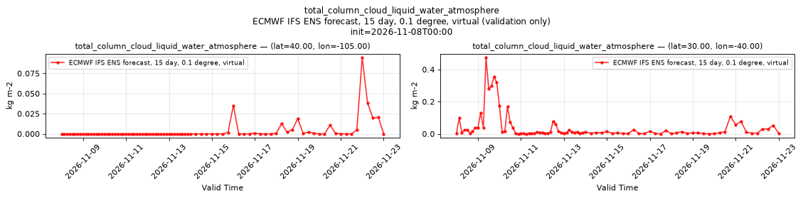
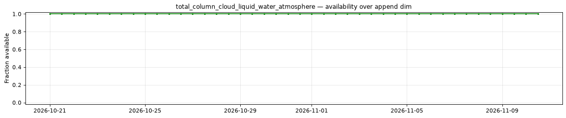
total_column_cloud_liquid_water_atmosphere
Metadata
| Field | Value |
|---|---|
| units | kg m-2 |
| long_name | Total column cloud liquid water |
| short_name | tclw |
| standard_name | atmosphere_mass_content_of_cloud_liquid_water |
| step_type | instant |
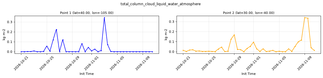
Point time series — 2026-10-21T00:00 - 2026-11-10T12:00, sampled lead=3h, member=0
| Point | min | mean | max |
|---|---|---|---|
| P1 | 0 | 0.02673 | 0.3433 |
| P2 | 0 | 0.04225 | 0.3394 |
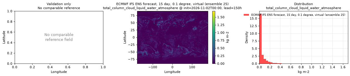
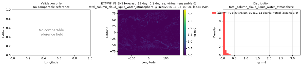
Spatial — init=2026-11-03T00:00, lead=150h (reference not available)
| Source | min | mean | max |
|---|---|---|---|
| Validation | 0 | 0.0385 | 3.33 |
Temporal — init=2026-11-08T00:00
| Source | min | mean | max |
|---|---|---|---|
| P1 Validation | 0 | 0.003182 | 0.09473 |
| P2 Validation | 0 | 0.04118 | 0.4746 |
Availability — 42 of 42 positions complete
Additional spatial comparison — member 25, init=2026-11-02T00:00, lead=150h.
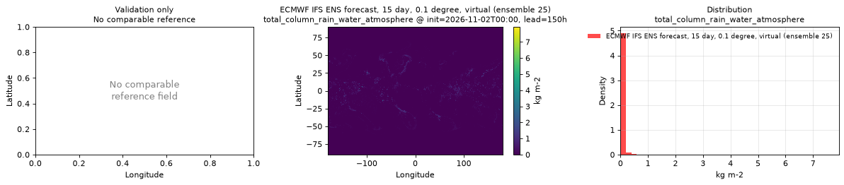
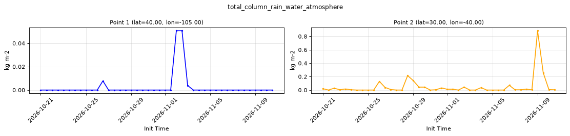
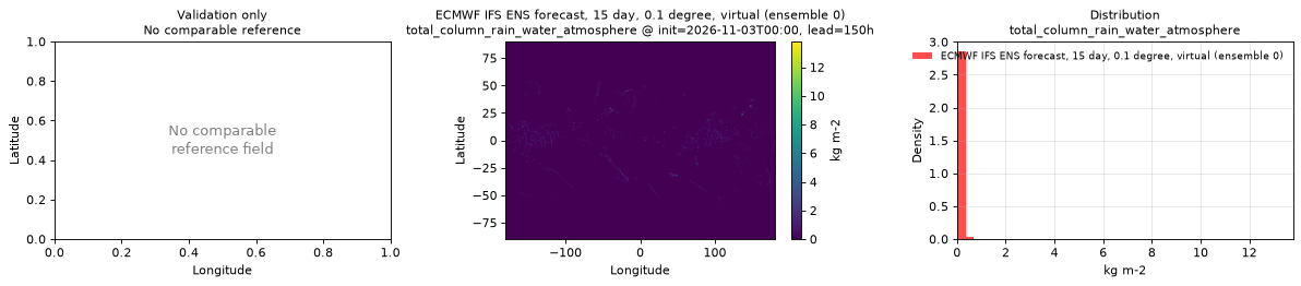
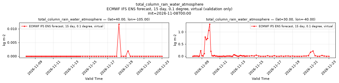
total_column_rain_water_atmosphere
Metadata
| Field | Value |
|---|---|
| units | kg m-2 |
| long_name | Total column rain water |
| short_name | tcrw |
| standard_name | n/a |
| step_type | instant |
Point time series — 2026-10-21T00:00 - 2026-11-10T12:00, sampled lead=3h, member=0
| Point | min | mean | max |
|---|---|---|---|
| P1 | 0 | 0.002697 | 0.05078 |
| P2 | 0 | 0.04934 | 0.8848 |
Spatial — init=2026-11-03T00:00, lead=150h (reference not available)
| Source | min | mean | max |
|---|---|---|---|
| Validation | 0 | 0.02024 | 13.79 |
Temporal — init=2026-11-08T00:00
| Source | min | mean | max |
|---|---|---|---|
| P1 Validation | 0 | 0.0001608 | 0.01172 |
| P2 Validation | 0 | 0.07178 | 1.324 |
Availability — 42 of 42 positions complete
Additional spatial comparison — member 25, init=2026-11-02T00:00, lead=150h.
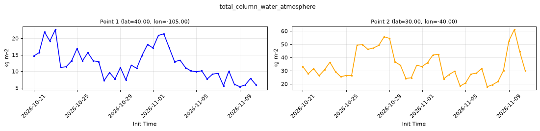
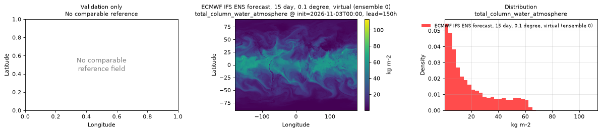
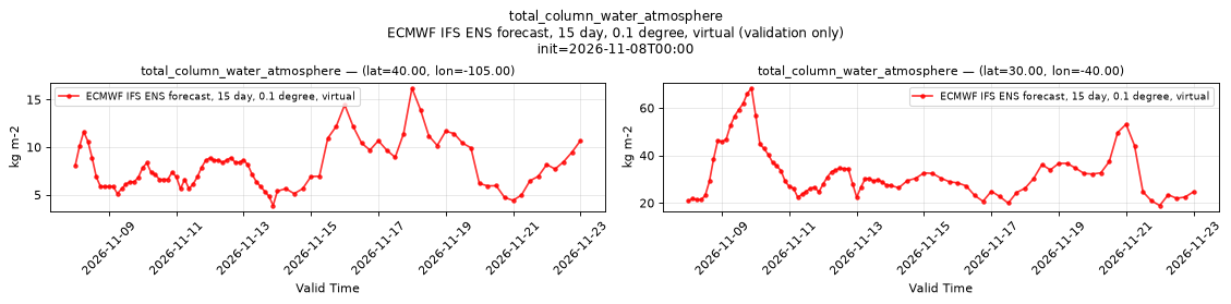
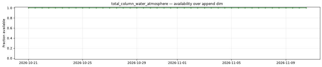
total_column_water_atmosphere
Metadata
| Field | Value |
|---|---|
| units | kg m-2 |
| long_name | Total column water |
| short_name | tcw |
| standard_name | atmosphere_mass_content_of_water |
| step_type | instant |
Point time series — 2026-10-21T00:00 - 2026-11-10T12:00, sampled lead=3h, member=0
| Point | min | mean | max |
|---|---|---|---|
| P1 | 5.328 | 12.32 | 22.67 |
| P2 | 17.87 | 34.2 | 61.1 |
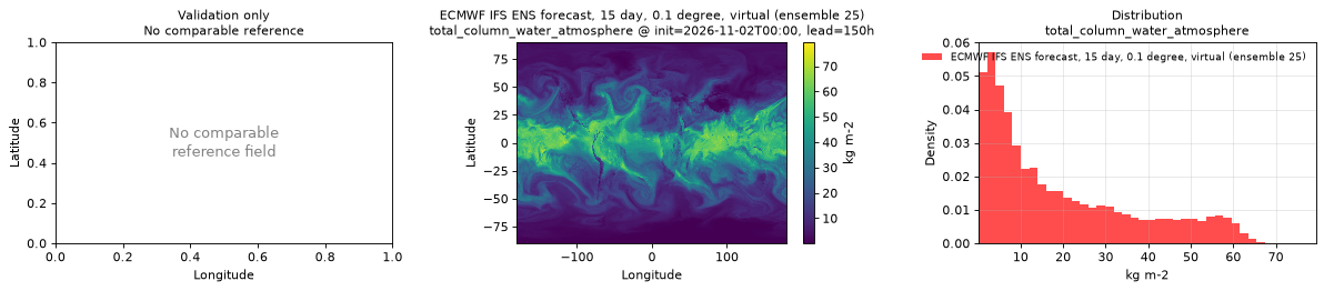
Spatial — init=2026-11-03T00:00, lead=150h (reference not available)
| Source | min | mean | max |
|---|---|---|---|
| Validation | 0.1146 | 19.05 | 113.4 |
Temporal — init=2026-11-08T00:00
| Source | min | mean | max |
|---|---|---|---|
| P1 Validation | 3.865 | 7.978 | 16.19 |
| P2 Validation | 18.92 | 32.79 | 68.34 |
Availability — 42 of 42 positions complete
Additional spatial comparison — member 25, init=2026-11-02T00:00, lead=150h.
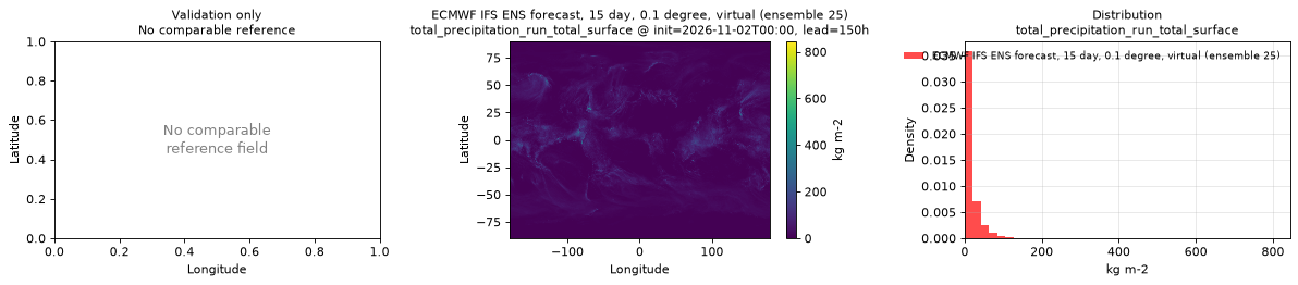
total_precipitation_run_total_surface
Metadata
| Field | Value |
|---|---|
| units | kg m-2 |
| long_name | Total precipitation |
| short_name | tp |
| standard_name | precipitation_amount |
| step_type | accum |
| comment | Accumulated since forecast initialization. |
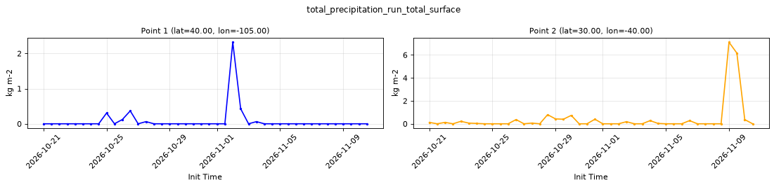
Point time series — 2026-10-21T00:00 - 2026-11-10T12:00, sampled lead=3h, member=0
| Point | min | mean | max |
|---|---|---|---|
| P1 | 0 | 0.08719 | 2.319 |
| P2 | 0 | 0.4316 | 7.111 |
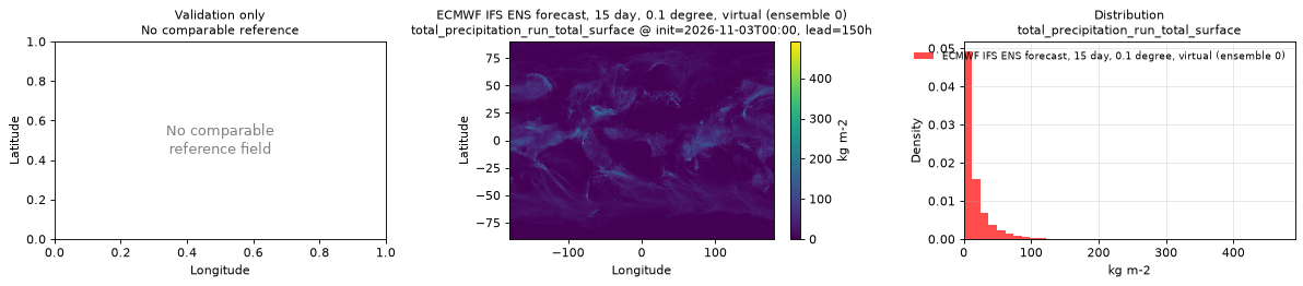
Spatial — init=2026-11-03T00:00, lead=150h (reference not available)
| Source | min | mean | max |
|---|---|---|---|
| Validation | 0 | 15.66 | 491.2 |
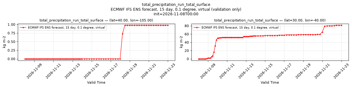
Temporal — init=2026-11-08T00:00
| Source | min | mean | max |
|---|---|---|---|
| P1 Validation | 0 | 0.2269 | 0.9766 |
| P2 Validation | 0 | 48.34 | 81.3 |
Availability — 42 of 42 positions complete
Additional spatial comparison — member 25, init=2026-11-02T00:00, lead=150h.
volumetric_soil_moisture_layer_1
Metadata
| Field | Value |
|---|---|
| units | 1 |
| long_name | Volumetric soil moisture |
| short_name | vsw |
| standard_name | volume_fraction_of_condensed_water_in_soil |
| step_type | instant |
| comment | ECMWF soil level 1, the uppermost soil layer. Applies over land only; over water the values are near zero, so mask with land_sea_mask_surface. |
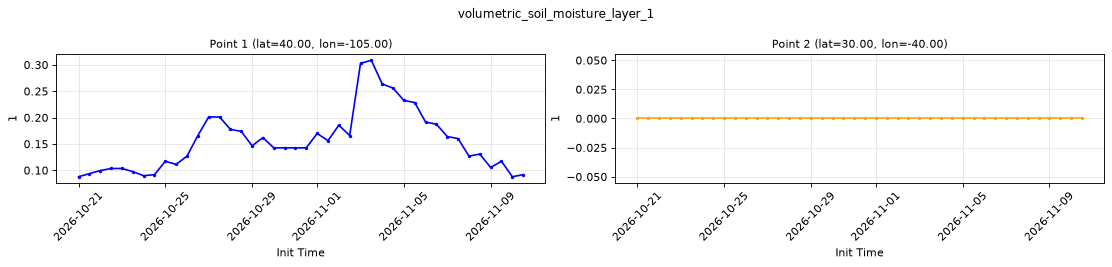
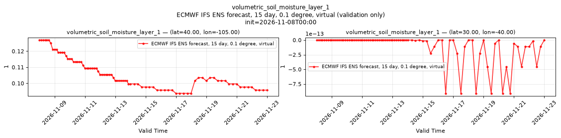
Point time series — 2026-10-21T00:00 - 2026-11-10T12:00, sampled lead=3h, member=0
| Point | min | mean | max |
|---|---|---|---|
| P1 | 0.08789 | 0.1561 | 0.3086 |
| P2 | 0 | 0 | 0 |
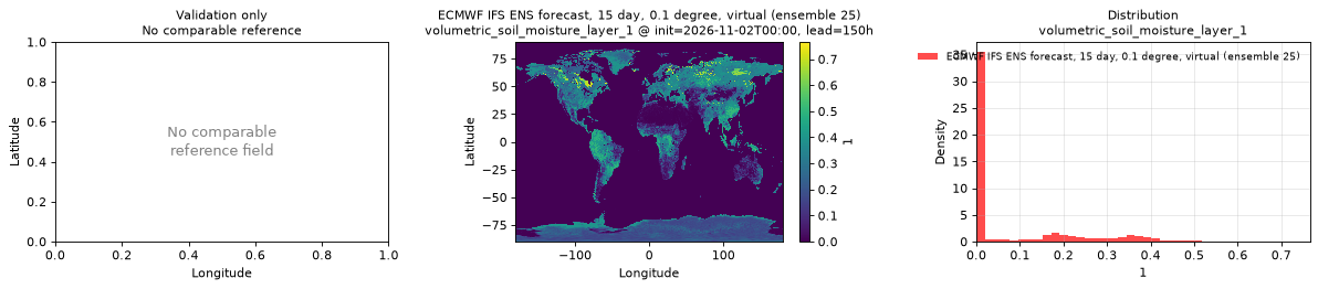
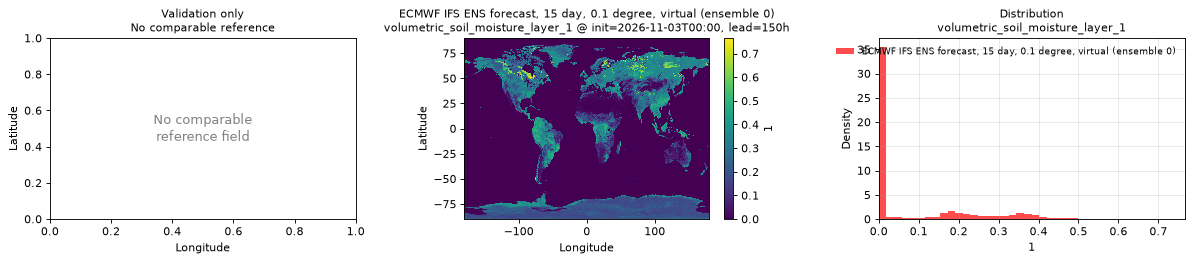
Spatial — init=2026-11-03T00:00, lead=150h (reference not available)
| Source | min | mean | max |
|---|---|---|---|
| Validation | -2.274e-13 | 0.08391 | 0.7656 |
Temporal — init=2026-11-08T00:00
| Source | min | mean | max |
|---|---|---|---|
| P1 Validation | 0.09375 | 0.1062 | 0.127 |
| P2 Validation | -9.095e-13 | -1.036e-13 | 0 |
Availability — 42 of 42 positions complete
Additional spatial comparison — member 25, init=2026-11-02T00:00, lead=150h.
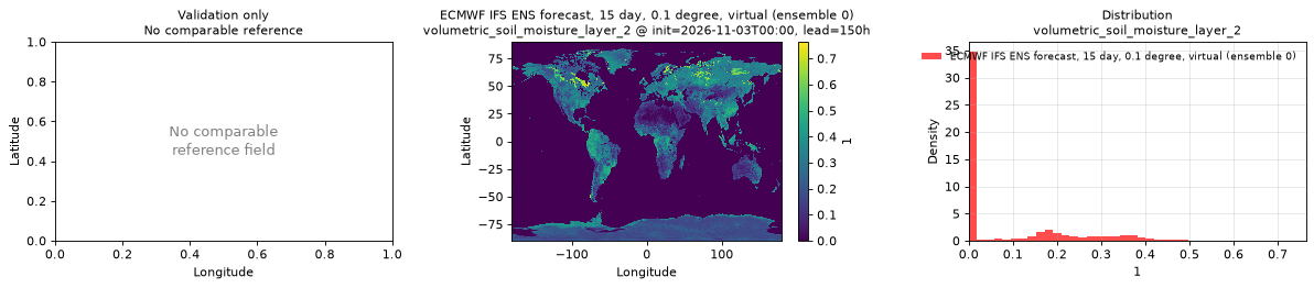
volumetric_soil_moisture_layer_2
Metadata
| Field | Value |
|---|---|
| units | 1 |
| long_name | Volumetric soil moisture |
| short_name | vsw |
| standard_name | volume_fraction_of_condensed_water_in_soil |
| step_type | instant |
| comment | ECMWF soil level 2, the second soil layer from the surface. Applies over land only; over water the values are near zero, so mask with land_sea_mask_surface. |
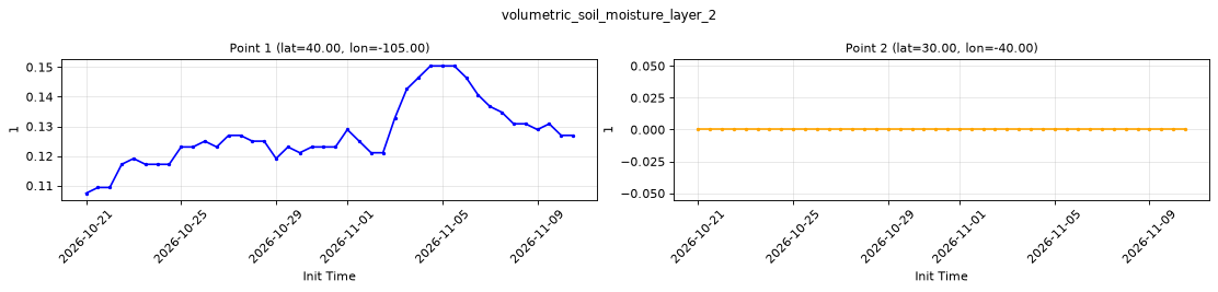
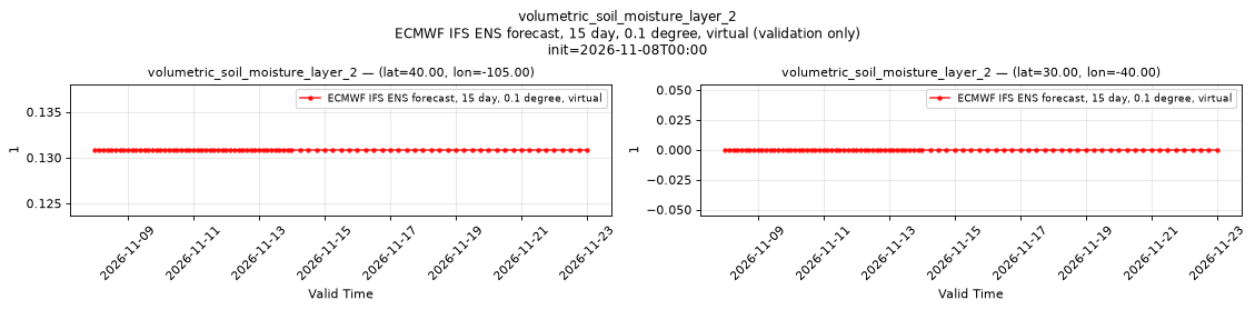
Point time series — 2026-10-21T00:00 - 2026-11-10T12:00, sampled lead=3h, member=0
| Point | min | mean | max |
|---|---|---|---|
| P1 | 0.1074 | 0.1273 | 0.1504 |
| P2 | 0 | 0 | 0 |
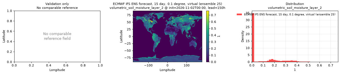
Spatial — init=2026-11-03T00:00, lead=150h (reference not available)
| Source | min | mean | max |
|---|---|---|---|
| Validation | 0 | 0.08546 | 0.7637 |
Temporal — init=2026-11-08T00:00
| Source | min | mean | max |
|---|---|---|---|
| P1 Validation | 0.1309 | 0.1309 | 0.1309 |
| P2 Validation | 0 | 0 | 0 |
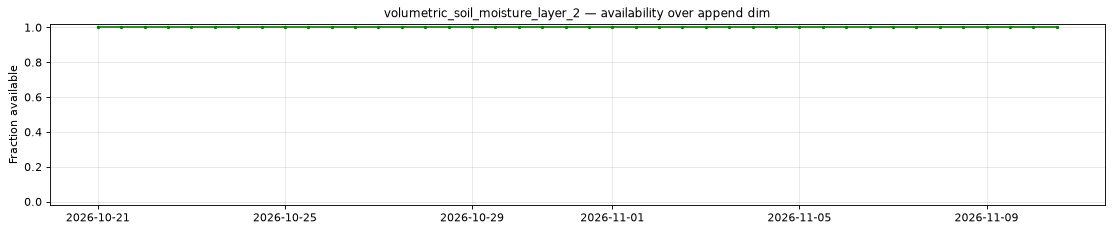
Availability — 42 of 42 positions complete
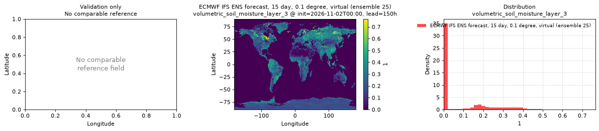
Additional spatial comparison — member 25, init=2026-11-02T00:00, lead=150h.
volumetric_soil_moisture_layer_3
Metadata
| Field | Value |
|---|---|
| units | 1 |
| long_name | Volumetric soil moisture |
| short_name | vsw |
| standard_name | volume_fraction_of_condensed_water_in_soil |
| step_type | instant |
| comment | ECMWF soil level 3. Applies over land only; over water the values are near zero, so mask with land_sea_mask_surface. |
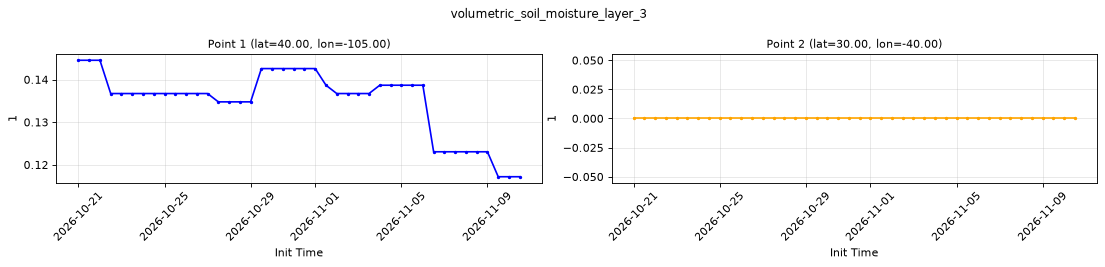
Point time series — 2026-10-21T00:00 - 2026-11-10T12:00, sampled lead=3h, member=0
| Point | min | mean | max |
|---|---|---|---|
| P1 | 0.1172 | 0.1349 | 0.1445 |
| P2 | 0 | 0 | 0 |
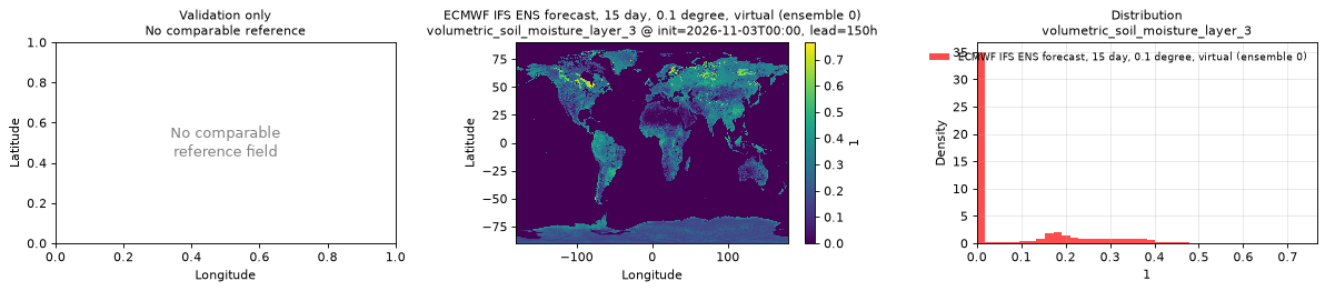
Spatial — init=2026-11-03T00:00, lead=150h (reference not available)
| Source | min | mean | max |
|---|---|---|---|
| Validation | 0 | 0.08226 | 0.7656 |
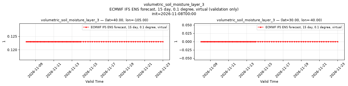
Temporal — init=2026-11-08T00:00
| Source | min | mean | max |
|---|---|---|---|
| P1 Validation | 0.123 | 0.123 | 0.123 |
| P2 Validation | 0 | 0 | 0 |
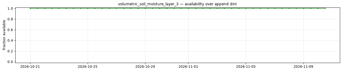
Availability — 42 of 42 positions complete
Additional spatial comparison — member 25, init=2026-11-02T00:00, lead=150h.
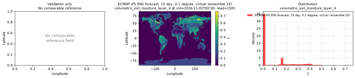
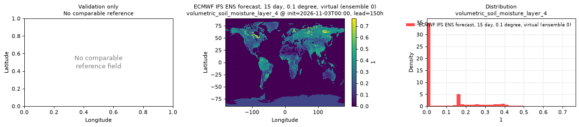
volumetric_soil_moisture_layer_4
Metadata
| Field | Value |
|---|---|
| units | 1 |
| long_name | Volumetric soil moisture |
| short_name | vsw |
| standard_name | volume_fraction_of_condensed_water_in_soil |
| step_type | instant |
| comment | ECMWF soil level 4. Applies over land only; over water the values are near zero, so mask with land_sea_mask_surface. |
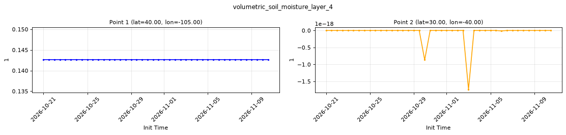
Point time series — 2026-10-21T00:00 - 2026-11-10T12:00, sampled lead=3h, member=0
| Point | min | mean | max |
|---|---|---|---|
| P1 | 0.1426 | 0.1426 | 0.1426 |
| P2 | -1.735e-18 | -6.228e-20 | 0 |
Spatial — init=2026-11-03T00:00, lead=150h (reference not available)
| Source | min | mean | max |
|---|---|---|---|
| Validation | 0 | 0.08363 | 0.7656 |
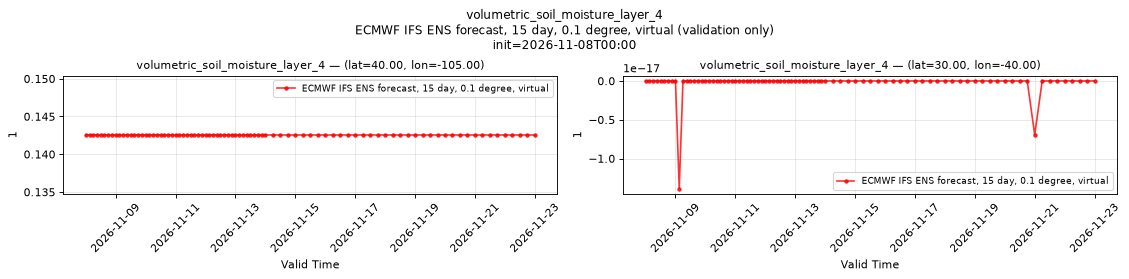
Temporal — init=2026-11-08T00:00
| Source | min | mean | max |
|---|---|---|---|
| P1 Validation | 0.1426 | 0.1426 | 0.1426 |
| P2 Validation | -1.388e-17 | -2.449e-19 | 0 |
Availability — 42 of 42 positions complete
Additional spatial comparison — member 25, init=2026-11-02T00:00, lead=150h.
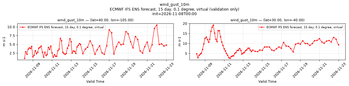
wind_gust_10m
Metadata
| Field | Value |
|---|---|
| units | m s-1 |
| long_name | Maximum 10 metre wind gust since previous post-processing |
| short_name | 10fg |
| standard_name | wind_speed_of_gust |
| step_type | max |
| comment | Maximum over the preceding hour through lead 90 hours, then since the preceding forecast step. Not available at lead time 0. |
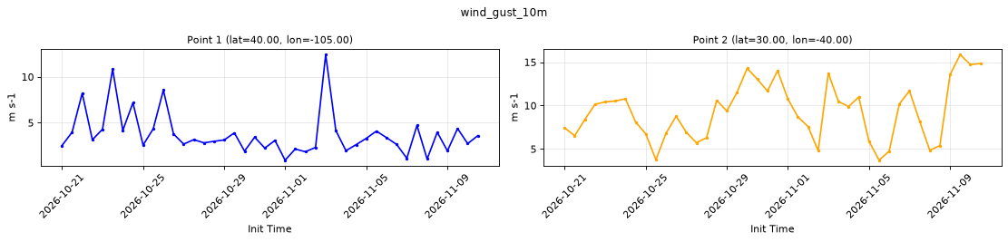
Point time series — 2026-10-21T00:00 - 2026-11-10T12:00, sampled lead=3h, member=0
| Point | min | mean | max |
|---|---|---|---|
| P1 | 0.9109 | 3.755 | 12.42 |
| P2 | 3.707 | 9.342 | 15.86 |
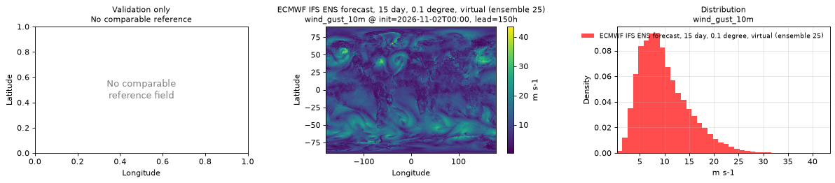
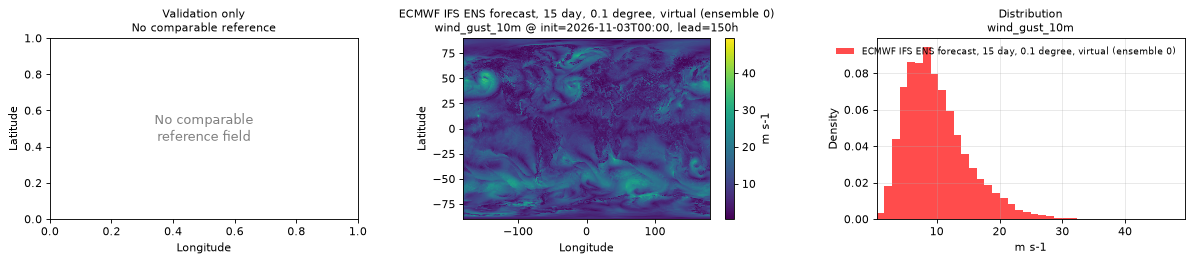
Spatial — init=2026-11-03T00:00, lead=150h (reference not available)
| Source | min | mean | max |
|---|---|---|---|
| Validation | 0.422 | 9.966 | 49.48 |
Temporal — init=2026-11-08T00:00
| Source | min | mean | max |
|---|---|---|---|
| P1 Validation | 1.037 | 4.088 | 10.55 |
| P2 Validation | 2.666 | 8.717 | 19.26 |
Availability — 42 of 42 positions complete
Additional spatial comparison — member 25, init=2026-11-02T00:00, lead=150h.
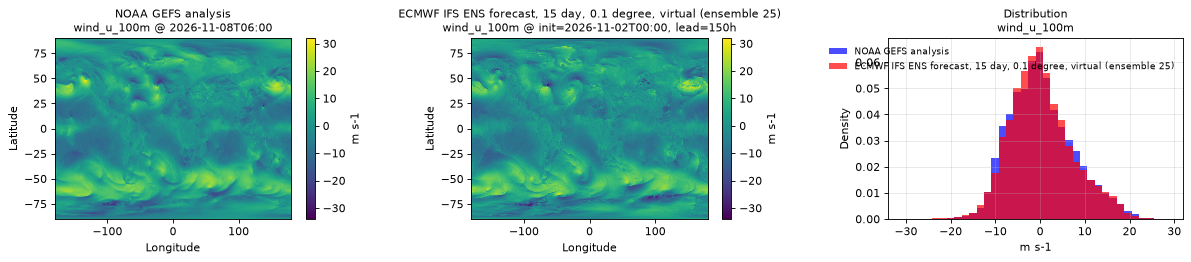
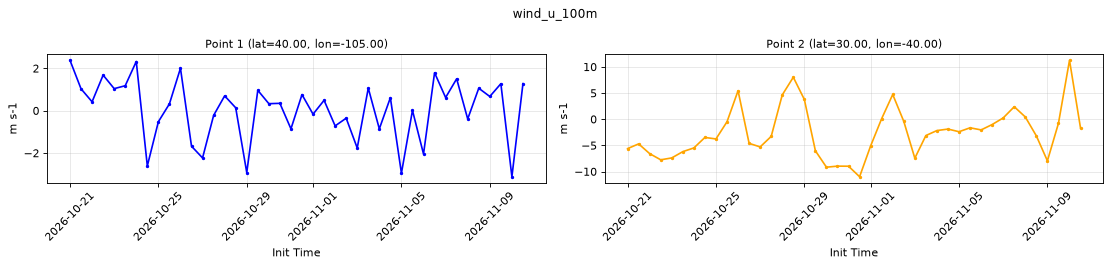
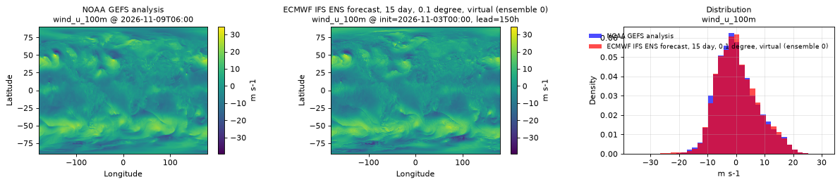
wind_u_100m
Metadata
| Field | Value |
|---|---|
| units | m s-1 |
| long_name | 100 metre U wind component |
| short_name | 100u |
| standard_name | eastward_wind |
| step_type | instant |
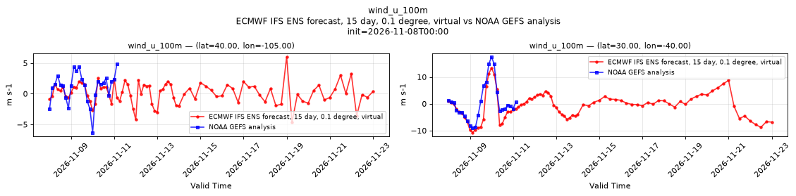
Point time series — 2026-10-21T00:00 - 2026-11-10T12:00, sampled lead=3h, member=0
| Point | min | mean | max |
|---|---|---|---|
| P1 | -3.12 | 0.06077 | 2.38 |
| P2 | -10.99 | -2.59 | 11.26 |
Spatial — init=2026-11-03T00:00, lead=150h (reference at 2026-11-09T06:00)
| Source | min | mean | max |
|---|---|---|---|
| Validation | -35.66 | 0.4744 | 27.44 |
| Reference | -39.5 | 0.3438 | 34.5 |
Temporal — init=2026-11-08T00:00
| Source | min | mean | max |
|---|---|---|---|
| P1 Validation | -4.634 | 0.1212 | 6.003 |
| P1 Reference | -6.312 | 1.033 | 4.812 |
| P2 Validation | -10.74 | -0.7847 | 13.34 |
| P2 Reference | -9.125 | 0.3606 | 17.5 |
Availability — 42 of 42 positions complete
Additional spatial comparison — member 25, init=2026-11-02T00:00, lead=150h.
wind_u_10m
Metadata
| Field | Value |
|---|---|
| units | m s-1 |
| long_name | 10 metre U wind component |
| short_name | 10u |
| standard_name | eastward_wind |
| step_type | instant |
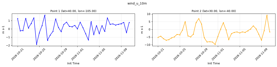
Point time series — 2026-10-21T00:00 - 2026-11-10T12:00, sampled lead=3h, member=0
| Point | min | mean | max |
|---|---|---|---|
| P1 | -1.876 | 0.2226 | 1.67 |
| P2 | -9.764 | -2.396 | 9.228 |
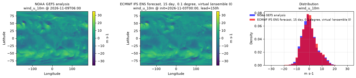
Spatial — init=2026-11-03T00:00, lead=150h (reference at 2026-11-09T06:00)
| Source | min | mean | max |
|---|---|---|---|
| Validation | -27.1 | 0.2784 | 23.87 |
| Reference | -35.5 | 0.1844 | 35 |
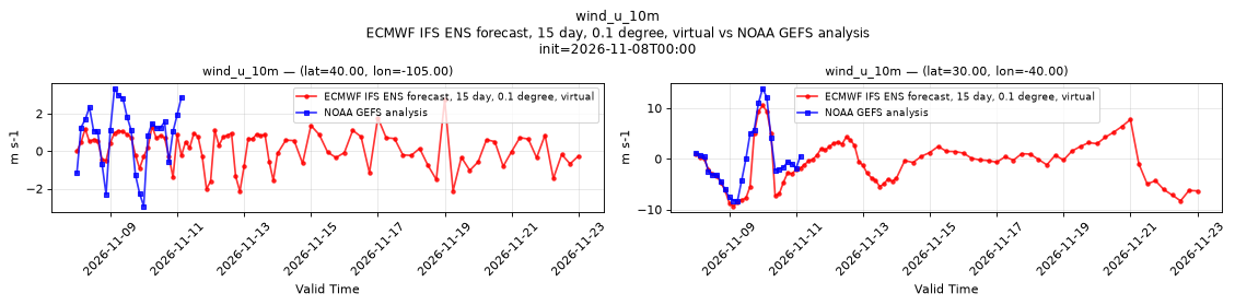
Temporal — init=2026-11-08T00:00
| Source | min | mean | max |
|---|---|---|---|
| P1 Validation | -2.144 | 0.126 | 2.763 |
| P1 Reference | -2.938 | 0.8356 | 3.344 |
| P2 Validation | -9.343 | -0.8034 | 10.53 |
| P2 Reference | -8.25 | -0.07389 | 13.88 |
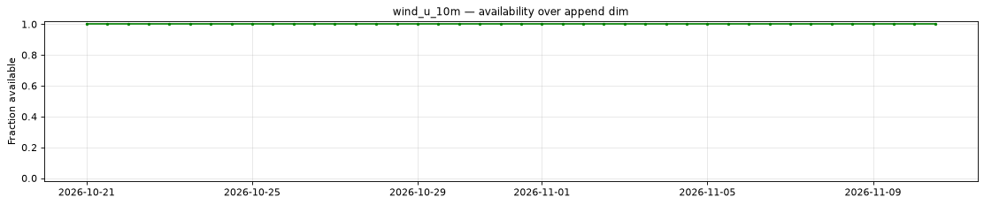
Availability — 42 of 42 positions complete
Additional spatial comparison — member 25, init=2026-11-02T00:00, lead=150h.
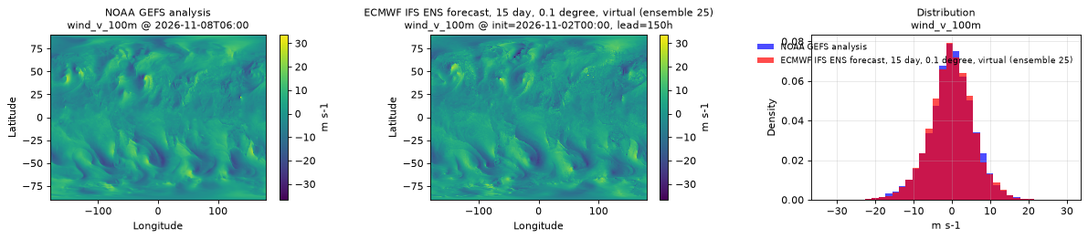
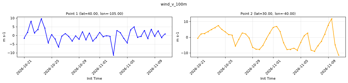
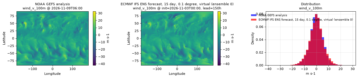
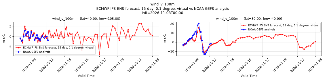
wind_v_100m
Metadata
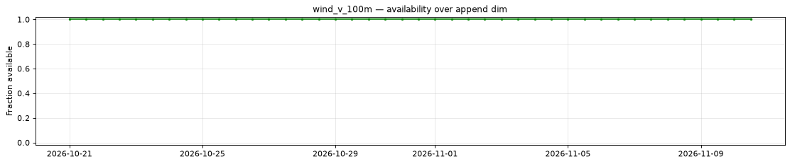
| Field | Value |
|---|---|
| units | m s-1 |
| long_name | 100 metre V wind component |
| short_name | 100v |
| standard_name | northward_wind |
| step_type | instant |
Point time series — 2026-10-21T00:00 - 2026-11-10T12:00, sampled lead=3h, member=0
| Point | min | mean | max |
|---|---|---|---|
| P1 | -11.27 | 0.1406 | 9.586 |
| P2 | -11.34 | -0.6541 | 11.82 |
Spatial — init=2026-11-03T00:00, lead=150h (reference at 2026-11-09T06:00)
| Source | min | mean | max |
|---|---|---|---|
| Validation | -32.46 | -0.02336 | 29.7 |
| Reference | -42 | -0.05077 | 32.5 |
Temporal — init=2026-11-08T00:00
| Source | min | mean | max |
|---|---|---|---|
| P1 Validation | -8.533 | 0.6324 | 6.464 |
| P1 Reference | -2.156 | -0.1299 | 3 |
| P2 Validation | -11.52 | 1.404 | 15.85 |
| P2 Reference | -13 | 1.767 | 20.5 |
Availability — 42 of 42 positions complete
Additional spatial comparison — member 25, init=2026-11-02T00:00, lead=150h.
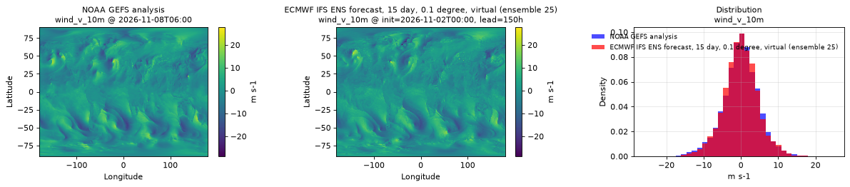
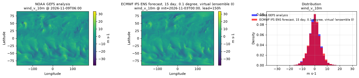
wind_v_10m
Metadata
| Field | Value |
|---|---|
| units | m s-1 |
| long_name | 10 metre V wind component |
| short_name | 10v |
| standard_name | northward_wind |
| step_type | instant |
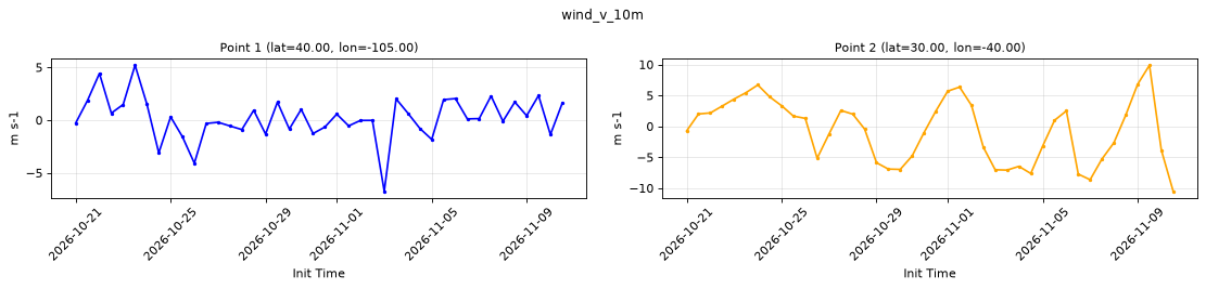
Point time series — 2026-10-21T00:00 - 2026-11-10T12:00, sampled lead=3h, member=0
| Point | min | mean | max |
|---|---|---|---|
| P1 | -6.749 | 0.1951 | 5.196 |
| P2 | -10.52 | -0.6494 | 9.887 |
Spatial — init=2026-11-03T00:00, lead=150h (reference at 2026-11-09T06:00)
| Source | min | mean | max |
|---|---|---|---|
| Validation | -22.08 | 0.006097 | 23.64 |
| Reference | -38.5 | -0.04947 | 33.5 |
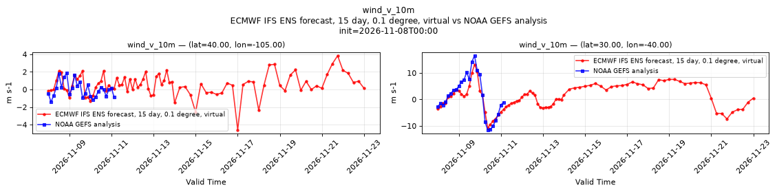
Temporal — init=2026-11-08T00:00
| Source | min | mean | max |
|---|---|---|---|
| P1 Validation | -4.586 | 0.5456 | 3.837 |
| P1 Reference | -1.438 | 0.009977 | 1.875 |
| P2 Validation | -10.7 | 1.214 | 13.21 |
| P2 Reference | -11.5 | 1.331 | 16.5 |
Availability — 42 of 42 positions complete
Additional spatial comparison — member 25, init=2026-11-02T00:00, lead=150h.