TAZEWELL COUNTY AIRPORT
| ID | A06800-00120 |
|---|---|
| USAF | A06800 |
| WBAN | 00120 |
| State | Virginia |
| Latitude | 37.06 |
| Longitude | -81.8 |
| Elevation | 808.6 m |
| Begin | 20140731 |
| End | 20250825 |
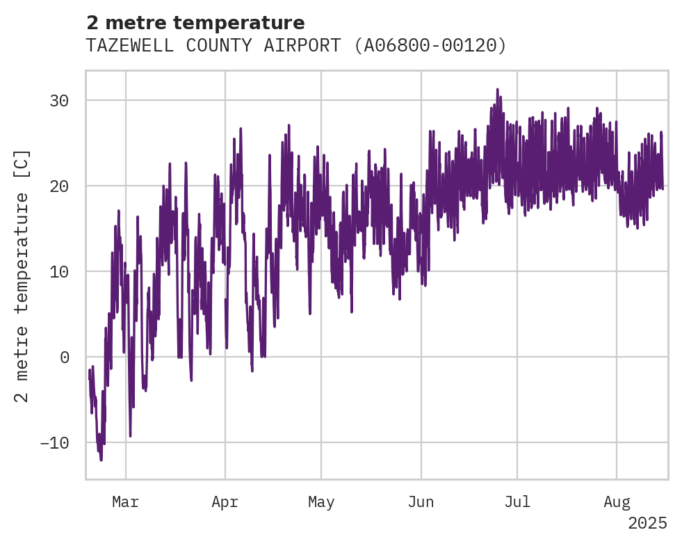
Temperature

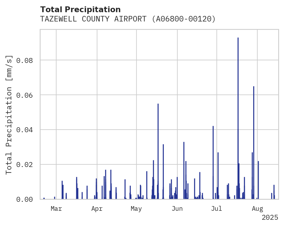
Precipitation

| ID | A06800-00120 |
|---|---|
| USAF | A06800 |
| WBAN | 00120 |
| State | Virginia |
| Latitude | 37.06 |
| Longitude | -81.8 |
| Elevation | 808.6 m |
| Begin | 20140731 |
| End | 20250825 |